
Become a supporter
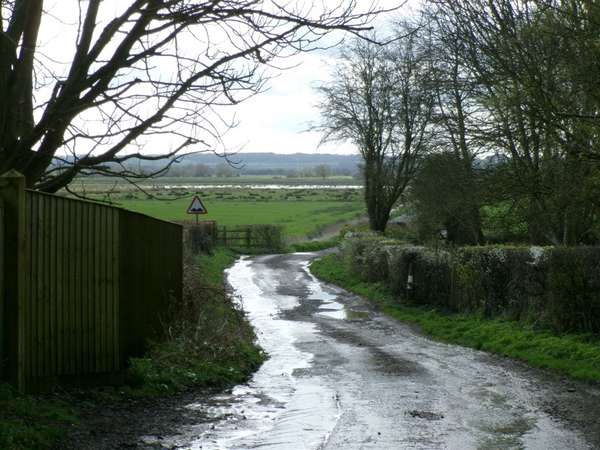
Severn Beach station is not the most logical railhead for the Cotswolds but this route provides a varied spring ride in pleasant country, crossing from Gloucestershire to Wiltshire and ascending from river mud to limestone in geology and ages from Roman to twentieth century. Return from Yate station.
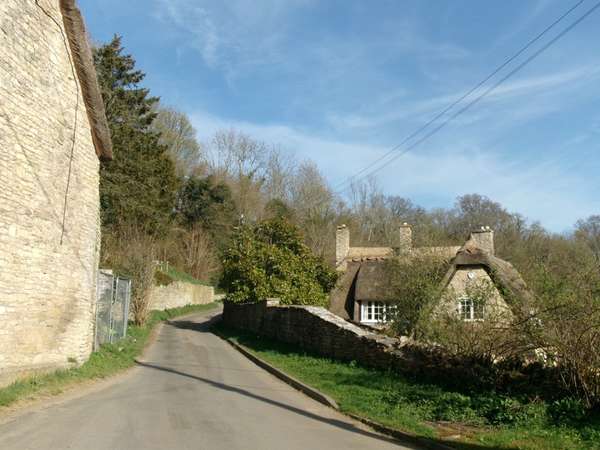
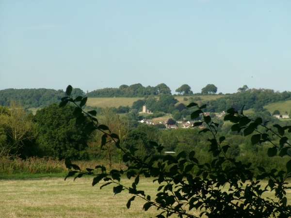
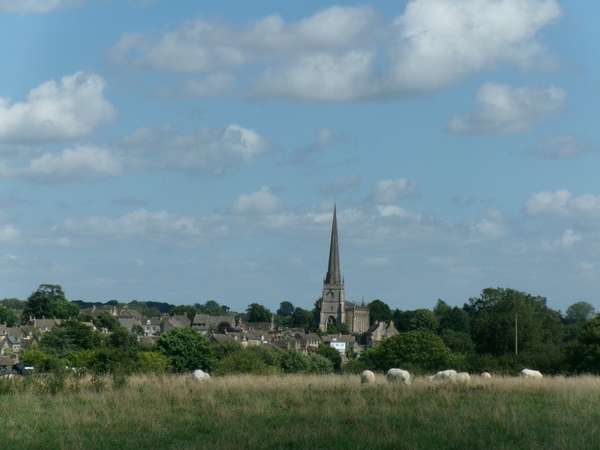
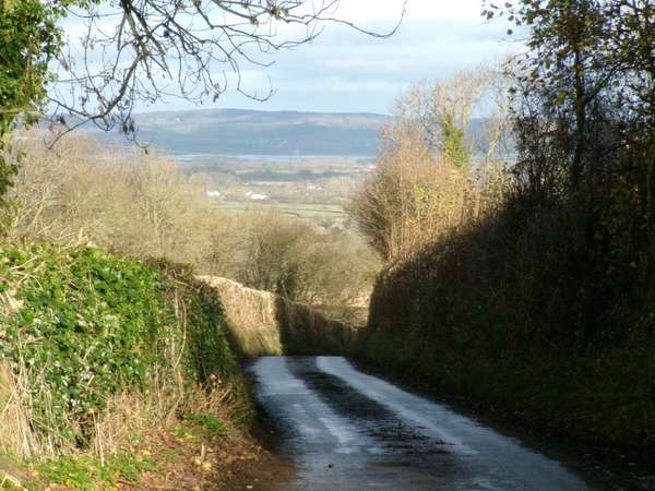
From New Passage I crossed the Severn Vale, pausing for early coffee and cake in Oldbury, then through Cromhall to Wickwar and up the first step onto the equally flat Inglestone Common where the Little Avon & Ladden rise to make their separate ways to the Severn, then up the further steep, but short, climb to the Cotswold Plateau at the Somerset Monument in Hawkesbury Upton.
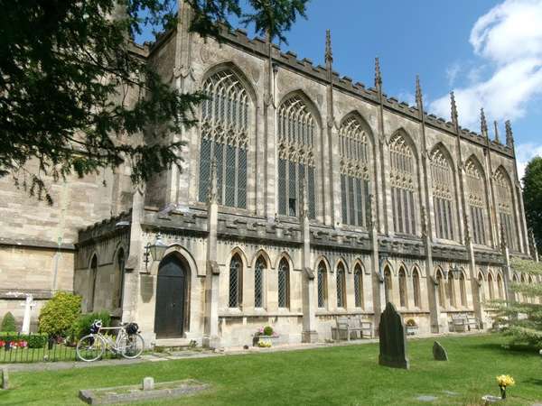
After a pleasant lunch in warm sunshine in the courtyard of the Beaufort Inn, across the A46 and rapidly south past Badminton and over fairly level country through Alderton & Littleton Drew. The church at Littleton Drew has two fragments of a Saxon porch shaft in the porch. From there I turned south west to follow the yet older Roman road, Fosse Way, on good, modern, slightly meandering tarmac to West Kington, where the gothic church stands above the steep sided valley in which the village sits and is reached by a detour along a wide tarmac bridleway through a farmyard. Dipping fairly steeply into the village to cross the Broadmead Brook making its way towards the Avon near Bath, and climbing less steeply out the route settles onto the vast plateau, climbs Shire Hill to enter Tormarton from the south and cross back over the A46 at traffic lights, before descending through quiet fields to Dodington to enter twentieth century Yate from the south east and follow cycle paths to Yate station for the train back to Bristol.
As usual the very busy A46 constrains the route to a small number of direct crossings. Near Hawkesbury Upton the road is only two lane and gaps in the traffic do occur. At Old Sodbury the A46 is much busier with traffic for the motorway, but the traffic lights allow crossing. Note the arrangement where only cycles and horses may turn right, and pay close attention to the light phase. The B-road from Cromhall has light but fast traffic and Shire Hill approaching Tormarton from the south also has fast but light traffic, which can be difficult on the steep section out of the dip into the valley of the Broadmead Brook. This can be avoided by using the minor road further north to the crossroads at Turnpike Cottage. Approaching Tormarton along roads south of the motorway avoids the narrow busy road from Acton Turville north of the motorway.
Severn Beach has an hourly train service from Bristol during the day. Yate provides two trains an hour, unfortunately those from Worcester are currently operated by surplus class 800 with poor cycle accommodation. The Gloucester trains are generally class 165/166 with better spaces.
Inns in the area include the Beaufort at Hawkesbury Upton, the Ship at Luckington and the Rattlebones at Sherston. Morning cake and coffee in the community cafe at Oldbury-on-Severn.
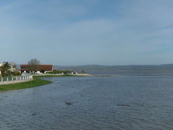
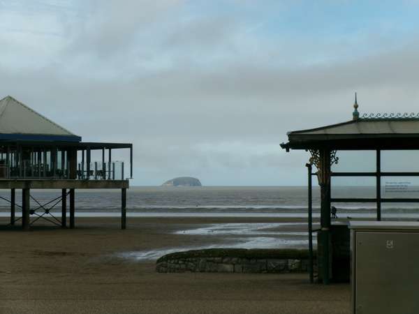
River mud - equinoctial spring tide covering the foreshore at New Passage.
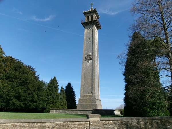
On the plateau edge: the Somerset Monument - commemorates the commander of the Household Cavalry at Waterloo.
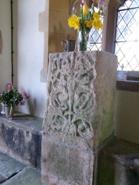
All Saints Littleton Drew - a ninth century Saxon cross shaft fragment.
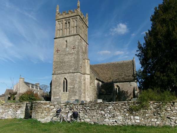
Saint Mary, West Kington C13 origins, much rebuilt 1856
A dip in the plateau - looking back up the road down to West Kington
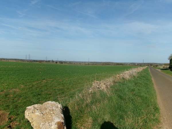
The limestone plateau - wide horizons on the road from West Kington.
When the summer of 2024 finally turned sunny, and before the trip to the wooden gothic light and height of Tetbury (1), a trip to the romanesque solidity and mass of Malmesbury Abbey. Oddly, despite the great mass of Norman stone bearing down on the Saxon borough and the apparently solid limestone ridge on which it stands, the Abbey was collapsing of its own accord before the reformation removed the chancel and monastic buildings. Both the west end of the nave, and the central tower fell in the middle ages.
Starting as usual from Yate station and proceeding to Chipping Sodbury I followed Portway Lane up at moderate gradients past Little Sodbury, then a steep holloway onto the Cotswold plateau to turn northwards, passing above prehistoric Horton Camp to touch Hawkesbury Upton, where the route turns west and south to cross the A46 towards Badminton, turning off at Shepherds Cottage to cycle north through an avenue of trees on the immense estate.
After turning east through the darkness of Bull Wood pass south of Sopworth and on to Sherston. Lunch at the Rattlebones Inn in Sherston and down the Avon valley. Due to a navigation error I went along the fast but fortunately not too busy B4040 into Malmesbury where the Abbey is obvious. (I had meant to go through Shipton Moyne, but turned off too soon - the correction is obvious.) Admired the immense remains of Norman work, enjoyed the more domestic English quaintness of the town centre and then left by the much quieter road through Foxley, Norton, Alderton and Littleton Drew to reach Acton Turville. After which I took an ill-advised minor road route past Tormarton, peace returning on crossing the A46 to descend from the Cotswolds into the Ladden Vale, with views of Old Sodbury church above on the Cotswold slope to the north. Thence home into the south side of Yate and the station.
The route is as usual constrained by crossing of the A46. I have mapped it as I went, but the dogleg between Sherston & Easton Grey resulted from turning too soon on a route meant to go through Shipton Moyne and avoid most of the B4040. The minor road return route through Sherston is much quieter, this and other options south of the B4040 would be more direct for an out and home trip. Between Acton Turville and Tormarton the minor road was surprisingly unpleasant, it is both narrow and plainly the main route east from the motorway. I recommend avoiding it by continuing south from Acton Turville to Burton then following what I know to be the much quieter road south of the motorway to Tormarton, then up to the A46 crossing. This light controlled crossing is interesting, motor traffic must turn left, but signs permit horses and bicycles to go straight across, which proved unproblematic, but pay careful attention to the light phases as you are crossing both lanes of a wide dual carriageway held back by traffic lights. Once over the A46 the minor road into the Chipping Sodbury - Yate boundary area takes you to cycle tracks starting along the main through road, then back over the common.
Inns in Sherston and some of the other villages. As befits a former monastic town Malmesbury also has plenty of options, including a cafe in the nave.
(1) https://cycle.travel/by/wjhall/a_marvel_of_light_and_height__through_golden_barley_to_tetbury_spire.
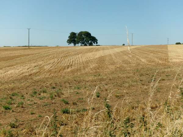
Early autumn and golden barley stubble on the plateau above Little Sodbury.
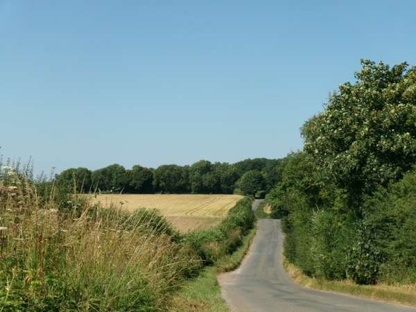
Along the Cotswold edge: the Little Sodbury - Hawkesbury Upton Road.
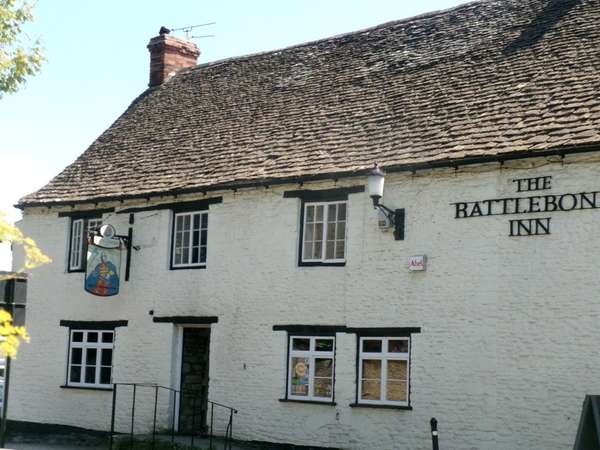
Sherston: the 17th century Rattlebone Inn commemorating a Saxon hero who fought Canute here in 1016.
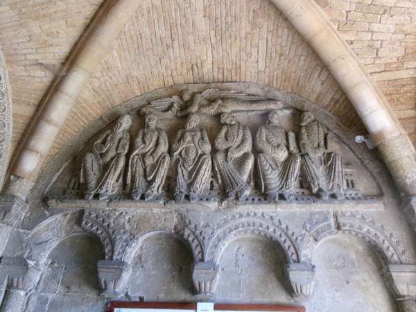
Malmesbury Abbey porch - the six apostles.
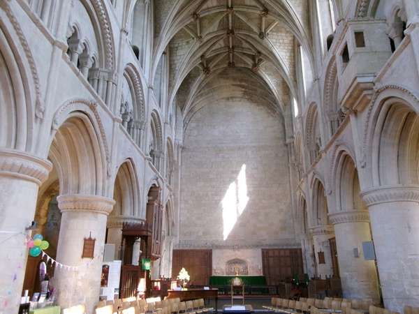
The Norman solidity of Malmesbury Abbey nave with its startling termination in a blank wall at the medieval collapse. Cafe to left.
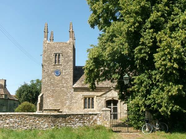
Foxley church - a modest English parish church on the way back.
The final stretch below the edge: Old Sodbury church seen above the Ladden Vale.
Through golden harvest fields to admire the marvel of light and height that is Saint Mary the Virgin, Tetbury, an eighteenth century interpretation of gothic in wood.
A high summer trip starting from Yate station, leaving town through cheerful Chipping Sodbury high street and up onto the Cotswolds through Little Sodbury. Then along the edge before turning east at Hawkesbury Upton to cross the A46 and Badminton estate, thence over the plateau through ripening corn past Sopworth and Sherston, leaving the arable western edge of the Cotswolds to enter a more pastoral area. Entering Tetbury by one of the minor road detours to avoid the A-roads and leaving via the other. Lunch at Lyndsey's Cafe in Church Street.
Admire the marvel of light and height that is the eighteenth century wooden gothic church of St Mary the Virgin, the fourth highest spire in the kingdom being a landmark for miles around. I had passed within sight of it three times in the previous year, but this was the first recent visit. The interior is supported by about two hundred thin engaged wooden columns, the lightness of the wooden roof allowing the C18 builders to create their own light gothic vision rather than imitate the massive weight of medieval stone gothic.
The return runs north on the plateau to Leighterton then south past the source of the Avon in Joyce's Pool near Didmarton, a pleasant place for a short break, spoilt only by the A433 behind the hedge. Rejoin the outward route from Sopworth to Hawkesbury Upton then down onto the flat marshlands of first Hawkesbury and then Sodbury Commons running beneath the Cotswold edge.
The route generally avoids major roads, crossing straight over the A46 and taking the minor road detours into and out of Tetbury. Avoiding the A46 & A433 constrains the route to a limited number of crossings, hence the duplication of part of the outward route on the return. Traversing Yate to Chipping Sodbury is easily done to the south of the main road, starting across the common. The dogleg junction at Didmarton uses about 100 metres of the A433, walk if necessary.
Refreshments in Tetbury in the courtyard of Lindseys' Cafe, Church Street, Tetbury. Other Tetbury establishments at all price levels, also inns in Sherston and Hawkesbury Upton.
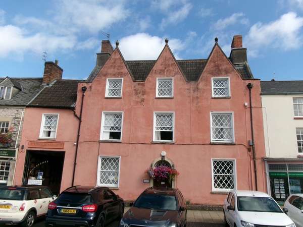
Chipping Sodbury, a cheerful coloured house now used as a catholic church.
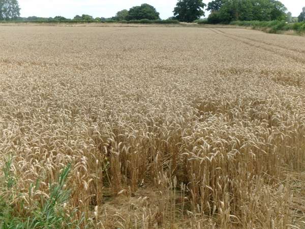
Ripe wheat on the Cotswold plateau.
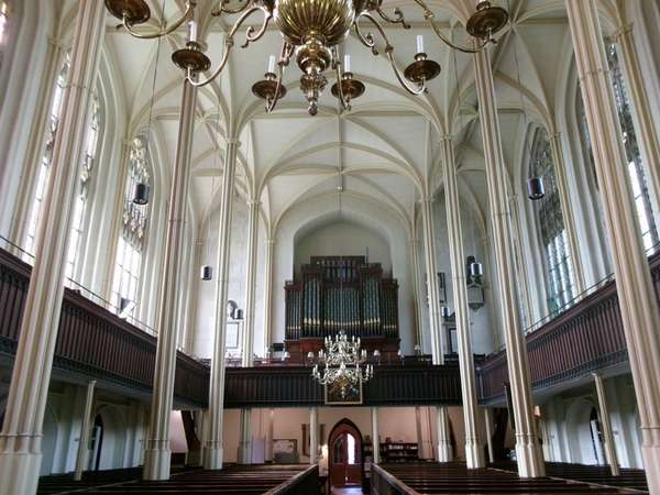
Inside St Mary's church, eighteenth century wooden gothic with slender wooden columns soaring to the heavens.
Outside, equally impressive cliff-like perpendicular style south side of the nave.
The fourth highest spire in the kingdom - back off about one kilometre to see this noted landmark in its entirety.
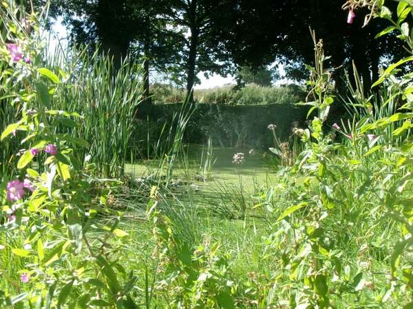
Joyce's pool near Didmarton, source of the Avon.
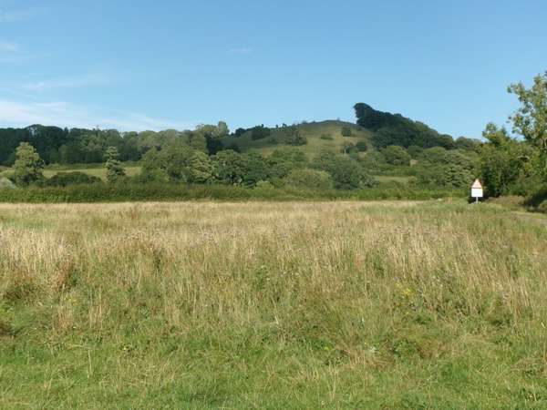
Back across the common below Hawkesbury Knott.
Mid-March, and a quick trip to see the receding winter floods on the Somerset Levels, with "February Fill Dyke woz 'ere" still graffittied across the landscape.
South along Weston promenade and out through the Walborough reserve to pass Brent Knoll, continuing south from Mark before turning east across Tealham Moor where the evidence of a wet winter is still draining away, then back north up Jack's Drove to find water still flowing off the Wedmore ridge. Through the outskirts of Wedmore and along the middle road to the Allertons and Weare, descending Sparrow Hill to pass the church and older part of the village. Then a dog leg through Cross and up to the Strawberry Line for a smooth run back through Shute Shelve tunnel to Yatton station.
A short detour to the seats at Ashton windmill for a picnic sandwich with view. Inns and cafes also in Wedmore, Winscombe and other villages.
Generally quiet roads. Crossing the A38 south of Brent Knoll is easy with patience, this section is dual carriageway with a wide central reservation. (Crossing in the reverse direction requires walking, northbound is signed left turn only) The short section of A38 from Weare to the old carriage road to Cross can almost be done before distant traffic catches up, or just walk on the pavement. Climbing from Cross to above Axbridge can be quiet, but can have quarry lorries. I looked longingly at the possibility of walking up the A38 pavement to the Strawberry Line, but the pavement is narrow and on the downhill side. If a better access from the Strawberry Line to Cross can be devised it would be welcome.
This outing is based on the Avonmouth to Weston train service which currently runs hourly during the day.
Water ebbing down the beach - neap tide at Weston-super-Mare:
A dry place - Mark church tower, a village on a little bump above the levels:
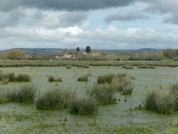
Water in the fields - Tealham Moor - Flooded fields with the end of the Wedmore ridge in the background:
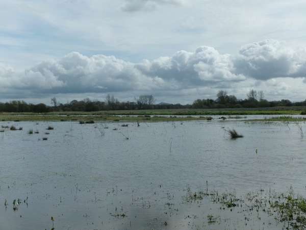
Waters of Avalon - Jack's Drove with North Drain overflowing - Glastonbury Tor in the background:
Water still draining from the hills - Jack's Drove at Heath House:
Water seeping through the ground - Shute Shelve tunnel - a 150 year old concretion and underground rain:
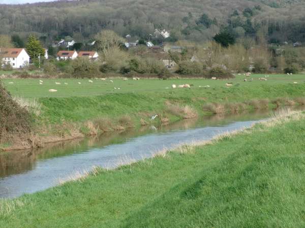
Water back in its place - finally, north of the Mendips, the Congresbury Yeo:
A modest, generally level ride for a short but sunny winter day enjoying the clarity of winter light on the plains. Ride along the river front to New Passage, cross the marshlands to Olveston and climb over Old Down to descend the steep Kyneton Hill from Mumbleys. To the Oldbury-on-Severn Community Cafe for morning coffee and cake, then north by Shepperdine and Nupdown followed by a circuit of the hill that gives its name to the hamlet of Hill, starting the return at the equally tersely named hamlet of Ham and crossing the low watershed between the Thornbury and Berkeley Vales. Back through Kington and over the gently graded Stock Hill with its views back across the vale to return along the river front by mid afternoon as the light fades, surmounting the midget bump of Ingst Hill before the final marshland stretch.
Community Cafe and shop at Oldbury-on-Severn, inns in Oldbury, Littleton & Olveston, baker, cafes and inn in Severn Beach.
Generally quiet roads, only the B4461 has fast but sparse traffic. Access to the marshlands is along the NCN4/41 cycle path beside the motorway from New Passage. Arrive at Severn Beach station at 0925 returning for the 1501. Train times as of winter 2024. Generally an hourly service operates to Severn Beach during the day.
Calm winter morning at New Passage - the new bridge.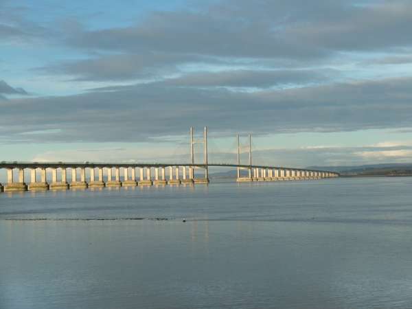
About to descend Kyneton Hill.
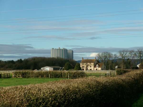
Near Shepperdine, the twentieth century looming over the nineteenth. Disused Oldbury nuclear power station and Knights Farm.
Behind the hill at Hill: New Park Farm perched above the flatlands.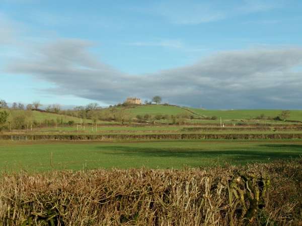
Bilsham Lane: the last of the marshlands - well drained.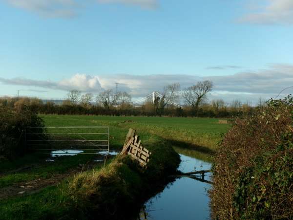
Late afternoon winter light over the Severn.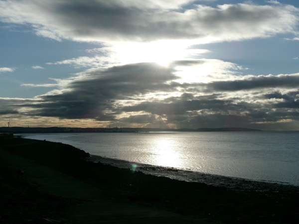


Made in the Cotswolds. Published by Éditions Système D Ltd.
Log in with your cycle.travel account:
| Password |
Or simply use your account on:
