
Become a supporter
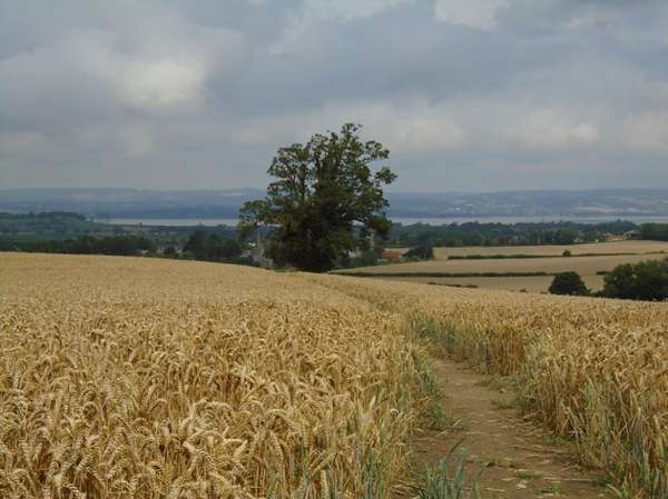
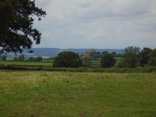
From Severn Beach station over the Old Down ridge with it's extensive views of the Severn and Berkeley Vales, for the usual morning cake and coffee stop at the Oldbury-on-Severn community cafe. Then north through Berkeley, of the notorious castle, and the adjacent church with the unusual feature of a separate church tower, giving the church the appearance of a village garage, belying its ornate interior, reflecting the Berkeley lords. Continuing through the low hills that protrude to the Severn to the river bank at Purton, where the Sharpness canal comes out to run beside the river. The famous Purton Hulks, a collection of wrecks in mud, used to strengthen the bank between the river and canal. Return generally similar close to the eastern edge of the marshes.
Severn Beach Station, now with an hourly service from Bristol, makes a convenient starting point for most places in the Severn Vale.
St John's Elberton and the Severn from the top of Vicarage Hill, Olveston.
St Arilda's, Oldbury-on-Severn, the cafe is just over the little hill.
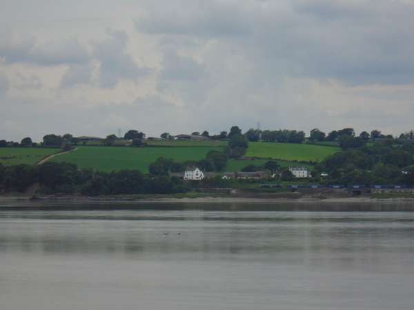
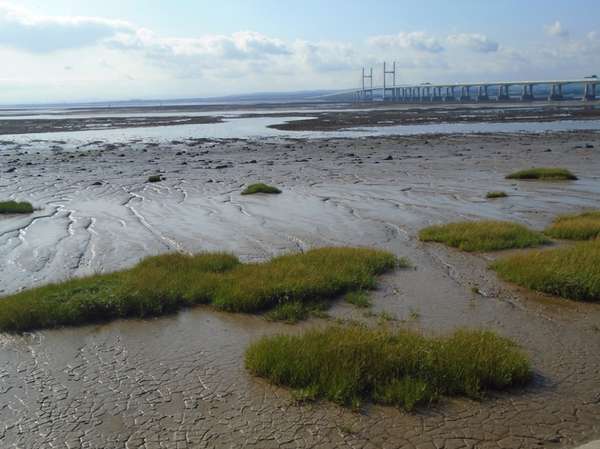
The Severn at Purton, narrower and calmer.
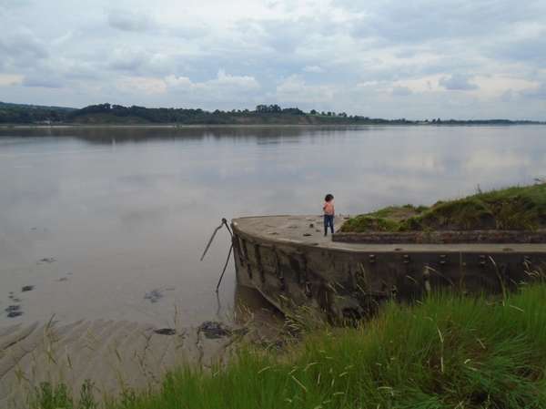
Wilful child Otis giving his grandparents a heart attack dancing on a ferro-concrete barge wreck, one of the Purton Hulks reinforcing the canal bank.
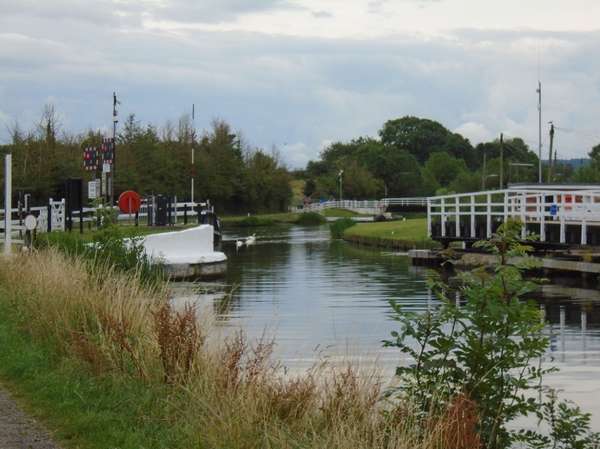
Sharpness Canal at Purton
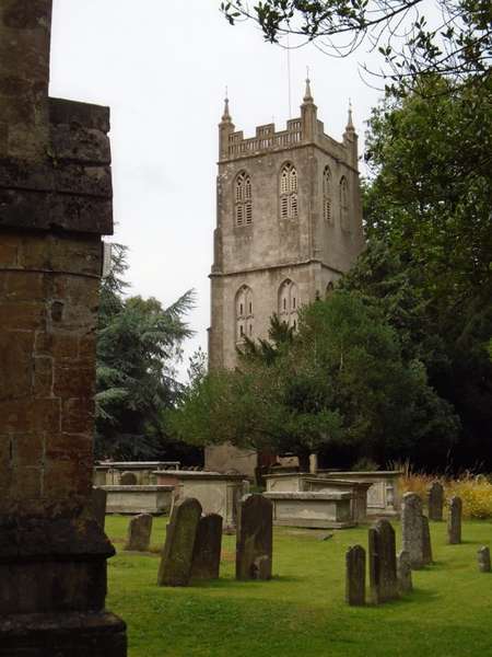
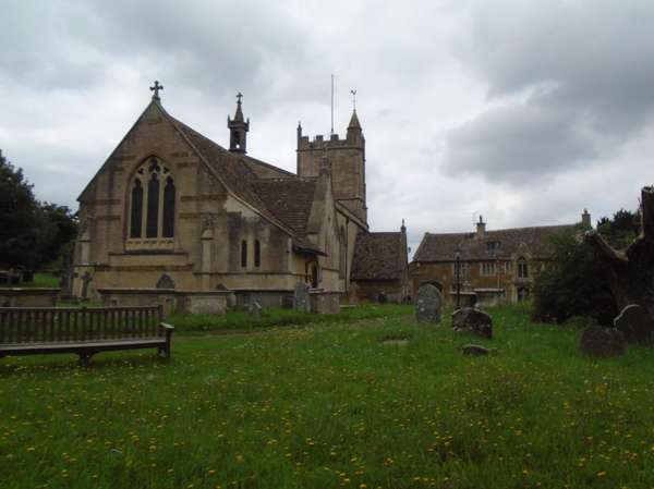
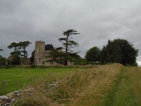
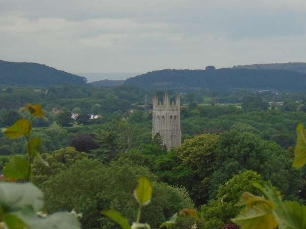
Berkeley - separate church tower
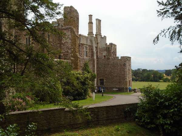
Berkeley Castle, as seen by roundhead gunners bombarding it from the churchyard.
As far as I can tell it is not possible to change the planned route linked to a travelogue once the travelogue has been posted.
For those of us who occasionally link things incorrectly this would be a useful tool for later corrections. There are probably other edits that it might be useful to allow.
A circular day out through Gloucestershire history, starting from Severn Beach station. North over the Old Down ridge, and down into Thornbury Vale past the community cafe in Oldbury-on-Severn, then across the marshlands to Berkely, passing a castle renowned for foul deeds. Then turning south east to North Nibley, near the site of the last private battle in England at Nibley green. Home past the six hundred year old Tortworth Chestnut, the castle and church in Thornbury, over Titter's Hill and back across the marshes to Severn Beach station.
Generally quiet roads, the unclassifed road from Berkeley to the A38 and the short stretch of B4060 being a little busier, but the climb out of North Nibley is mostly within the village 30 mph limit. Staggered crossroads over the A38 at Heathfield, with good sight lines. Similarly at Buckover a direct crossing with good sightlines.
Following the NCN route markings round the south of Thornbury takes you past the church and castle, and quite close to the the high street, without getting lost in the sprawling modern housing estates. More direct routes may be possible for those who know the town.
Taking the train to Severn Beach, now hourly, is handy for those needing to cross Bristol to reach the countryside; direct routes to and from north Bristol are also obvious.
Foggy morning at Severn Beach
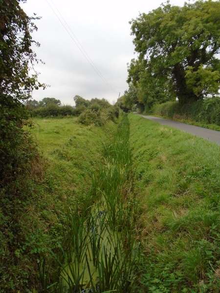
Greenditch street: the marshlands
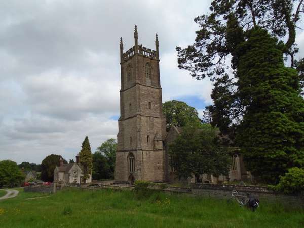
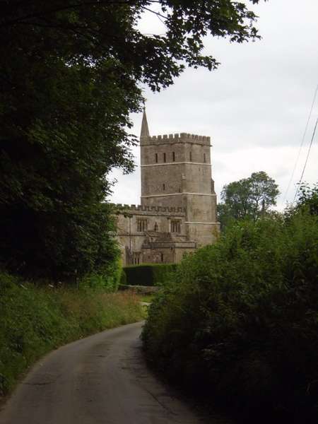
North Nibley, St Martin's with Tudor school
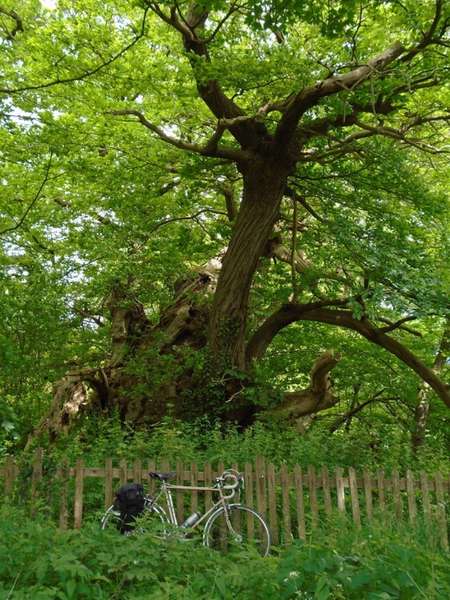
Tortworth Chestnut: six hundred years old, and a great sprawling wreck of a tree
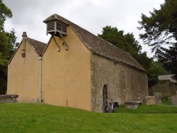
St Leonard, Tortworth
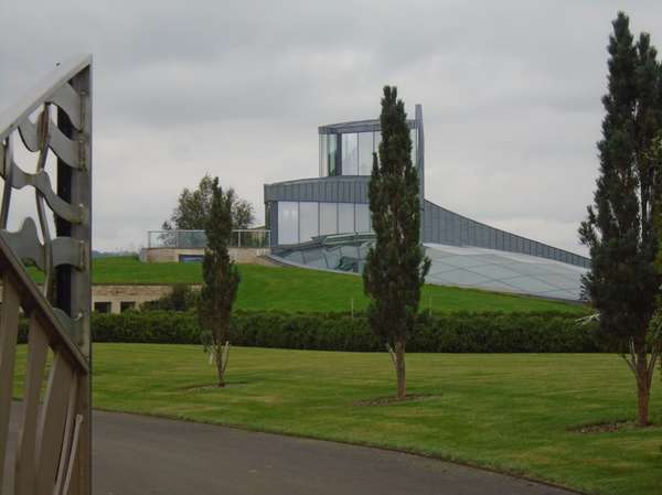
Swinhay Farm: Sir David McMurtry's ultra-modern country seat near his Charfield works
Brightening up: evening sunshine at Severn Beach
Across the marshes, into the Ladden Vale and up into the hills to visit the other church dedicated to the saxon martyr Arild, at Oldbury-on-the-Hill high on the Cotswolds. The better known church is Saint Arilda's, not so high on its own little bump amid the marshes at Oldbury-on-Severn. Saint Arild's is also near a source of the Avon in Joyce's Pool, Didmarton.
Out across Inglestone Common from Wickwar, then through Little Badminton and the Badminton Estate, passing the rustic church, formerly the Beaufort's private chapel. Then through the impressive estate woodlands.
Return along the Cotswold edge through Hawkesbury Upton, before touching the edge of modern Yate, then turning aside past the medieval church of Iron Acton and Agar Abbey.
Generally quiet roads. The B4058 south of Cromhall carries fast traffic. The slight detour south after Hawkesbury Upton avoids the A433 and visits attractive Little Badminton, then goes through the Badminton estate. St Arild's is approached up the grassy, easily ridden track to the east end of the churchyard.
The train to Severn Beach saves about 5 km, gives estuary views and avoids seeing the outskirts of Bristol twice in one day; return direct to N Bristol. The Severn Beach service is now hourly.
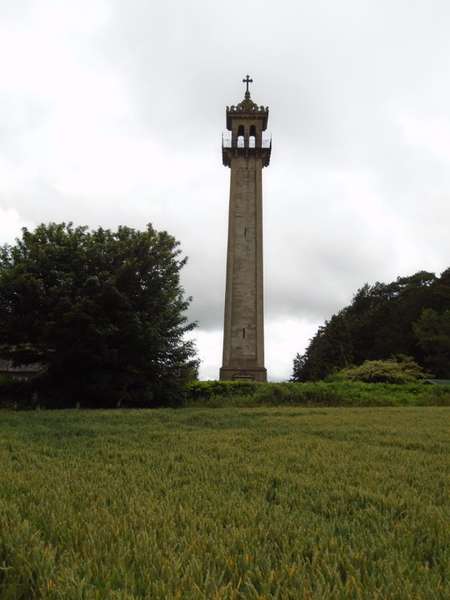
Hawkesbury Upton - Somerset Monument
St Michael and All Angels - Little Badminton
Saint Arild from the grassy approach track
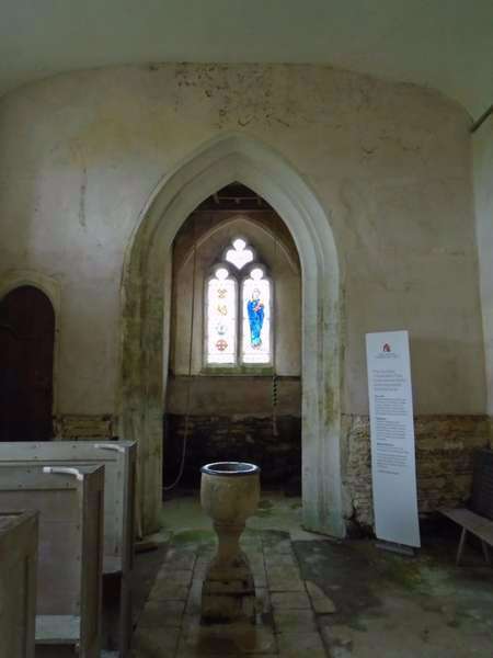
Saint Arild - Oldbury-on-the-Hill - Chalice font
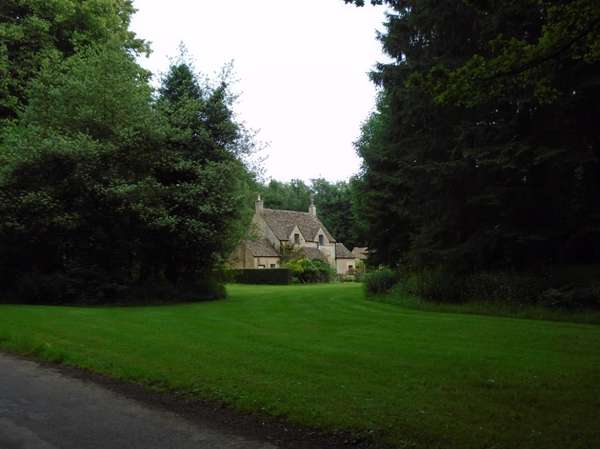
Badminton Estate woodland - Holly Bush cottage
St Mary - Hawkesbury
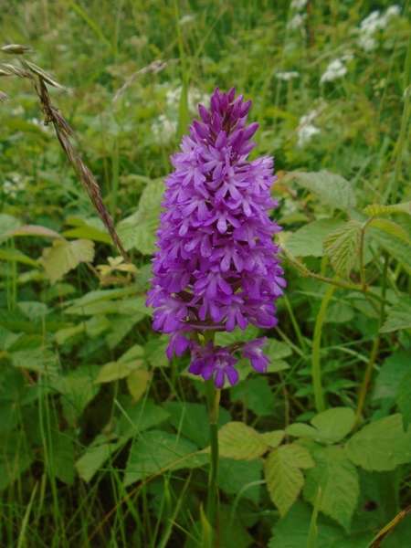
Tockington Lane Almondsbury-Pyramidal orchid Anacamptis pyramidalis
Over the Failand Heights (140 m), down Beaumont Hill, up Backwell Hill (200 m), down Brockley Coombe, and over Wrington Hill (150 m), descending steeply to the pleasant small town of Wrington with its magnificent church and Georgian Broad Street. Thence along above the edge of the marshes to Congresbury whence the northern part of the Strawberry Line starts a generally flat return apart from a small encore past St Andrew's church (60 m) in Backwell.
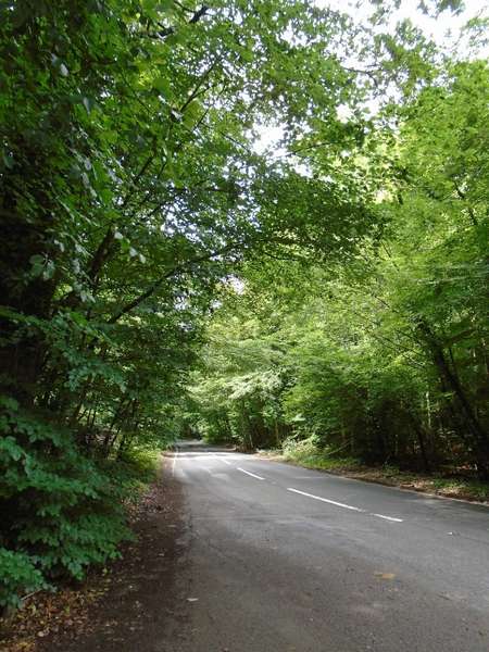
Good views from Failand, Beaumont Hill, and Wrington Hill. The bends on Beaumont Hill create sudden distant glimpses. Brockley Coombe is a long dark tunnel of trees with cliffs hidden to the right on the lower section. Slow down to see them.
Coffee, tea and cake at Mother Hen's in Wrington. Ale, coffee and desserts at The Plough.
Picnic spots at Failand, on the Millenium Way near Tyntesfield Sidings, the Strawberry Line and in Cleeve quarry. Uses the very verdant Common Lane to Lower Failand, the more conventional route up Failand Lane from Portbury is also possible.
Fast descents of Beaumont Hill and Brockley Coombe, the first often has surprisingly little traffic, the latter tends to be busier. A short stretch of the A370 entering Backwell has a 30 mph limit. Walk across the A369 in Easton in Gordano to reach Common Lane. Otherwise generally quiet roads.
Failand Heights
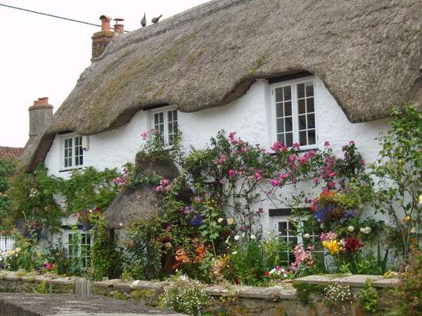
Gem of a cottage garden at the crossroads in Backwell Farleigh
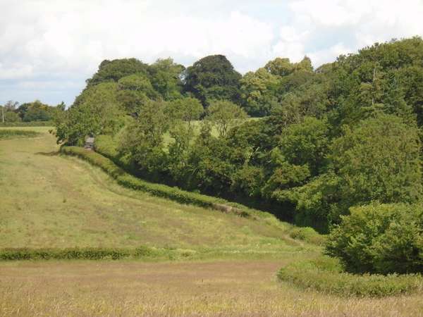
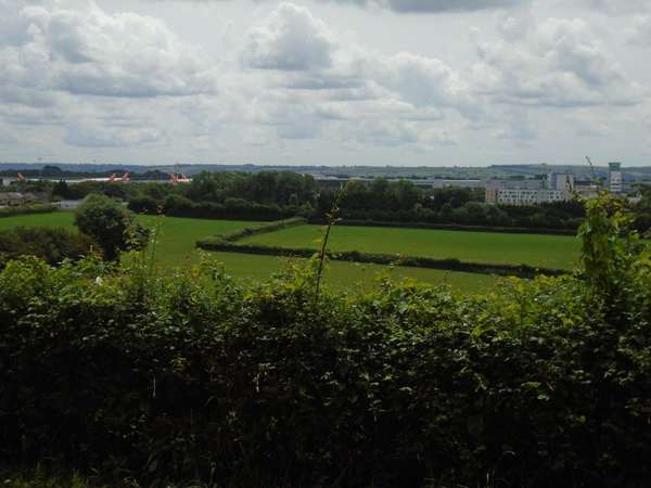 Looking down on the airport from Backwell Hill
Brockley Coombe: into the trees
Wrington from Wrington Hill
And back across the levels... ... Claverham Drove Rhine.


Made in the Cotswolds. Published by Éditions Système D Ltd.
Log in with your cycle.travel account:
| Password |
Or simply use your account on:
