

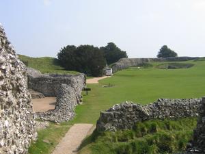
Salisbury (133mi) The route doesn’t pass through Salisbury city centre – at least, not the modern one. Instead, it goes via Old Sarum, the imposing Iron Age hill fort where the first, 11th century Salisbury Cathedral stood. If you’re B&Bing/hotelling your way round, we’d suggest an overnight stop at Salisbury – it’s a bit off-route, but it’s much more interesting than Amesbury. Plan in an hour or two to walk around Old Sarum, its massive earthworks topped by sturdy fortifications. The obligatory artists’ impressions do a good job of sketching out the historic town.
Setting forth, a wide track follows the side of the Avon Valley towards Netton. Here you can cross the river by road, or on the footbridge a short way upstream. The latter is more fun, but means you miss out on lunch at the Bridge Inn.
Stonehenge (140mi) There are three route choices here – none of them ideal. Cycling past Stonehenge is an attractive prospect, but the fast, busy A303 has few easy crossings. Here’s what you can do:
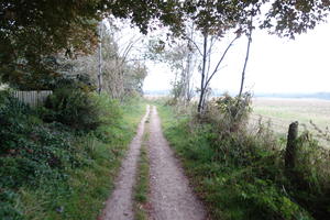
Option 1 – via Amesbury. Follow the valley road into the town, and turn left (north). A roundabout with traffic lights gives a fairly easy crossing of the A303. Peel left shortly after onto a narrow, tree-lined bridleway for a welcome return to peace and quiet. This emerges at the camp village of Larkhill. At the end of the military housing, you’ll see a private road ahead: turn right for the main route, or left to take a byway direct to see Stonehenge.
The fast, busy road after Larkhill is unremittingly grim, and the track on the northern side barely rideable. Teeth gritted and head down, you’ll emerge at a crossroads by Rollestone barracks.
Option 2 – off-road via Stonehenge. At Lake in the Avon Valley, take the lane left opposite the phone box. This becomes a bridleway. Follow it all the way to a path crossroads with Stonehenge in view ahead. Turn left here (strictly it’s a footpath, so you should push), then take the byway right. Cross the A303 with extreme care – there is no island or other refuge. After Stonehenge, continue north along the byway to rejoin the main route.
Option 3 – crossing at Stonehenge Bottom. We think this is the best mix between scenery and safety. Continue along the valley road, but at the T-junction after West Amesbury, turn left along Stonehenge Road. Before the road merges into the A303, switch to the (tarmac) pavement. Continue for half a mile to the end of the tarmac. Cross here. Although there’s no formal refuge, there’s a wide central hatched area which makes crossing much easier than in Option 2. (Still, take great care.)
Go through the gates and ride along the grassy path past Stonehenge. Amazingly, this is the old A344, grubbed up to improve Stonehenge’s environment. The old tarmac returns after the stones, but cars are still banned. At the roundabout, turn right for a mile on the less than pleasant B3086.
The routes rejoin by Rollestone barracks. Head north here to the former Bustard Inn, a 16th century coaching inn which closed a few years ago and is now a Christian therapy centre. More relevantly for our ride, it marks the start of Salisbury Plain, the vast military training area, and as near to a wilderness as you’ll get in southern England.
As you ride west along the tarmac road, you’ll see Army trucks speeding along the parallel gravel track, kicking up clouds of pebbles as they do. (Which is why, off-road purism aside, the tarmac is a better bet on this stretch.) An enjoyable valley-bottom bridleway delivers you into the little village of Orcheston.
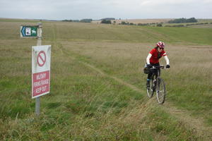
Imber Path (149mi) The Imber Range Path is an earlier Cycling UK success, a 30-mile route circumnavigating the notorious firing range. Villagers were evicted in 1943 and, save for a few days a year, Imber remains off-limits over 75 years on.
The perimeter path stitches together bridleways and byways around the wild edge, giving some of the remotest riding of the whole route. Gravel tracks and grassy paths loop across the rolling downs, with little sign of human life other than the occasional military helicopter.
Keep a close eye on your GPS: with numerous ancient byways crossing the route, navigation can be difficult. There’s a petrol station (with shop) and pub in Tilshead if you need supplies.
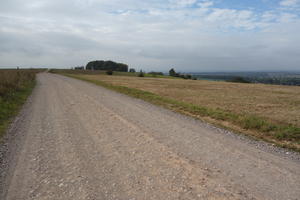
Salisbury Plain (157mi) This magnificent stretch gives the closest view of the training area. A long climb up a concrete road takes you to the gravel tracks that encircle Salisbury Plain. Reaching the top, you’ll be riding past military lookouts and communication towers, adorned with warning flags and fierce signage citing the Official Secrets Act. To the west, superb views open out across the Avon Valley.
The tracks are wide and well gravelled, but even on thick tyres you might find yourself gravitating to the well-worn grooves. Watch out for the coppice as the route turns east, where you’re meant to keep to the ‘outer’ hill side rather than the inner military track.
Barrelling downhill on a bridleway takes you to the A342 crossing, where a tree-lined bridleway seems rather sweetly bucolic after the stark landscape above.
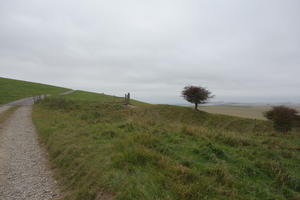
Avon Valley (163mi) There’s an on-road breather as you make your way through the well-to-do villages of the Avon valley, country lanes of the sort you’d expect to find in a Sustrans route – indeed, the route follows NCN 4 for a short way. After All Cannings a track crosses the Kennet & Avon Canal, though it’s perhaps a shame the route doesn’t run further east to take in the fabulously nutso Barge Inn at Honeystreet. (It’s two miles of easy towpath riding if you want to investigate for yourself.)
The narrow road up Tan Hill eventually gives out into a rutted track for an enjoyably white-knuckle descent. Cross the A4 roundabout at Beckhampton before making your way on back streets and a narrow tarmac path to the heart of Avebury.
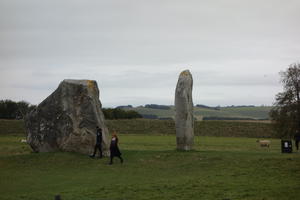
Avebury (174mi) Avebury’s three stone circles, perhaps as old as 5000 years, today enjoy a much more relaxed atmosphere than Stonehenge. There’s no entrance booth; a road runs through the site; there’s a pub on the corner, and a community shop with enticing local snacks. This is a good departure point if you’re planning to overnight in the well-heeled market town of Marlborough: follow the lanes along the valley via West Overton.
The main route takes the ancient (and rutted) Herepath along a steep ascent to a noteworthy crossroads. This is where we meet the Ridgeway – one of England’s oldest roads, a National Trail, and among the finest off-road cycling experiences. We will follow it all the way to Streatley, on the River Thames.
The wide, gravelly track closely follows the upland ridge, the land dropping away on your left. At Barbury Castle, the route cuts straight through this ancient hill fort. On a clear day the views from Barbury Hill are simply breathtaking, Swindon notwithstanding. As the route turns east, the path becomes grassier and a little less well defined, but the grooves of the countless cyclists, horse-riders and ramblers point the way.
Ogbourne St George and the River Og mark a breach in the ridge, a thrilling descent and a laborious climb back up from 150m to 220m. Here the Ridgeway feels remote and untrodden, a field-edge path where the grass grows high. Reality intrudes with an on-road section under the M4 before the trackway climbs once more.
(If you’ve diverted via Marlborough, take the railway path north from the town – NCN 482 – to join the Ridgeway at Ogbourne St George.)
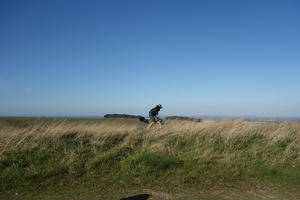
The Ridgeway (191mi) Standard advice for King Alfred’s Way is to ride it clockwise, and this section is why. It can be blowy up on the Ridgeway, and having a westerly behind you is far preferable to battling into the wind.
Still, don’t imagine that you’ll be sailing along serenely with the wind at your back. This section is far hillier than any ridge path has the right to be, a series of exhilarating dips and climbs across evocatively named contours: Fox Hill, Charlbury Hill, Lammy Down and Kingstone Coombes, Devil’s Punchbowl and Childrey Warren.
In quick succession you’ll pass the long barrow at Wayland’s Smithy, then Uffington’s ‘castle’ hill-fort and white horse. There are short paths directly from the Ridgeway, but do lock your bike up before venturing on foot – these are busy sites.
More than anywhere on King Alfred’s Way, rut riding is the technical skill you’ll need along here. Keeping momentum for the uphills is crucial, so when the ruts are narrow, you’ll need to master the art of balancing on the high ground. It’s worth it, a truly exhilarating ride with landscapes to match.
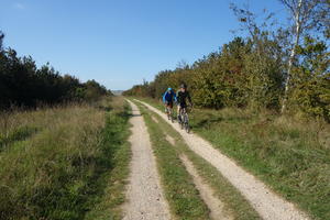
Wantage (202mi) Wantage was the birthplace of King Alfred in 849. It’s an attractive town studded with historic buildings, winning ‘Britain’s Best Town Centre’ in 2014. So it might seem mildly surprising that King Alfred’s Way avoids it… that is, until you realise you’d have to ride down off the ridge then up again.
This is easier riding than the Uffington leg. There are fewer hills, and the gradient is largely downhill other than the half-mile climb by Blewbury Down (after the A34) – look for the disused railway bridge at the bottom. Aside from a few grass sections, the going is firmer, particularly on the hard chalk sections.
Above West Ilsley, day-trippers, travellers, and drivers looking for a respite from the A34 congregate around the car park. On summer days you’ll often find an ice-cream van parked up here. At last, as the ridge dips towards the ‘Goring Gap’ in the Thames, a long, drawn-out descent takes you towards Streatley and the Royal River. Don’t lose control on the descent; it’s still the Ridgeway, and as such pretty bumpy… you wouldn’t want a sudden pothole puncture to spoil your enjoyment!
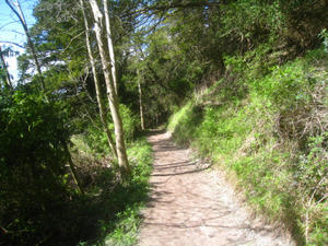
Thames Valley (216mi) King Alfred’s Way follows the east bank of the River Thames into Reading. The three miles to Whitchurch are shared with the Thames Path, so keep an eye out for walkers on this narrow path. It’s much more fun than a riverside path has any right to be, clinging to the edge of the steep hillside with a sharp drop down to the Thames – a very genteel form of singletrack. There’s a sudden dip before Whitchurch which is essentially uncyclable, but steps and a handrail have been provided.
Estate roads and narrow connecting bridleways continue the route past Mapledurham House, a comfortable brick-built stately home. The route enters Reading via Caversham Bridge. It’s not far from the riverside path to Reading railway station, which has frequent trains to London, the Midlands and west.
Log in with your cycle.travel account:
| Password |
Or simply use your account on: