

Ordnance Survey maps are justly famed for their clear, detailed coverage of the British countryside. Generations of cyclists have planned their adventures with an OS map or two stuffed in their panniers or mounted on their handlebars.
You can now use the OS Landranger (1:25k) and Explorer (1:50k) maps right here on cycle.travel. The same great cycle.travel routing… but with an Ordnance Survey map background. It’s perfect for planning off-road adventures or finding the quietest rural lanes.
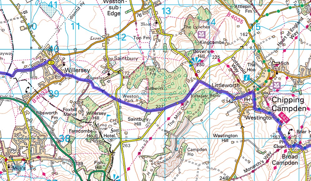
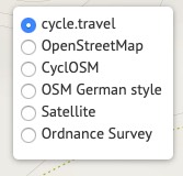
Because OS charge for access to their maps, we can’t offer this free to all-comers – so it’s a cycle.travel supporter benefit. Sign up as a supporter (for just £2 a month) and you’ll get access to the OS maps. Just choose them in the map switcher in the top right-hand corner:
Happy planning!


Comments
This is great news.
Just one question - when I hover over the map selecter at the top right of the map, it says:
"Become a supporter to add satellite, Ordnance Survey and IGN maps"
Is it right that IGN maps for France are included, as they are not shown on the list above? I hope so, as this would make it even better!
It is true. The above capture was done before Richard added IGN map.
Important to keep in mind: the IGN map currently available is IGN Plan, the vector tiles shifted to Open Data recently.
It does not include the IGN "Classic", which are the copyrighted version as can be had on purchased paper maps. The latter contains all the touristical information, signed posted tracks and routes, etc.
At least for now... ;-)
can points on the maps be converted to National Grid References?
I don't have an IGN option in the Map Style window?
Is it me or do the NSRoutes disappear when you zoom out on yuour version of OS mapping - on OS proper I can see them when I zoom right out?
Cheers,
Keith