
Become a supporter
It’s easy to plan a route on cycle.travel then get it onto a GPS unit.
If you have a recent Garmin GPS unit, we recommend using Garmin Connect to transfer your routes.
Make sure you have an account on Garmin Connect as well as your cycle.travel account. Download the Garmin Connect app to your phone, and link it to your GPS via Bluetooth.
Then on cycle.travel, when you've planned and saved your route, click the GPS button. You'll see this:
![]()
Click Send to Garmin Connect. A new window will appear asking you to log in and grant permission to cycle.travel. (You’ll only have to do this once!)
Once you’ve done this, your route will be transferred to Garmin Connect as a ‘course’. The Garmin Connect app on your phone can then transfer it via Bluetooth to your GPS unit.
You can also download a ‘GPX track’ file, which can be read by all brands of GPS and many apps. This will show the route as a line on your GPS screen. Click Download GPX track, and the file will be downloaded to your computer or phone. You can then copy it manually to your GPS unit.
There are lots of different formats of GPS file. You can access these by clicking More download options. GPX tracks are simplest, but you can also choose a ‘TCX course’ which includes turn-by-turn prompts. cycle.travel offers these formats:
If you choose a format with turn icons, you can get cycle.travel to position them slightly ahead of each turn. This means any audible warning from your GPS will sound before you get to the turn. Select ‘TCX course’ or ‘GPX route’, then select ‘Announce turns in advance’.
If you download a route from cycle.travel, it will by default simply appear as ‘cycle.travel’ on most GPS devices. To give it a distinct name, save it on cycle.travel before you download it. The name you choose on cycle.travel will be reflected in your download.
You can include elevation data in the downloaded file so that it shows up on your GPS unit. To do this, download from the map page (not your journeys page) and click the elevation button so the graph is showing before you download it. Elevation data can be included in GPX routes and all TCX files.
Our maps are made using open data from OpenStreetMap, licensed under the Open Database Licence; with additional elevation data from Sonny, licensed under Creative Commons Attribution 4.0; additional UK data from Ordnance Survey and the Department for Transport, licensed under the Open Government Licence (© Crown copyright and database right); additional US data from federal and state sources; additional French data from départements under Licence Ouverte and the Open Database Licence; additional Canadian data from StatCan (Geography Division, Statistics Canada); additional Australian data from the governments of NSW, Queensland, South Australia, Western Australia and Victoria under Creative Commons Attribution 4.0.
OpenStreetMap is made by people like you. If a cycle path, road, pub or café is missing, just head in and add it. It’ll then be available to thousands of other cyclists using cycle.travel, OpenCycleMap, CycleStreets, Sustrans’ printed maps and many other projects: we all take the same data and add our own spin to it.
Here at cycle.travel we’ve supported OpenStreetMap since its first months back in 2004; we’ve mapped countless miles of cycle routes and contributed a lot of the code that’s been used in the project over the years.
We aim to take updates from OpenStreetMap every month or so: it then takes around three days to do all the calculations to find the best routes.
We do a lot of processing work to make the raw OSM map as useful as possible for cyclists (several thousand lines of code!). If you’re editing OSM, here are some of the things to keep in mind:
We also use Ordnance Survey data for UK built-up areas, Corine data for European built-up areas, and government open data for North America. We use both Ordnance Survey and NASA data for elevation.
If you find something missing or misleading in our maps and directions, head over to OpenStreetMap to fix it. But if OSM’s right, and cycle.travel isn’t doing what you’d expect with the data, we want to know. Post in the cycle.travel site forum and let us know what you think.
Yes! cycle.travel has five route options:
However, the fast speed of the route-planner means that it isn’t feasible to add lots more options. Basically, the speed comes from precalculating all the best routes. Adding more options means precalculating more routes, which requires more memory, which means more expensive servers.
Unfortunately that rules out adding fine-tuning options like “no hills” or “don’t mind traffic” or “very little traffic”. Instead, cycle.travel aims to make it easy for you to adjust the route (by dragging) if there are sections you want to avoid. Alternatively, you can turn the route-planner off between any two points, by clicking the first of the points and choosing ‘Go direct’ to the next one. This means you can plan a short stretch on a busy road even if cycle.travel doesn’t recommend it.
(If you want to read up on the maths behind cycle.travel’s super-fast routing algorithm, it’s known as Contraction Hierarchies.)
Calculating the total climb of a ride is notoriously difficult.
cycle.travel, like most route-planners, uses a worldwide grid of elevation data. When it’s calculating the elevation for a route, it looks up each point on a grid, and works it out by averaging the nearest points. It then calculates out the amount you’ll climb over the course of your ride by looking at the elevation difference between points.
Sounds simple? If only. On its own, this method leads to a lot of little fluctuations that aren’t reflected in the road/path you’ll ride. It doesn’t take any account of tunnels or bridges, where you’re not riding at ground level. And in areas where the road follows a steep-sided valleys, like the Alps, it can sometimes appear that the road is further up the hill than it actually is – causing lots of little ups and downs that aren’t there.
cycle.travel does a lot of extra calculation to minimise these effects and make the total figure more accurate. We think our figures are among the most accurate there are. But because different route-planners (and GPS units) use their own calculation methods, comparing figures from two sites will invariably result in a discrepancy. We’d suggest that you use the total climb as a guide to determining which of two cycle.travel routes will be the hilliest, rather than as a gospel fact.
When you add a via point to a route, cycle.travel recalculates the entire route from start to finish.
If you’re editing an old route, then it’s possible that the base map might have changed since you first created it. There might be new cycleways, a closed bridge, a surface change – something that leads cycle.travel to choose a different route from when you originally planned it. I do also aim to continually improve cycle.travel’s routing choices, which can lead to a different route choice.
So if you’re adjusting a route you saved a while ago, do keep an eye out for accidental changes. You can usually work around this by adding a via point in the place that cycle.travel is no longer routing you through, to “pin” the route into going a particular way.
(This also applies to showing turn-by-turn directions for an old route.)
As explained above, the fast speed of the route-planner is very hardware-intensive. In other words, adding more countries means renting more expensive servers! It also means fine-tuning the routing rules for each country to reflect road characteristics and traffic behaviour.
cycle.travel launched as UK-only; since then, coverage has gradually expanded to include the rest of Europe, North America, Australia and New Zealand. Although more countries are added gradually, long rides across Asia or Africa aren’t currently a priority.
Garmin Connect can sometimes refuse to accept routes even when it was working previously. The equivalent of “turning it on and off again” usually fixes this.
Go to your profile page and click ‘Remove Garmin Connect link’ at the bottom left. This will break the link between cycle.travel and Garmin Connect. Then go back to the map page and try to send a route to Garmin Connect. You will be prompted to link the two once more, and hopefully this should fix it.
Around once a month, we update our mapping from the source data. To do this we have to temporarily disable our mapping server for one night (usually UK time from around 8pm–8am). During that time you’ll see OpenStreetMap instead. The routing is still the same, it’s just the basemap that changes briefly.
Unfortunately Wahoo don’t yet provide a upload facility like Garmin Connect. Until they make that available, you can download a GPX or TCX file using the ‘GPS’ button, then manually transfer the file using the Wahoo app on your smartphone.
Yes! You can now get cycle.travel on your iPhone or Android phone.
cycle.travel’s costs are covered by support from users and a little commission from hotel bookings, so there’s no free routing API. However, if you do want to use cycle.travel’s mapping and routing, drop me a line and we can chat.
The “Sign in with Apple” option includes an Apple-provided option to “Hide my email”.
Selecting this means cycle.travel doesn’t receive your email address. So if you already have an account registered with your email address, cycle.travel won’t be able to connect it with your Apple login.
We’d suggest you either a) don’t select “hide your email”, or b) use Apple sign-in all the time, or c) don’t use Apple sign-in at all. But if you’re really stuck, drop us a line at info@cycle.travel and we can manually marry up your two accounts.
Thank you! You can make a donation via Patreon or in the app. But you can also help by spreading the word about cycle.travel to your fellow cyclists.
Unlike many other route-planners, cycle.travel doesn’t have external funding from venture capitalists or investors – it’s entirely independent. So your support makes a big difference.
Post at our forum and I’ll try to fix it!
Please say what the route is where the bug or unexpected behaviour is happening. You can copy and paste the address from your browser (e.g. “https://cycle.travel/map/?journey=310586”). Please make sure the route is public, not private, or I won’t be able to see it.
You can now get cycle.travel on your phone! Download the free app for iPhone or Android.
With the cycle.travel app, you’ll get clear mapping and turn-by-turn directions for every step of your route. Plan the route on your computer, save it and open it on your phone, or just do everything in the app if you like.
Once you’ve downloaded the app, open it and choose ‘Help’ from the Settings menu to find out more.
You can also use the cycle.travel website on your phone. You’ll find a few things are different to make best use of the limited screen space.
Click ‘Map’ as usual, and you’ll see a bar at the bottom of the screen with three sections: Map, Directions and Routes.
You’ll also see a three-line menu (‘hamburger menu’) at the top right, which is where you can find useful functions such as saving and downloading your route.
You can tap to add your start and end points as usual. If you want to add more points, double-tap on the screen.
Find out more about how to use cycle.travel’s map and cycle route planner.
It’s this easy:
If the route doesn’t go the way you want, you can simply drag it. A new numbered ‘via point’ will appear.
You can also extend the route by clicking points on the map. On desktop: Tick the option on the left that says ‘Click map to add more points’, then click at the new end of your route. On mobile: Quickly double-tap (iPhone) or long-press (Android) the new end of your route.
You can remove a via point by clicking on it and selecting ‘Remove via’ in the popup.
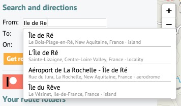
You can type street or town names for the start/end of your route. A pop-up menu will appear as you type – choose the matching place. Click ‘Get route’ when you’ve chosen the start and end.
Our map data comes from OpenStreetMap. OSM doesn’t usually record house numbers, so just type the street without a number.
You can add a via point at a named place, too. Click ‘Add at…’ and type the name.
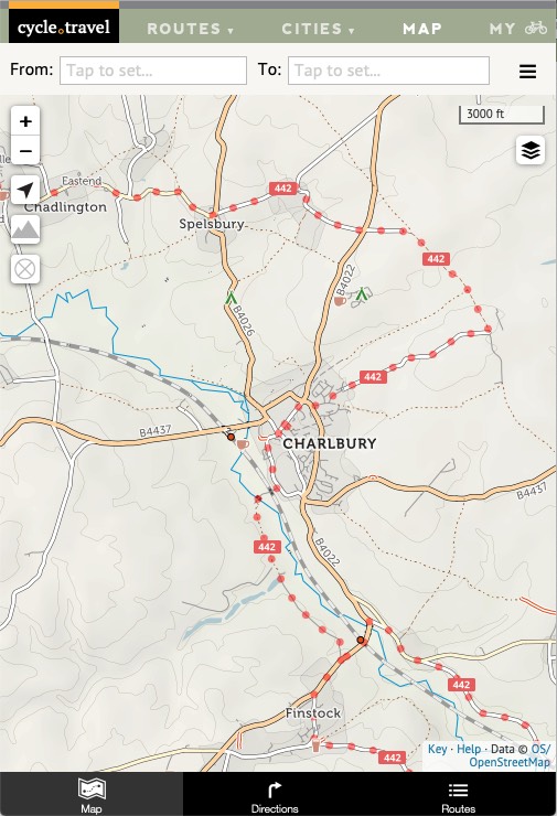
cycle.travel aims to choose a balanced route that prefers smooth surfaces, but will sometimes go off-pavement to avoid hills, busy roads or long detours.
If you’re on a road bike, you might prefer to stay on tarmac at all times. Flick the switch from ‘Paths & roads’ to ‘Paved only’ to change this. (On mobile, click the three-line menu and choose ‘Set to paved only’).
To get the best out of cycle.travel, remember that it’s a route-planner more than a plotter. In other words, its aim is to find you a great route from A to B, not to draw a route you already know. (There are lots of other sites that do that!)
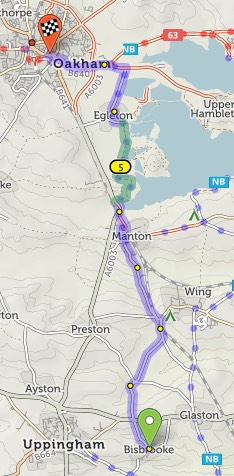
Journeys don’t have to be A–B: you can plan circular round-trips too. Choose your start and end points as per usual, then click ‘Round-trip’. cycle.travel will try to find you a different return journey. (Note that sometimes it won’t be different, particularly on short journeys or in areas with few roads.)
Or if you just want a ride but you don’t mind where, cycle.travel can do that too. Click just one start place on the map, or type it next to ‘From:’, then click ‘Suggest a ride’. Up to three circular routes will show on the map:
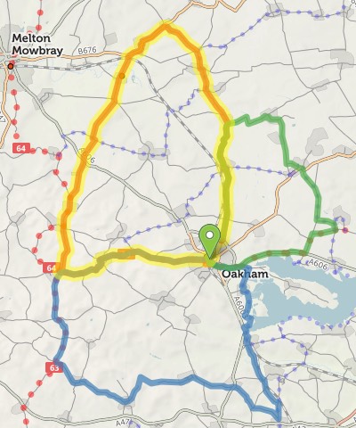
Choose the one you want by clicking on it.
All things being equal, cycle.travel prefers paved routes. But if a dedicated cycleway is unpaved, or it’d save a stretch on a busy or hilly road, cycle.travel will sometimes choose an unpaved route instead.
On the basemap, unpaved trails are shown with brown dots or dashes; unpaved roads have dashed edges. When you plan a route, the unpaved sections are highlighted in green, contrasting with the usual blue.
If you want to stick to paved sections only, then change the toggle beneath the from/to places. You can even restrict just the section between two via points to paved-only: click the first via point to bring up a popup, and change ‘Go any way’ to ‘paved’.
You’ll need a (free) account on cycle.travel to save your route. You can create an account by clicking ‘Log in to save routes’, or at the top of the page, ‘My bike’. If you have a Facebook or Twitter account, you can log in with that.
Once your account is set up, you can just click ‘Save’ to give your route a name and save it. Your routes are listed on the left of the screen; on the ‘Routes’ tab on mobile; and under ‘My bike > Journeys’.


Made in the Cotswolds. Published by Éditions Système D Ltd.
Log in with your cycle.travel account:
| Password |
Or simply use your account on:
