
There’s a handy map key (or legend) that shows you what the road and symbol colours mean. Click the link at the corner of the screen, by the credits.
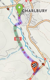
When you’ve planned a route, it’s highlighted in blue and green on the map. Blue for paved sections; green for unpaved.
You’ll see summary statistics on the left. These show how much there is of each road type:
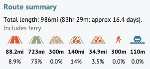
From left to right: busy paved road, other paved road, unpaved road, paved cycleway/trail, unpaved trail, pushing section, ferry.
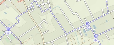
All map databases have incomplete coverage for roads and trails in the rural US, particularly the Midwest. In particular, surface information is often missing. cycle.travel takes a deliberately cautious approach and tries not to route you along such roads, which are very often unpaved tracks or worse. These roads are shown as thin single-dashed lines when you zoom in.

If you know the surface of any such roads, we’d encourage you to create an account on OpenStreetMap and add that information.
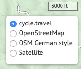
You can choose OpenStreetMap, the OSM German Style, and CyclOSM as well as cycle.travel’s standard basemap.
cycle.travel supporters can choose from many extra maps – Ordnance Survey, IGN (France), Swisstopo, satellite imagery, and numerous others.


Made in the Cotswolds. Published by Éditions Système D Ltd.
Log in with your cycle.travel account:
| Password |
Or simply use your account on:
