


How busy is that street? How muddy is that bridleway? Planning a bike route just got easier with the latest addition to cycle.travel’s journey-planner.
You can now view over 3 million photos of paths, tracks, roads and landmarks while planning your route. Just click on any section of your planned route, and you can open a photo window:
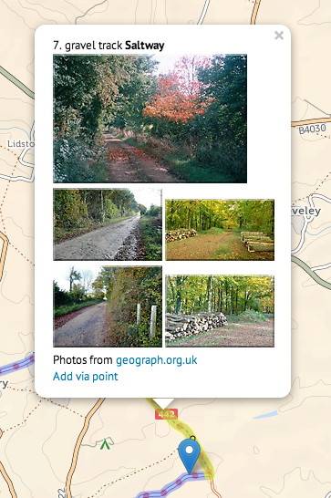
We were inspired to create this feature after noticing that “what’s the surface on this cycleway?” was one of the most commonly asked questions on bike forums. Although Google’s Street View will show you photos of roads, the Street View car fortunately doesn’t venture down bridleways or cycle paths.
So, instead, we turned to the wonderful community photo project Geograph, which collects photos of every corner of the British Isles. From family-friendly railway paths to rugged trails in the Scottish Highlands, Geograph’s 12,000 contributors have snapped it all.
Coupled with cycle.travel’s unique cartography, which shows cycle path surfaces in three clear styles (tarmac, firm, or muddy), this makes it easier than ever to plan a country ride or a quick shortcut through town. And if the planned route follows a path you’d rather avoid, it’s easy to change – just drag the route onto another road or path with your mouse.
Try it now: click ‘Map’ above and get started.
Improved circular routes
We’ve also upgraded the popular ‘circular route’ function on our journey-planner.
You can now add ‘via’ points into circular routes, and drag them around like any other route. Too long? Too short? Just drag the markers around until you have the perfect route.
Logged-in users can save routes, download GPX files, and print PDFs of clear, bike-specific mapping.

