

The Waterline Route, known as the LF Waterlinieroute, is one of the most original long-distance cycle routes in the Netherlands. The route follows the old Dutch water defence lines that protected the country for centuries. It combines history, water management and the Netherlands’ famous cycling culture in one journey. Instead of mountains or dramatic climbs, the route offers canals, flood protection dikes, forts, locks and peaceful polder landscapes. The atmosphere is calm and relaxing, with a strong connection to Dutch history visible almost everywhere along the way.
Officially, the Waterline Route runs from Edam to Bergen op Zoom and is around 410 kilometres long. It starts in the northern part of the country, among landscapes reclaimed from the sea, and then curves around Amsterdam towards the south. Along the way the route passes places such as Haarlem, Muiden, Naarden, Utrecht, Gorinchem and the wetlands near De Biesbosch National Park. The scenery changes regularly - one day the route leads through historic fortified towns, and the next through quiet wetlands and canal landscapes. Ferries crossing rivers and canals are also an important part of the experience and are well adapted for cyclists.
The main theme of the entire route is the Dutch water defence system, today recognised as a UNESCO World Heritage Site. The Waterline Route follows both the Defence Line of Amsterdam and the New Dutch Waterline. In the past, the Dutch could intentionally flood huge areas between the forts to stop enemy armies. The water was carefully controlled so it became too deep for soldiers to walk through but too shallow for boats to pass. Canals, locks, pumping stations and dikes played a key role in managing the water levels. Today these former military structures are part of the landscape and often house museums, restaurants or accommodation facilities.
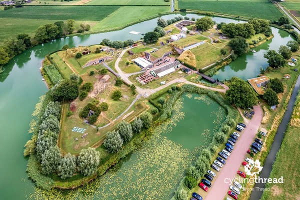
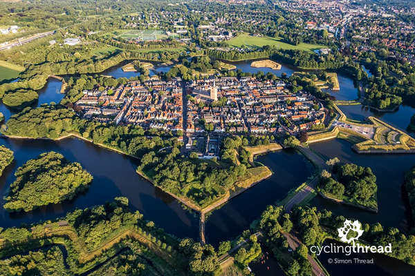
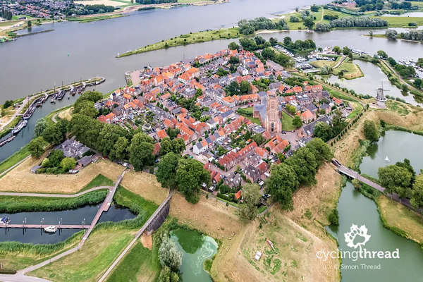
Many forts and military structures can still be seen along the route, especially around Amsterdam and Utrecht. One of the most interesting is Fort bij Nigtevecht, built at the end of the nineteenth century beside the Amsterdam-Rhine Canal. Nearby stands Fort aan de Drecht, surrounded by typical Dutch landscapes of canals and green polders. Another highlight is Naarden, one of the best-preserved fortified towns in the Netherlands, famous for its star-shaped defensive layout. Gorinchem also leaves a strong impression with its old defensive walls and historic riverside atmosphere. Many of these former military sites are now naturally integrated into everyday Dutch life.
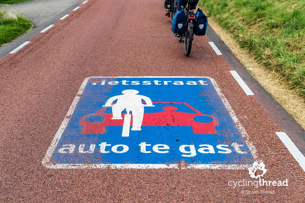
One of the biggest advantages of the Waterline Route is the quality of Dutch cycling infrastructure. The route mainly follows smooth asphalt cycle paths and quiet local roads running beside canals and flood protection dikes. Cyclists often ride on fietsstraat roads, where bicycles have priority and cars are treated as guests. Another typical Dutch solution is the “2 minus 1” road, where cars share a narrow carriageway with cyclists. Gravel sections are very rare and usually limited to short stretches in protected natural areas. Combined with the calm behaviour of Dutch drivers, this creates a very safe and comfortable environment for long-distance cycling.
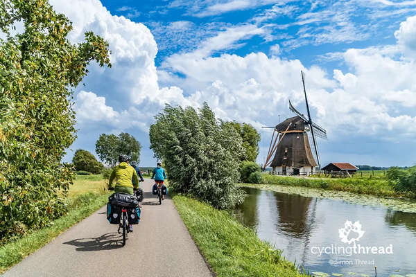
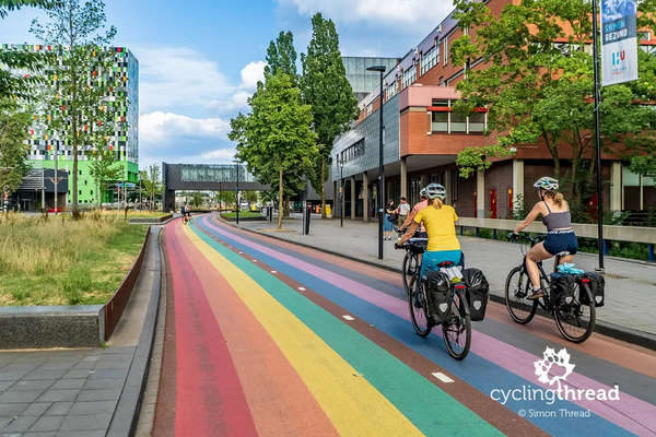
One of the most memorable parts of the journey is the ride through Utrecht, often considered one of the most bicycle-friendly cities in the world. This is where the famous colourful bicycle path can be found, frequently photographed as a symbol of modern Dutch cycling infrastructure. Utrecht combines a historic city centre with a highly modern approach to mobility and public space. The Waterline Route shows an interesting contrast between old military history and today’s cycling culture. Windmills are another important symbol of the Dutch landscape visible along the route. Near Amsterdam, cyclists can also spot the photogenic Mondriaan windmill, one of the most beautiful views of the entire trip.
The final part of the route leads through the area of De Biesbosch National Park, one of the most unique natural landscapes in the Netherlands. This large wetland area is filled with rivers, canals, islands and floodplains that clearly show the country’s deep connection with water. De Biesbosch is one of the largest freshwater tidal wetlands in Europe and an important habitat for birds and beavers. Here the atmosphere becomes even quieter and more natural than around Amsterdam or Utrecht. It also presents the diversity of Dutch nature and landscapes in a very accessible way.
Find more river cycle routes on our website.
Don't miss my other posts on cycle.travel:
- Around Luberon cycle route in Provence
- Elbe Cycle Route in Germany
- Ciclovia Alpe-Adria - Austria & Italy
- Loire by bike in France
- Rhine Cycle Route in Switzerland
- Tauber-Altmühl Radweg in Franconia

