Become a supporter
The inner Ring Road is the worst spot for accidents, particularly to the south of the city centre. Three junctions in succession have a poor safety record: those with Trumpington Road, Hills Road/Regent Street, and Mill Road/Parkside. Improvements have been announced for the Hills Road junction, but local cyclists are sceptical that they’ll actually make a difference.
Mill Road itself is avoided by many cyclists. Though there’s a 20mph limit, it still has a high collision count. You can often piece together a backstreet route as an alternative, but unfortunately it’s almost a mile north to the next bridge over the railway, at Coldham’s Lane. Take care on the other arterial routes, too: Milton Road’s shared-use path should be safe, but exasperatingly gives out at crucial moments, requiring you to mix with the traffic.

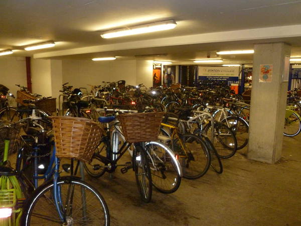
Cambridge is in the curious position of having vast amounts of cycle parking – and nowhere near enough. There are now two large underground car parks in the city centre: one at Park Street, the other at Grand Arcade. Meanwhile, a new cycle park has been announced for the railway station with 3,000 spaces – and no, that’s not a typo. Anyone who’s tried to find a space in the current racks, with about one-quarter of that, will understand the need right away.
Large employers often provide dedicated bike parking for staff, particularly the University and the hi-tech businesses that it has fostered. There are cycle racks at the Park & Ride sites, too, so you can ride into town rather than catching the bus.
And, of course, there’s plenty of racks dotted around Cambridge, both in the city centre and further afield. But don’t expect them to be empty…
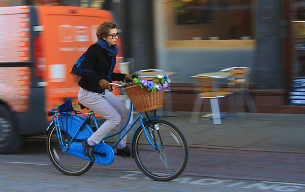
The story of Cambridge is that of ‘town and gown’, and the university looms over cycling as it does the rest of the city. Indeed, it’s thanks to the university that the bike is so ubiquitous. Students are forbidden from keeping a car, an entirely sensible rule given the compact city centre. Having a bike is therefore de rigeur – and the simpler, the better. You won’t see Pinarellos tied up outside college gates!
But there’s more to it than that. Cambridge cycling is growing, in a very practical, down-to-earth fashion. Cargo bikes are now a common sight on the streets. Commuting by bike is popular with all ages, not just the young. Compare it to London, and there’s no cycle cafés, fewer protest rides – that’s not how Cambridge rolls. Instead, it’s just how you get around. (That said, the flat terrain makes it ideal for fixed-gear bikes!)
The downside of Cambridge's cycling culture is that bike theft is all too frequent. Organised raids on the station bike parking have even been known. The police are fighting back with GPS-equipped decoy bikes and even a fake bike shop. But be prepared: either ride an expendable bike for everyday journeys, or insure yourself to the hilt. And if you're buying a second-hand bike in the city, think carefully as to its provenance.
The Cambridge Cycling Campaign can be thanked for much of the city’s cycling progress. This forward-thinking, energetic group has played a crucial role in campaigning for practical improvements. Many of its campaigns have borne fruit, and its most ambitious proposal of all, an entirely new path alongside the railway line, now looks likely to go ahead.

Most journeys around Cambridge will be largely on road. It might not be Dutch-style cycling nirvana, but the roads have been tamed such that it’s better than pretty much anywhere else in Britain.
Cars are kept out of the city centre, but the pedestrianised streets are open to bikes – with a few exceptions, principally Petty Cury. The one-way system still applies: westbound on Sidney Street, eastbound on Trinity Street.
Elsewhere, traffic is funneled onto the main roads by one-way systems, traffic calming and blocked-off roads. The back streets are therefore mostly free of fast traffic, and cycling there is a comfortable experience. That does mean that the main roads can be unpleasant: some have painted-on cycle lanes or intermittent shared-use paths, which provide a modicum of reassurance but are no substitute for proper cycleways.
The route from the city centre to the station is an example of this approach. Hills Road is traffic-filled and not too pleasant, especially at the Lensfield Road crossroads. The alternative route follows residential streets and is much more enjoyable, but also less direct and certainly slower.
Still, continued lobbying by the Cambridge Cycling Campaign has succeeded in getting the worst parts of the main roads sorted out. Most recently, an unusual arrangement of cycle lanes has made the Hills Road railway bridge less of a nightmare.
And is there safety in numbers? It may be a cop-out, but it’s undeniable that Cambridge motorists watch out for bikes in a way that you simply wouldn’t see in (say) a large industrial city. Every September, thousands of new students take to their bikes, wobbling their way across town for the first time since primary school. It’s a sight to behold and – mostly – comes off without incident.
The terrain deserves comment for one reason: it’s flat. Cambridge really only has one hill (Castle Hill), and it’s not exactly Alpe d’Huez.

Bikes everywhere: that’s the defining feature of Cambridge. Other cities would (and do) forbid cycling across parks, through pedestrianised areas, and down alleyways. In Cambridge, by contrast, comparatively few places are off-limits. It’s expected that you won’t ride like a maniac, and in this city of everyday cycling, few people do.
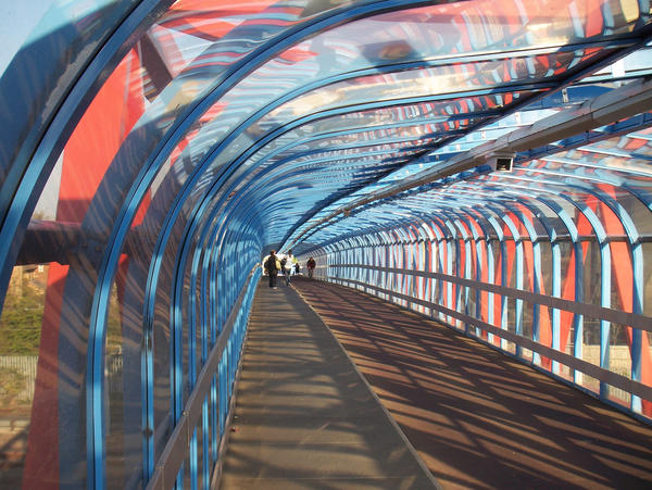
Paths across parks like Midsummer Common, Parkers Piece and Coe Fen make it easy to get across town safely. Cut-throughs link cul-de-sac roads. In particular, the city has a nice line in cycle bridges over busy roads, the railway and the river, opening up possibilities for quiet through-routes that are closed to cars. There are eight car-free crossings of the Cam (discounting the private university bridges), and the cycle bridge near the railway station is, famously, heated!
There are a few longer routes. A riverside path runs from Jesus Green all the way to Waterbeach, though the surface peters out the further you go. Several of the main arterial roads have shared-use paths alongside, such as Madingley Road and Milton Road. The city has recently announced it plans to build Dutch-style segregated cycleways – notably along Huntingdon Road, which currently has little provision for cyclists.
Cambridge’s new guided busway was controversial at the time, but it’s gifted the city with a high-quality cycleway alongside. It heads west to Histon and St Ives, and south to Addenbrookes Hospital.
Log in with your cycle.travel account:
| Password |
Or simply use your account on: