

After the last map update, something weird is happening.
In the last two years, the situation around Nunspeet station (Netherlands) has changed dramatically. A tunnel has been built under the railway for car traffic, and a bicycle/pedestrian tunnel has been created. Many of the intermediate phases were processed on OSM, and CycleTravel always knew the correct route. The work is now more or less complete. And CT's routing for cycling is not correct. The route still runs as it did until a few weeks ago, partly on the old cycle path, partly on a temporary path.
See route: https://cycle.travel/map/journey/796589
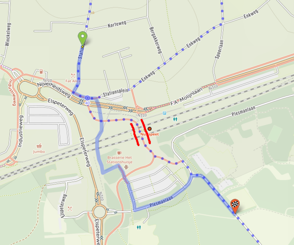 Between the red lines, the tunnel.
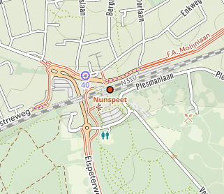
When I zoom out, suddenly the cycle tunnel disappears, and the old cycle tracks appear. And the route (according to the map) is correct.
 The cyclepath until a few weeks ago.
To check, I checked with OSM, and it seems OK. But I'm no expert.
Also checked what RideWithGPS does. And there the route is correct.

So it looks like there is something wrong with CT's update. It's also not clear to me whether it's something that only happens here, or whether it's something that happens more often with major infrastructure changes.
Peter


Comments
Map updates are not a case of “click your fingers and it’s done”!
First of all, the (raster) map on the website is updated. This usually runs overnight (European time), during which time cycle.travel’s default map isn’t available on the website and it shows OpenStreetMap instead.
Even once this is updated, there are three levels of caching that might show you the prior mapping for a while: caching on the server (‘metatiles’), caching at the delivery level (Cloudflare), and caching in your browser. So that’s why you will see differences between zoom levels for a while.
That’s only the website mapping. Next comes the routing. This runs afterwards and takes about a day to calculate for Europe and another two days for North America.
Finally, the mobile app mapping can be updated.
As I write, the website mapping has been updated (but the old mapping may still be cached), and the new routing has been calculated but I haven’t flicked the switch to make it live yet – that will probably be tomorrow.
Hmm, it's more complicated then I imagined. Thanks for the answer. I wait patiently.
Peter
It will now route through the station, but there’s a highway=elevator node along the way which cycle.travel gives a big penalty. If there really is an elevator on the route then it should have an access tag (e.g. bicycle=yes) to indicate it’s usable by bikes – otherwise the elevator tag should be moved onto a side node.
By the way, I also noticed that the stairs on either side of the elevator are drawn as ramps. CT thought you don't have to walk on the stairs. :-)
What you see in front of the elevator is the footpath.
By the way, in the Netherlands elevators at stations are also accessible for bikes, but that is separate from this problem.On OSM everything is OK now, for CT. Just waiting for the next update in a few weeks.
Peter