
Become a supporter
Hi Richard,
Requesting the elevation profile of a route does not work. I have tried several routes, but no elevation profile appears. Yesterday, it was all working fine.
Wishing you many safe cycling travels in 2026.
Peter
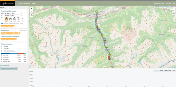
https://cycle.travel/map/journey/901418
A single message works. When answering my own posting, I get the error message.
After the last map update, something weird is happening.
In the last two years, the situation around Nunspeet station (Netherlands) has changed dramatically. A tunnel has been built under the railway for car traffic, and a bicycle/pedestrian tunnel has been created. Many of the intermediate phases were processed on OSM, and CycleTravel always knew the correct route. The work is now more or less complete. And CT's routing for cycling is not correct. The route still runs as it did until a few weeks ago, partly on the old cycle path, partly on a temporary path.
See route: https://cycle.travel/map/journey/796589
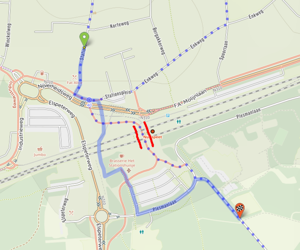 Between the red lines, the tunnel.
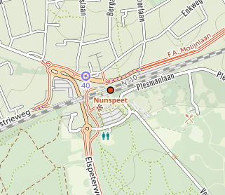
When I zoom out, suddenly the cycle tunnel disappears, and the old cycle tracks appear. And the route (according to the map) is correct.
 The cyclepath until a few weeks ago.
To check, I checked with OSM, and it seems OK. But I'm no expert.
Also checked what RideWithGPS does. And there the route is correct.

So it looks like there is something wrong with CT's update. It's also not clear to me whether it's something that only happens here, or whether it's something that happens more often with major infrastructure changes.
Peter
I have never had any problems with downloaded routes from CT. My default routine is to download a route and open it in Garmin's Mapsource. Very old-fashioned, but that must be due to my age.
Today I made a new route: https://cycle.travel/map/journey/754856
The file is not recognised by Mapsource. Now there is a work-around via gpsvisualizer.com, but it was not necessary in the past.


Made in the Cotswolds. Published by Éditions Système D Ltd.
Log in with your cycle.travel account:
| Password |
Or simply use your account on:
