
What has happened to the Menai Suspension Bridge? Cannot plan a route across the gap!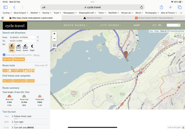

Become a supporter
cycle.travel now has Ordnance Survey maps
Plan multi-day adventures easily
Thanks to Swaledale Outdoor Club!
We’re now in Australia and New Zealand too
Stick to tarmac with our new routing option
cycle.travel expands to Scandinavia and Eastern Europe
Smart Turns – new on cycle.travel's route-planner
What has happened to the Menai Suspension Bridge? Cannot plan a route across the gap!


Made in the Cotswolds. Published by Éditions Système D Ltd.
Log in with your cycle.travel account:
| Password |
Or simply use your account on:
Comments
From https://www.gov.wales/a5-menai-bridge-frequently-asked-questions#:~:text=Why%20did%20the%20Menai%20Suspension,bridge%20span%20hangers%20was%20identified.
"Following advice from UK Highways A55 Ltd and their structural experts, we closed the A5 Menai Suspension Bridge to all traffic from 21 October until 2 February 2023, while the temporary work was completed."
Between the time taken for OSM to update that info and then CT to update from that (approx. monthly, I believe) it's not unusual for there to be a lag.
I believe the "direct to end" function should allow you to plan a route across the bridge
Thanks for the reply. Whilst the bridge was closed to vehicular traffic it was still open for pedestrians and dismounted cyclists and is fully open now.
I’m struggling to find the “direct to end” function. Many thanks.
Yes, it appears to be open. But only since early February.
There are two things that need to be updated to reflect that:
The OSM data
And CT itself needs to take that OSM data on board (approximately monthly, I believe)
The direct to end function is available on a waypoint/viapoint.
You can click on the viapoint and one of the options given is direct to end. That will plot a straight line from the viapoint to the end.
In the example I placed a start point on one side of the bridge, the endpoint on the other, added a viapoint, selected direct to end. Then I added another via point before the Endpoint and that allows me to move the end point to wherever I want.
https://cycle.travel/map/journey/399267
You should be able to replicate this for your own route.
Note: I have no idea how this will affect the PDF printout if you use that but any gps device should handle this without a problem.
That’s a handy function. Thanks