

How does c.t decide what counts as paved please?
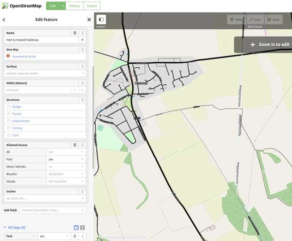
Context of the question is I rode the Hart to Haswell Walkway as part of a longer loop a couple of days ago however it's this bit that is https://cycle.travel/map/journey/135543 that prompted the question. In the OSM there is no value specified for the surface, see image below.
What is actually on the ground isn't paved. Some of it is loose matchbox sized stone, some is muddy puddles, some is wooden boardwalk. Whilst it was passable on a touring bike with care, I'd have been carrying my road bike. I last rode it in the summer of 2017 on the touring bike and it was just as rough, but drier!
The reality is it was probably compacted when first constructed. I'd probably tag it as unpaved now, as the more precise tags seem to refer to the surface as it is intended to be, and do not take in to account neglect.
I am planning to update the OSM surface tag by the way.


Comments
Where there isn’t an explicit surface tag, c.t takes an educated guess. This varies a bit from country to country and between urban and rural areas, but broadly speaking, in the UK anything tagged with highway=cycleway will be assumed paved if not otherwise tagged. (highway=bridleway and highway=track are unpaved, and so on.)
Some of the NCN routes in the County Durham/Teesside/Newcastle area are indeed a bit lacking on surface information – so thanks for adding the surface to OSM!