
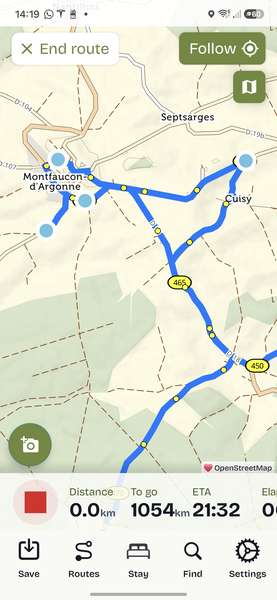
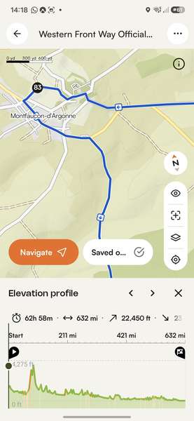
I'm planning my first big ride along the Western Front. I've downloaded the official .gpx file but when opening it in the cycle.travel app, some alarming variances to the same rout in Komoot occur....
What am I doing wrong?
Thanks
Nigel

Become a supporter
cycle.travel now has Ordnance Survey maps
Plan multi-day adventures easily
Thanks to Swaledale Outdoor Club!
We’re now in Australia and New Zealand too
Stick to tarmac with our new routing option
cycle.travel expands to Scandinavia and Eastern Europe
Smart Turns – new on cycle.travel's route-planner
I'm planning my first big ride along the Western Front. I've downloaded the official .gpx file but when opening it in the cycle.travel app, some alarming variances to the same rout in Komoot occur....
What am I doing wrong?
Thanks
Nigel


Made in the Cotswolds. Published by Éditions Système D Ltd.
Log in with your cycle.travel account:
| Password |
Or simply use your account on:
Comments
Nigel, you're making (in my opinion) a few poor decisions.
First of all, I wouldn't trust Komoot to direct me to the bathroom!
Second of all, importing a route, especially a long one, can be a tricky process. To my simple way of thinking, imagine I ride a full suspension MTB and love singletrack but someone else is on a recumbent. The route that works for me is going to cause a problem for them!
Thirdly, and most importantly, you're using the CT App (which with all due respect is really for simple, point to point plotting) and not using the website which has far superior tools for importing a route accurately.
On the map page of the CT website, on the LHS you'll see the import gpx function - that's what you should be using, to my mind. It will give you three import options depending on the type of route it is and it will display the imported route with a blueish 'trace' line that will highlight where the CT version varies from the original.
See the last post in this thread to see what I'm talking about.
Once you're happy with the imported route and have saved it, it will be available in the app.
If all that seems too much like work and Komoot seems to be so easy in comparison, well, there's generally a reason for that. Hopefully you won't find out why! :-)
Could you provide a link to the official .gpx file?
Hi Richard
I think this is it…
https://waytrails.com/western-front-way-official-cycling-trail-nov-2024/
Nigel
Thank you for the helpful comments…
I’ve opened the route on my computer by importing it into the website….but the same thing happens!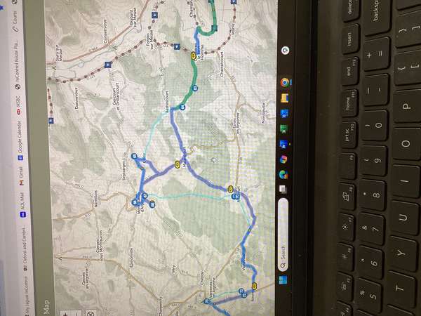
This is how Garmin’s Mapsource interprets it..
I this the aim is to go via the American Memorial…
Nigel, I think you're seeing the value of CT in action.
I've imported the route, and we can see that your example varies from the original. However, the real question is why?
It looks like the 'roads' CT is not using are not very good quality. I've moved a VP onto one and cannot generate Street view - normally a sign of an inferior road.
You could explore the area further by opening a new map page and plotting various routes around that specific area. Does CT want to use those roads? Can you use Street view where they intersect with a better road?
In any case, you have a choice:
Use the CT version of route (maybe tidy up the via points into something smoother) or adjust the CT route to exactly match the original / use a different planner. (By the by, it's not clear to me that the Garmin version isn't adjusting the original, too).
There are many times CT will divert us off an 'official route' - there is normally a good reason for that. Here, it seems that CT wants to avoid 2 particular roads and is producing a complicated detour to achieve that.
Thanks! Looks like CT was avoiding an unpaved road (Chemin Vicinal Ordinaire de Cuisy a Bethincourt), although there are good roads (D160, D18) around it.
I am curious as to how CT has generated waypoints (I assume those are what the numbered circle are) which are not on the original route and lead to nowhere (see number 68 in the picture above - its a few metres down a road and the u-turn).
There are bigger issues to contend with though - the route over the mountains from Metz uses entirely different roads to the original, missing various memorials and sites.
I will have to replan the whole thing trying to follow the original as far as I can. The main issue with the Western Front website is that there isn't a description of what I am supposed to be looking for without zooming in to see what shows up on the detailed GPS maps....
Yep, this sort of route which mixes on-road and unpaved/gravel sections isn’t really suited to the GPX import. As a general rule, if it’s not a route that c.t itself would choose to plan (due to rough terrain, busy roads, or whatever) then the GPX import will struggle. It should only be about ten minutes’ work to drag it back onto the original route as represented by the thin cyan line, though.
Thanks for you advice both!