
Become a supporter
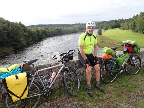
This 120 mile 4 day tour came about because my friend Mike wanted to cycle the full length of Glen Lyon (which is supposed to be Scotlands's longest enclosed Glen at 34 miles), but we didn't just want to do an out and back ride up to the head of the Glen and back to Fortingall. So, after careful studying of the OS 1:25,000 map of the area, we discovered that there was an unclassified road that ran from Lubreoch at the head of the Glen, where the Lubreoch Dam holds back the waters of Loch Lyon over to Glen Lochay, where a "C" road runs down the Glen to the village of Killin which is located on NCN Route 7 as it heads from Callander to Aberfeldy and then Pitlochry on it's way North. We'd previously put together a touring route for a friend, which included Loch Tummel, Loch Rannoch and the climb over to Aberfeldy, but had ignored Glen Lyon. So the challenge was to stitch all the above into a multi-day tour, which would start and finish at Pitlochry, include a night of wild camping at the head of Glen Lyon and two nights on campsites, one at Loch Rannoch and one at Aberfeldy. As this was a predominantly on road tour, both Mike and I used our road touring bikes, with front and rear panniers.
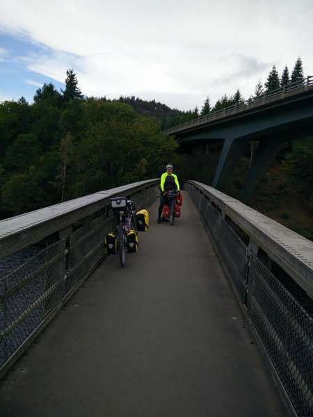
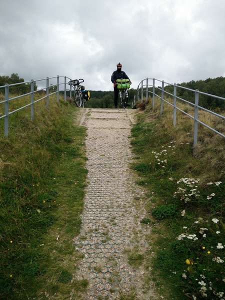
We left Pitlochry early on a Friday afternoon in September, both bikes heavily laden with provisions, as we knew there were no shops of any size until we reached Killin on Day 3. Because we wanted to cycle along the road on the Southern side of Lochs Faskally and Tummel, we headed to the Pitlochry Boating Station along Clunie Bridge Road, where we pushed the bikes along the footpath which traverses Loch Faskally via the Clunie Bridge, which is an aluminium trussed footbridge, the only one of it's kind in Scotland. This route avoids any contact with the busy A9.
Once across Loch Faskally, we started cycling west along the "C" class road towards it's junction with the B846. The road stuck fairly close to the side of Loch Tummel and as a result it undulated quite a bit as it crossed the multitude of burns that flowed down from the hillside, there was one very steep climb about 3 miles in which required some pushing. We passed our first of many power stations (Clunie) after about 2 miles.
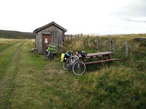
After about 10 miles we met the B846 and followed it down into Tummel Bridge, where we passed the second power station (Tummel). From Tummel Bridge we continued westwards along the B846, the road climbed fairly gently until we hit a fairly stiff climb at Dunalastair, but at the top we were rewarded with great views over Loch Dunalastair. We had a fairly steady run into Kinloch Rannoch, where we left the B846 and headed for the "C" class road which ran along the South side of Loch Rannoch towards the Forrestry Commision campsite at Kilvrecht. This is a basic camp site which has toilets and washing facilities with cold running water; no hot water or showers, but it is in a great location, is cheap and was pretty quiet when we were there in mid September.
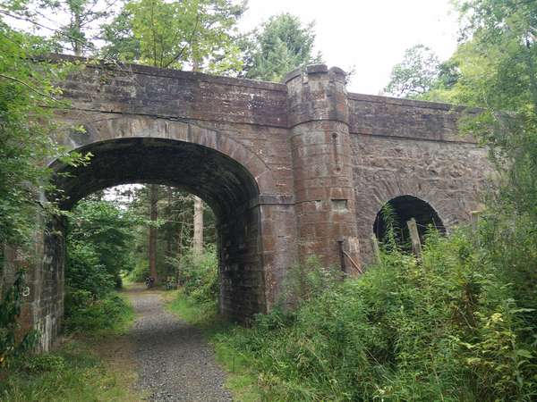
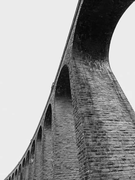
Our route on day 3 followed the Dava Way to it's end in Forres. At Dava there is a short section where the Dava Way deviates from the old railway onto the A940, it's well signposted but care is needed as it is a fast road. There is an old permanent way hut about halfway between Grantown on Spey and Forres; it has been restored as a shelter and information point and is well worth a visit. Another impressive feature is the Divie Viaduct and further along the Scurrypool Bridge, which only carries a humble estate track over the Altyre Burn and the railway but is quite ornate. Just before reaching the outskirts of Forres we passed the Dallas Dhu Distillery, which although no longer a working distillery, is now a whisky heritage attraction.
The Dava Way ends rather unceremoniously in a housing estate, so we turned left to pick up the A940 and followed it into the town centre, where we picked up our lunch at the local Tesco, before heading to the public park to eat it. From the park we headed North to cross the A96, where we met Route 1 and followed it on the new road past the new train station and then the minor road towards Waterford Farm, where Route 1 heads East following a track to a rather long bridge over the River Findhorn. We continued to follow Route 1 until we came to a pair of large stone gate posts, where we deviated and followed a footpath - it is signposted Kintessack via Wellhead, it's a narrow path but is well used by local cyclists, we rejoined Route 1 at a 4 way junction. At this point Route 1 heads towards Brodie Castle, our route followed the road signposted Cloddymoss and Nairn and we rejoined Route 1 about 2 miles along this road for the final few miles into Nairn. Once in Nairn we headed down to the harbour and along the sea front before heading towards Sandown Farm and taking the track up to the A96 and then onwards to Delnies Wood and journeys end.
This is an interesting circular tour, the amount of riding per day was governed by the locations we'd earmarked for wild camping, rather than the difficulty of the terrain. The steepest climb is on the first day, from the Clava Cairns up past the railway line, it's about 7% average, the rest of the climbs tend to be long and steady. The off road section of Route 7 after Sloch is pretty rough and washed out in places and some pushing will be required. The Dava Way is all ride-able, but there are some sections where tree roots could be challenging in the wet, some sections where the old railway ballast is very chunky and rough and some sections that can be wet and boggy. All the on road sections are fairly quiet from a traffic perspective, other than the main roads - crossing the A95 at Chappleton and again near Grantown on Spey, the A939 in Grantown on Spey, the short section of the A940 at Dava and again in Forres and the crossing of the A96 in Forres. The route could easily be reversed - the climb to the summit of the Dava Way from Forres is longer than the climb from Grantown on Spey. Neither wild camping location has any accessible water nearby, so make sure you carry some extra with you, we carried about 6 litres between us on day 1 and day 2 and made sure our bottles were topped up when we could.
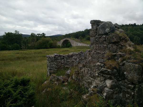
We named the tour the Bridges Tour because of the number of interesting bridges we went over, under or passed by along our route.
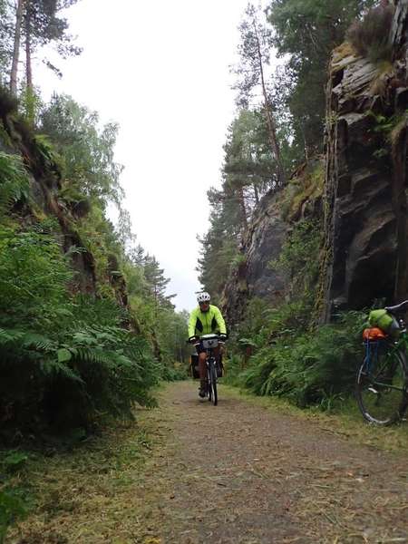
Our route continued along the off road section of Route 7, this was the General Wade's Military Road section, so it wasn't long before we came across a fine example of one of his bridges, Sluggan Bridge crosses the River Dulnain at Sluggan.
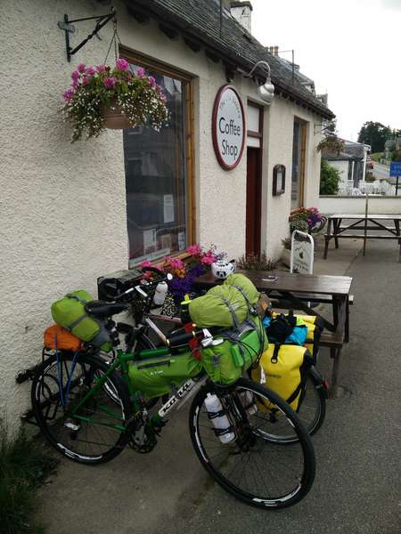
About a mile after Sluggan Bridge the rough track joined a minor tarmac road all the way into Carrbridge, where The Old Bakery Coffee Shop did fine mid morning bacon rolls and coffee and also filled up all our water bottles.
In Carrbridge Route 7 splits with the option of either an on road or off road route towards Chapleton; we chose the off road route which meandered through woodland before climbing out onto open land on the flanks of Docharn Craig, the views across the Spey Valley to the Cairngorms were pretty spectacular. We met up with the on road route at Chapleton and followed Route 7 into Boat of Garten on a mixture of cycle path and road; in Boat of Garten Route 7 splits again with the option of an on road section to Coylumbridge on the East side of the River Spey, or a traffic free section following the Speyside Way to Aviemore on the West side of the river. Our route followed the Speyside Way on a well surfaced path into Aviemore, with a bit of minor on road riding through the Dalfaber Estate.
After picking up supplies in Aviemore we followed Route 7 to Coylumbridge and headed up the on road section (now on the Western side of the River Spey) towards Boat of Garten. After about 5 miles, just after Auchgourish, we took a track to the right towards Tulloch, the track has a "Unsuitable For Motor Vehicles" sign, but the track is fine for cycling. Once the track turned back to tarmac at Tulloch, we followed the minor road through the Abernethy Forrest into Nethy Bridge, the RSPB Osprey Centre at Loch Garten is located nearby and is worth a visit.
From Nethy Bridge our route followed the B970 towards the A95 and Grantown on Spey; at the junction with the A95 we crossed the road and followed the Speyside Way and crossed the Spey on the old Spey Bridge, before heading into Grantown on Spey through the Anagach Wood.
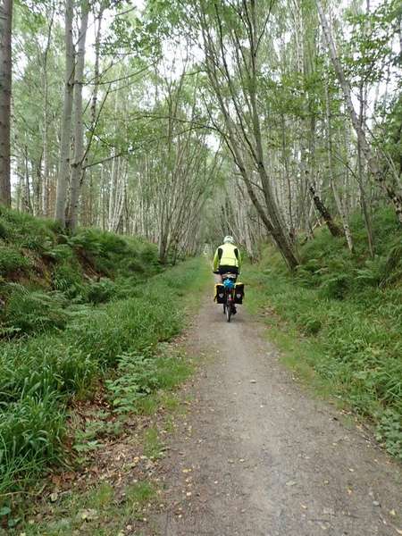
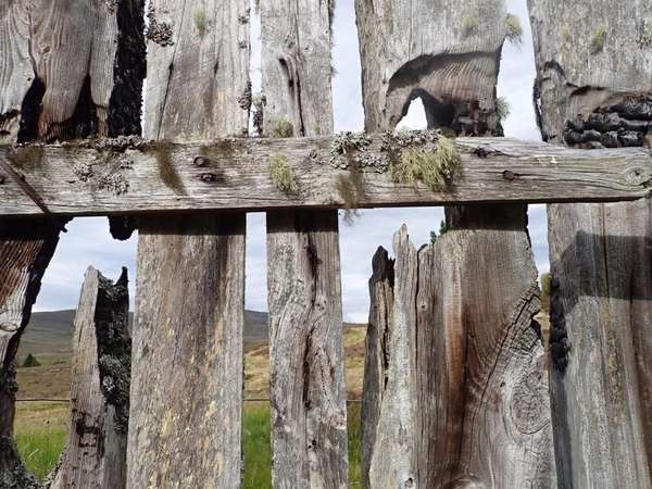
After a fish and chip tea and replenishing our water bottles in Grantown on Spey, we picked up the Dava Way at Dulicht Bridge, adjacent to the large Caravan Park and commenced the long gradual climb to the summit. The Dava Way follows the route of the old railway between Grantown on Spey and Forres, the surface varies from pretty good to very rough and there are some very wet sections, the summit section on Dava Moor is remote, exposed windy. Again we wild camped just after the summit, where the track passed through a small section of forest and a old sleeper fence provided good shelter from the wind (GR012367), but when the wind dropped the midges were merciless.
This three day on & off road tour started off as a challenge to create a 2-3 day circular tour based on my friend Mike's home town of Nairn.
NCN Route 1 passes through Nairn, NCN Route 7 joins Route 1 to the West of Nairn before heading to Inverness and the Dava Way links Grantown on Spey a town to the South of Nairn, to the town of Forres which is to the East of Nairn, so the challenge was to stitch these together to come up with a route, which would combine on road and off road riding with wild camping - no credit card touring for us.
As the route was going to be roughly 50:50 on and off road, we both used bikes with an off road bias, I used my old Stumpjumper FS and Mike used his old Kona Sutra which he'd built up as a bike packing rig.
Day 1 of our route headed out of Nairn on a more direct Westerly direction than Route 1 (which takes a big loop to the South); after turning left at Clephanton and crossing the River Nairn, we joined Route 1 at Wester Galcantray and followed it until it met Route 7 near the Nairn Railway Viaduct and the Clava Cairns, both impressive structures for different reasons.
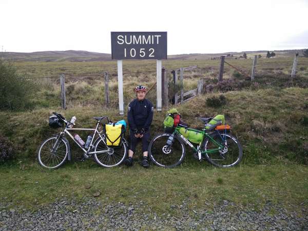
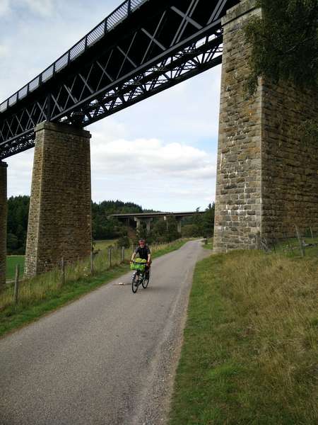
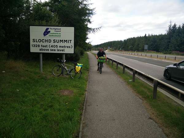
We then followed Route 7 until we reached the village of Tomatin; on the way we passed the Moy Viaduct, which is a wooden bridge carrying the Perth - Inverness railway line over a stream. In Tomatin we deviated from Route 7 for a short while to cross the River Findhorn via an old bridge at Raigbeg, which gave great views of the A9 road bridge and the very impressive Tomatin railway viaduct. Our short deviation rejoined Route 7 just as the climb to Slochd Summit commenced, the climb was fairly steady all the way up to the summit sign ( 1328') next to the busy A9. After a short section running alongside the new A9, Route 7 moved away to follow the old A9 road. Near the old outdoor centre Route 7 splits with both on and off road options, the on road route follows the old A9 road into Carrbridge, the off road route follows a mixture of estate tracks and part of General Wade's Military Road which takes a longer South Easterly loop into Carrbridge, the off road route is pretty rough and expect to do a bit of pushing if your bike is loaded.
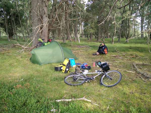
Our route followed the off road section of Route 7 as it offered the best options for wild camping, we chose a spot about 3 miles along the track, it was in a small clearing about 50m off the track and well away from any of the estate cottages (GR865220), we knew there were no streams close to this camping spot, so we had carried extra water with us for cooking and drinking. Midges could be a real problem at this campsite location because of all the trees, but thankfully there was enough of a breeze to keep them at bay, but we had midge repellent just in case; it's also worth noting that the 4G signal at this camping location is pretty good.


Made in the Cotswolds. Published by Éditions Système D Ltd.
Log in with your cycle.travel account:
| Password |
Or simply use your account on:
