

Readers of my earlier travelogues may guess that I am fascinated by enclaves and exclaves – “a portion of territory of one state completely surrounded by territory of another or others.” I was surprised to read on Wikipedia that until 1844 there were several parts of Wiltshire that were distantly detached from the main part of that county. This is a day ride to visit those exclaves. It may look as though I had lost my sense of direction and had gone astray, but the route is a consequence of the irregular polygon exclave boundaries.

I must confess that I had thought that it was nonsense that there could have been Wiltshire exclaves separated from the county by as much as thirty miles: either a misinterpretation of the historical record or a cartographer’s joke, but visual evidence on this ride confirms that it was indeed true.
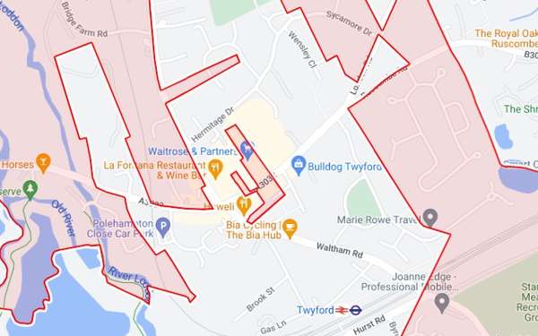
Starting from Mortimer railway station, the ride followed quiet lanes until crossing over the M4, then good cycle paths through the centre of Reading, parallel to the A4 London to Bath road, and a short distance in the direction of Wargrave to the northernmost tip of one exclave. Turning back and into the centre of Twyford where there was apparently a tiny exclave (no more than 180 metres in length) where Waitrose is now (although the adjacent Tesco was Berkshire).
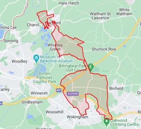
Continuing southwards along The Straight Mile where the exclave narrowed to a strip only the width of the road before widening again. The railway line and A329(M) dual carriageway form a barrier to the strict exclave perimeter, so I continued through Amen Corner and crossed using the large footbridge – presumably built for people to walk to work (um…) – and into the large new Peacock Farm housing area, where credit is due for incorporating a network of new cycle paths. North again, then along the Forest Road, and turning south at the Warren House Roundabout (Bracknell has been described as roundabout-ey) and into Wokingham for a stop for coffee and food.
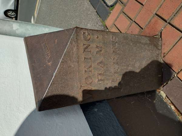
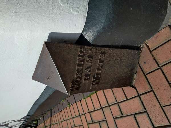
Heading northwards again, I spotted an old metal boundary marker at the corner of Rose Street and (duh) Wiltshire Road that said “Berks” on one side and “Wokingham Wilts” on the other. Gob well and truly smacked. Do the residents know that they are Moonrakers?
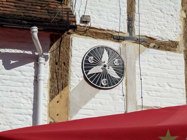
Onwards with short excursions along the lanes that surround the M4-A329(M) interchange, where old Wiltshire wrapped around Berkshire, then to Hurst and past The Castle Inn with its old winged wheel Cyclists' Touring Club plaque, before turning south again at Whistley Green.
Away from the Wokingham-Twyford exclave, and to a separate Wiltshire patch around Farley Hill south of Arborfield Green. I did get lost a bit here, as I had hoped to cross over the River Blackwater but the fords proved unfordable. Finally, into the remaining historic exclave at Swallowfield and through Riseley to return to the railway station.
Perhaps it is time for a campaign to repeal The Counties (Detached Parts) Act 1844, so that Wiltshire can reclaim its historic territory?

