
Become a supporter
Following up my earlier post:
https://cycle.travel/post/7102
Continuing my quest to produce some of the most boring videos ever made public, I offer a few more. These might enable you to compare navigation using the cycle.travel app with the appearance on some dedicated cycling computers.
I apologise if this seems like an application for membership of the Dull Men’s Club (a real thing, see https://dullmensclub.com/). At least they are mercifully shorter than my previous efforts.
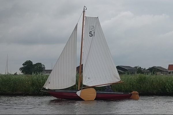
This is a series of videos of real-world rides from Sherborne to Castle Cary, 19.5 kilometres (or 12 miles) through part of the Dorset and Somerset countryside. The route was created on the Cycle.Travel website and saved as the GPX Track format with elevation data.
There are links to individual videos, but you can also find these by an internet search for “YouTube Reg Pither”.
1. The first video is a screen capture of the Cycle.travel app, version 2.1, with audio so you can hear the turn prompts. This was done using the screen recording function pre-installed on my Sony Xperia mobile phone, but for an unknown reason the recording stops part of the way through the ride. The C.T app continued to work properly to the destination.
https://www.youtube.com/watch?v=ih3Z1RZtHCY
2. The second video is similar: a recording of the Cycle.Travel app, version 2.3, with audio and with the elevation displayed (swipe up on the app). Again, the screen recording stops a little short of the destination, but the app did not. Note that at 10:06 the elevation profile zooms in because the C.T app has chosen this as the start of a distinct climb.
https://www.youtube.com/watch?v=gQFSOpzq6_w
3. Same ride, as seen on the screen of a Garmin Edge 840 with default appearance. Screen recording is switched on via a hidden menu in beta firmware (version 30.18 dated 12/02/26). The route was sent from C.T to the Garmin Connect app, and thence to the 840. There was quite a bit of work to turn this into a video (I know, yawn), as the Garmin stored the screenshots as 9,473 bitmap files. The Garmin decides that there are five distinct climbs on this route.
https://www.youtube.com/watch?v=gvEwq-_8k7Y
4. Same ride, as seen on the screen of a Wahoo Elemnt Roam v2 (firmware WC50-17071). The right-hand side of the screen shows vehicles approaching from behind, as detected by a Garmin Varia radar device – a faintly amusing feature is that the version 1 or 2 Wahoos allowed you to change the graphic of the approaching car: in this video they are Father Christmases left over from December. The Wahoo decides that there are eight distinct climbs.
https://www.youtube.com/watch?v=BLn04SsCUKw
5. Same ride, as seen on the screen of a Wahoo Elemnt Ace (firmware WG77-302041). Version 3 Wahoo devices (Bolt, Roam or Ace) don’t allow the radar graphic to be changed, so just cars. Just one feature might be of interest: I placed a marker on the Cycle.Travel map at the location of Chapel Cross Tearoom, which is slightly off the planned route; this becomes a waypoint in the GPX Track, and transfers to third generation Wahoo devices as a Custom Point of Interest (a magenta circle on the map). At 48:47, a magenta banner pops up clearly warning you that you are approaching your chosen point – this might be useful for, say, an Audax control point or sportive feed station, or (for me) something like a monument or church that I want to look at. The Wahoo Ace also does audio turn announcements, but as most of my riding is in quiet areas, I don’t have this turned on. The more riding I have done, the less I depend on the turn-by-turn instructions – an occasional glance at the chevron route line and I can see where to go long before any junction.
https://www.youtube.com/watch?v=rlqeRD5dfak
6. If you would prefer to see a slow ride through Dorset and Somerset, I have also uploaded video footage from my Cycliq Fly12 front safety camera: blue sky, birdsong, and hollow way hedgerows. This is in two parts, because I can’t work out a way to merge all of the five-minute MP4 files into a single video. On the audio track you will be able to hear the turn prompts from the Cycle.Travel app, and see how these relate to the road. Try to ignore the sound of an old man puffing up the hills.
https://www.youtube.com/watch?v=bEV88A9YL3k
https://www.youtube.com/watch?v=wdMXQhyEPEc
Hope this helps.
Another trip to the Netherlands, this time to combine some musical events with attending the Tour de Retro cycling event.
We travelled again via the Harwich to Hoek van Holland ferry, and chatted for a while with a young couple who were just starting out on a cycle camping expedition to Istanbul – a daunting undertaking, and we wished them well. Disembarking, we rode on the excellent cycle paths into Rotterdam and then caught the train to Utrecht to stay for three nights. The first reason for this journey was to go to some of the concerts in Het Festival Oude Muziek: the ten-day festival of European early music, i.e. music from the thirteenth to eighteenth centuries. By pre-arrangement we also went to Holy Trinity church so that Mrs G could join the choir practice for their Anglo-Dutch choir – apparently Anglican choral evensong services have become quite popular in the Netherlands, as described in Hanna Rijken’s book My Soul Doth Magnify.
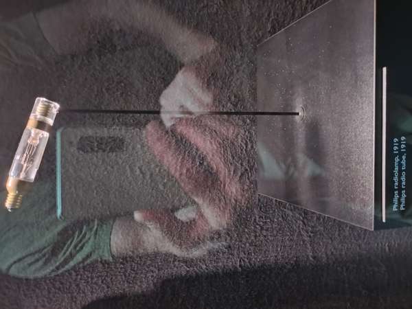
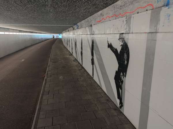
Thereafter we took the train to s’Hertogenbosch, and cycled the remaining distance into Eindhoven to stay for three further nights. This gave us time to visit the excellent Philips museum on the site of the company’s original 1891 light bulb factory. A short walk then to find the cycle and foot tunnel under the main railway line, recently decorated with a Ministry of Silly Walks mural.
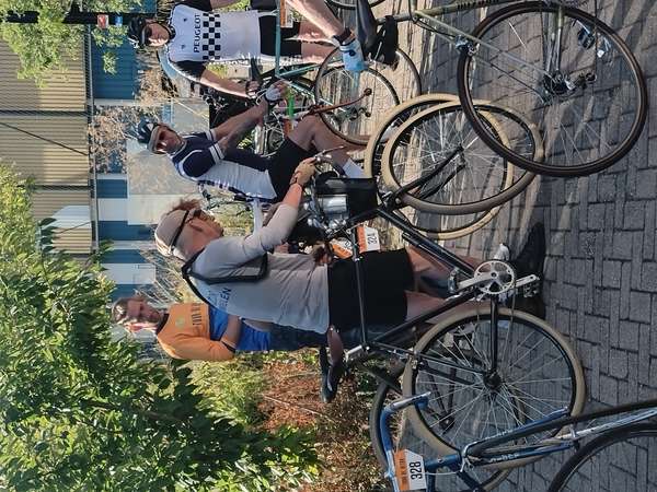
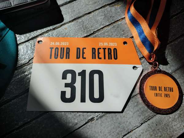
On the Sunday we joined around 85 other cyclists for the Tour de Retro cycling event starting from De Cyklist café. This year’s event offered 45 or 75 kilometre sign-posted and GPX routes into the Noord Brabant countryside, with a stop halfway at another cycle-friendly café, Borrelbar Kikkerop at Maarheeze.
www.tourderetro.net

This event is not a race or a sportive, and can be ridden on any bicycle, although there were several steel racing bikes (the organisers joke that there are no Retro-police to check the antiquity of your machine). However, it must be ridden wearing a retro cycling jersey – Mrs G was one of five riders sporting the classic red-yellow-black TI Raleigh jersey, while I had a reproduction Frimatic Viva de Gribaldy (France 1969). One of the other participants rode a single-speed Azor and was dressed in the style of early Tour de France. We were blessed with excellent weather, and passed hundreds of others (mainly couples on e-bikes) out for a ride in the early autumn sunshine.
The Tour de Retro is the idea of cycling jersey collector Ton Merckx (no relation to Eddy) – his continuing collection has reached an astonishing 2,800 jerseys.
https://tonmerckxwielershirts.nl/en/about-ton-merckx/
Returning the next day by train to Rotterdam, we retraced the route back to Hoek van Holland for the return ferry. In the check-in queue we chatted to a young man returning from a tour to Amsterdam riding a G-Line Brompton, and who was towing a small trailer that carried his placid Labrador dog passenger. We shared enthusiastic comments about the wonderful Dutch cycle paths.
Following on from last year’s Meridian straight line travelogue, I came across an interesting cycle route on another route planning platform (includes the letter K, but the route is on open display on the internet). This is the “Netherlands Giant Circle”: approximating the biggest circle that fits within the borders of the country, and this seemed like a good way to see different parts of the Netherlands and go to some previously-unvisited towns.
First, the prologue. This time I opted to use the ferry from Harwich to Hoek van Holland, and I found the check-in, boarding and disembarkation much more pleasant than the frantic procedure at Dover Eastern Docks (the latter’s disappearing red line for cyclists being particularly unhelpful). At Hoek van Holland it is only 450 metres from the ship to the RET Rotterdam area metro, bicycles allowed after 09:00, tap-on tap-off with a debit card for the Lijn B journey to Rotterdam Alexander, then a NS train to Woerden and the start of the circle ride.
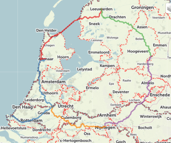
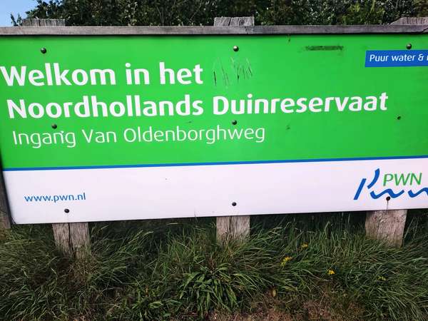
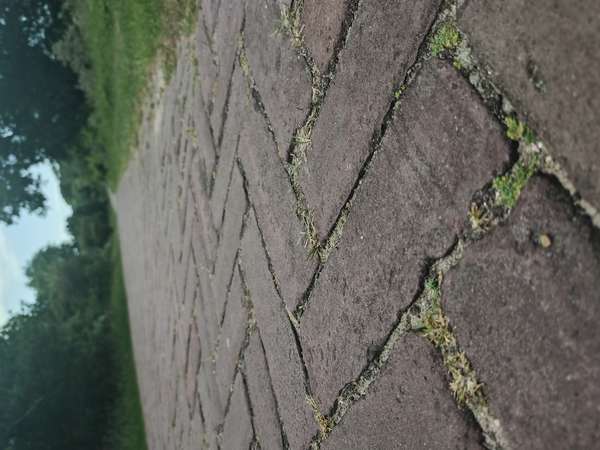
Day 1: Woerden to Alkmaar. Soon out of the town and into open countryside. This is Het Groene Hart van Holland, the green heart of the southern part of the Netherlands, with lush green fields interleaved with a grid of drainage ditches. Although it was not remotely like the Dutch Headwind Cycling championships (NK Tegenwindfietsen), it was still steady work into the prevailing wind. Onwards through Haarlem to the Nordzeekanaal ferry (free for cyclists, of which there were many). This was the first of eight ferry crossings of varying sizes on this tour. From there into the dune reserve (Noordhollands Duinreservaat), the herringbone brick cycle path weaving among the steep dune and heathland landscape, then turning off to head into Alkmaar for the overnight stop.
Day 2: Alkmaar to Leeuwarden. Back towards the coast and continuing in the dune reserve, this part more forested, then emerging into flat farmland at Groet, followed shortly by a bonus ferry crossing near Burgerbrug as the small bridge was under repair.
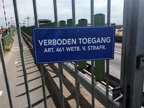
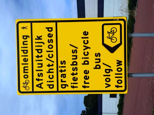
Onward to Den Oever, but here things went wrong. The borrowed Giant Circle route (and cycle.travel) indicated that you could ride over the Afsluitdijk causeway, but as I write (July 2025) you can’t. Massive disappointment: I was looking forward to riding 30 kilometres with a tailwind. At the point where the cycle path should start along the causeway there was a padlocked gate with an entry prohibited sign. A local man called out as I stood looking puzzled, and explained that the path had been “closed for years” but there is a bus. He was indeed correct: after-the-fact internet research shows that most of the Afsluitdijk cycle path has been closed since 1 April 2019 as the dyke is raised and improvements made to the sluices (the Dutch Cyclists' Union thought it might be an April Fool joke, but no). Although car traffic continues, the bike path is not scheduled to re-open until October 2025 at the earliest. Turning back, I saw rather obvious signs that I had ridden past, eventually found the bus station behind the DekaMarkt car park, then had a wait for the hourly bike bus to arrive. See: https://theafsluitdijk.com/bicycle-bus-timetable/
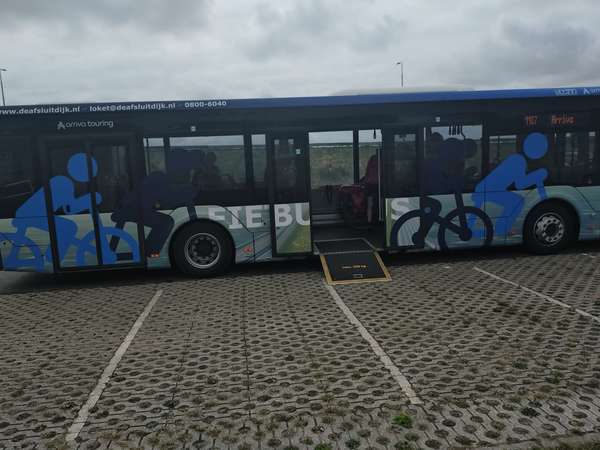
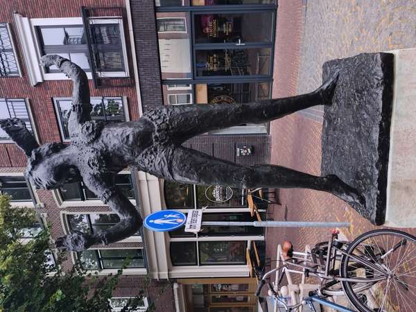
The bus drops off at the Kornwerderzand island, so I did get a short tailwind-assisted ride (40 km/h) along part of the causeway before turning east and zig-zagging across the windy but lush green Fryslân farmland, many village signs (e.g. Cornwerd/Koarnwert) in both Dutch and Frisian. After Easterwierrum turning north into Leeuwarden for the overnight stop, with a quick walk to find the statue of Margaretha Geertruida Zelle, also known as Mata Hari.
I really should have done more research before coming to this area, as further Wikipedia reading revealed my ignorance of the multiple dialects in different parts of Friesland (and the Netherlands), this also leading me to the wonderful Wikitongues website, www.wikitongues.org, with videos of volunteers speaking Dutch, Frisian, and Bildts.
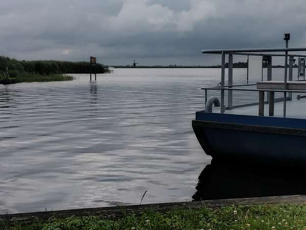
Day 3: Leeuwarden to Coevorden. South out of Leeuwarden towards Grou to return to the Giant Circle, and turning east to enter De Alde Feanan, one of the Netherlands twelve national parks. Crossing into the park and onto De Burd island was on the first of the day’s three small ferries (pontjes), this one carrying me and one car, the ferryman advising me that they were working on the “klok” (engine) of the next ferry and hoped it would be ready to start operating at 10:00. Riding on a little further I reached that ferry: the wonderfully-named Pont de Snoekcbears which shuttles the short distance across De Greft canal, and the engineer was indeed working below deck with three volunteer ferrymen cheerfully chatting nearby. I had a half-hour wait but the ferry was ready on schedule, and it gave time to sit and watch the activity on the adjacent lake Sitebuorster Ie: motor yachts, canoes, sail boarding, and many sailing boats including a glimpse of one example of a traditional Frisian skûtsje with its fan-shaped leeboards (pivoting keels). Larger skûtsje flat-bottomed sailing barges were once the main form of cargo transport in the shallow waters of inland lakes and canals, but smaller ones are now for skilled recreational activity.
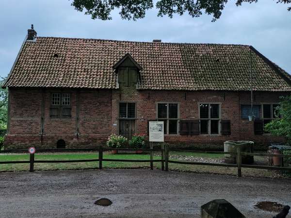
Continuing and across De Grietman ferry (there is a live webcam: https://webcam-friesemeren.nl/iesicht/, so you can watch the crossing from your laptop), then to Beetsterzwaag/Beetstersweach and a stop for coffee and cake. Onward along quiet lanes among more wooded farmland, and into Drenthe province and Fochteloërveen where the cycle path runs through marshy heathland, white storks stalking alongside a drainage ditch where the farmer was raking weed up onto the bank, presumably hopeful of feeding on disturbed frogs. Finally into Coevorden for the overnight stop.
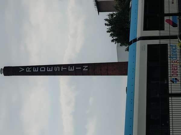
Day 4: Coevorden to Nijmegen. This was the longest day, and it unfortunately started with heavy rain for the first two hours, remaining overcast and windy all day. Grateful to stop for an early coffee at Gramsbergen to allow the rain to ease, before continuing south in more wooded countryside. Eventually up a very slight climb to Needse Berg (all of 36 metres above sea level) where there is a wooden viewing tower. Through Borculo and into woodland, stopping for lunch at the small farm museum at Lebbenbrugge. Onward through Doetinchem, where there was once a large Vredestein bicycle tyre factory, across the Pannerdensch Kanaal via a busy ferry, and into the centre of Nijmegen on the excellent bicycle superhighway, parking my bike overnight in the Fietstransferium underneath Nijmegen railway station as my city centre hotel had nowhere to store a bike.
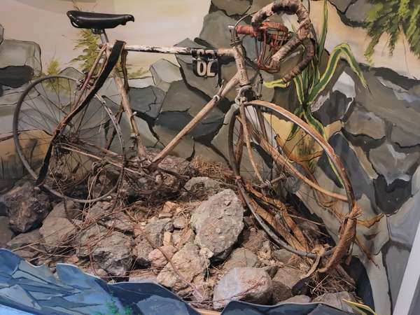
Day 5: Nijmegen to Woerden. First to the Waal riverside to visit Velorama: originally the private collection of Gertjan Moed, now the Dutch national cycle museum with a superb collection of very early bicycles, as well as the bicycle ridden in 1951 by Willem van Est (1923-2003), the first Dutch rider to wear the yellow jersey in the Tour de France, but who fell 70 metres down a ravine on the descent of the Col d’Aubisque. He raced the Tour again in 1952-1955, winning three stages. The attic space of Velorama contains a reconstruction of an old workshop.
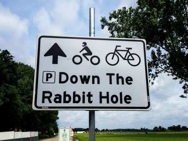
Onwards out of Nijmegen, then riding past the De Groene Heuvels park near to Bergharen that was a hive of activity setting up a huge covered stage with associated temporary buildings and campsites for Down the Rabbit Hole (DTRH), a Glastonbury-style music festival which was to take place on 4-6 July. Across the Waal on the Tiel-Wamel ferry, then stop for lunch at Twins diner. Continuing in farmland, here with extensive fruit orchards, then the last of the ferry crossings, this one over the river Lek at Ameide-Lopik, and back across flat grassland with a strong cross-headwind back to Woerden to complete the Giant Circle.
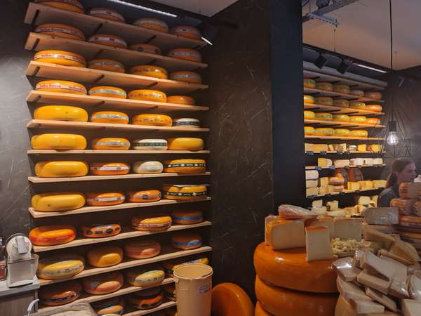
Day 6: Woerden to Hoek van Holland. A morning stroll around the island that forms the centre of Woerden, and I was hoping to see the cheese market that the internet suggested took place every Saturday morning. There were plenty of market stalls, but no Kaasmarkt, instead there was the superbly-stocked van Bemmel kaashandel.
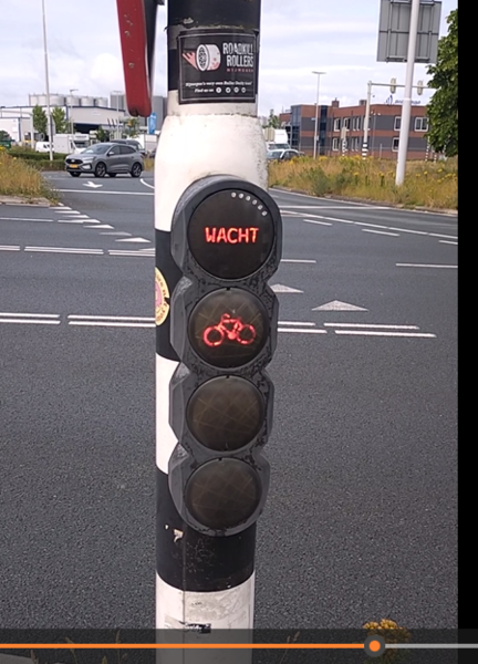
Out of Woerden across the grassland neatly divided with drainage channels, and the busy cycle path winding among the lakes of Reeuwijke Plassen, then into the centre of Gouda, many market stalls in the area around Sint-Janskerk. Continuing alongside the Ijssel to the outskirts of Rotterdam, and a magnificent succession of cycle paths. Occasionally motor traffic had priority with bicycles controlled by dedicated lights, the circle of white LEDs counting down to the green, and it was noticeable how well this was obeyed, in contrast to riding through London where red traffic lights are routinely ignored by e-bike riders - UK cyclists don't help ourselves with this behaviour.
Stop for lunch at De Eekhorn at the edge of Kralingse Bos, then onward past Rotterdam Centraal station and after Maasluis riding alongside the river towards the ferry terminal. Too early for the ferry, so I diverted into the centre of Hoek van Holland, before a superbly efficient check in and boarding, followed by the smooth crossing back to Harwich. The following morning, I rode to Manningtree to catch the train and (sigh) saw the first pot-hole since travelling to the Netherlands.
Right, I think that’s enough of the geometrical cycle.travelling.
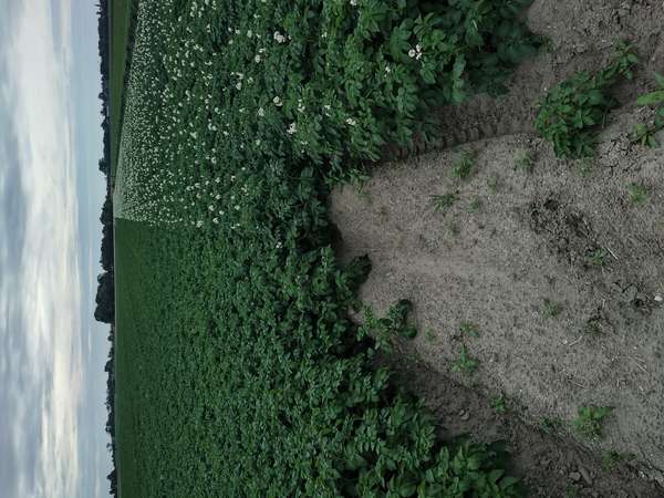
Oh, I nearly forgot to continue the running joke, but here is a photograph of a potato field somewhere near Burgerbrug. Membership of the fan club remains disappointingly low (OK, zero). The variety on the right have white flowers, while a different variety on the left had yet to come into bloom. Some on the same farm had pale blue or purple flowers, but I couldn’t get them in the same picture.
There have been threads in this Help Forum about the choice between the use of a mobile phone with the cycle.travel app or a dedicated cycling computer (sometimes called a head unit or just a GPS). As others have explained, your decision depends on your type of riding.
I use Wahoo devices and I thought it might be helpful if I offer some visual evidence to show what this looks like in practice - Wahoo devices have screen record capability. This is what you see on the handlebars as you ride along. These are also my offerings of the most boring videos ever to go on public view.
The route was planned using cycle.travel, and downloaded as “GPX Track” format with C.T’s elevation data. It is 47.7 km (30 miles) mostly in Dorset, and passes along roads with such splendid names as Horsey Knap and Tilly Whim Lane. The turn-by-turn announcements that appear on screen are generated by Wahoo, rather than cycle.travel.
Wahoo Elemnt Roam: The first video shows navigation using the “map page” on a Wahoo Elemnt Roam v2. For those used to the high-resolution screen of a smartphone, this will look odd, but don’t be discouraged: on the small (2.7 inch) screen of a cycling computer on the handlebars at arms’ length, this is adequately clear. The lower resolution is the trade-off for ~15 hours always-on display and weatherproofing.
https://www.youtube.com/watch?v=8u0jyMsXXfc
Wahoo Elemnt Ace: The second video is navigation of the same route on the map page of a Wahoo Elemnt Ace.
https://www.youtube.com/watch?v=RwbWu5ipo3E
I apologise for the duration (2 hours 44 minutes), but these are screen captures of a real-world ride. You could think of this as sakte-TV (slow television).
There are also screen recording methods for other cycling computers, and I would encourage someone else to upload comparable (preferably shorter) videos for other equipment. For Garmin, see for example Shane Miller’s “GP Lama” cycling technology channel, that explains how this may be done:
https://www.youtube.com/watch?v=0DM_aF8oLd4
This travelogue is only partly about cycling, but hopefully you will find it interesting. First the long drive up and back, but with stops as part of our ongoing quest to visit the open-air swimming pools described in Emma Pusill and Janet Wilkinson’s wonderful book The Lido Guide:
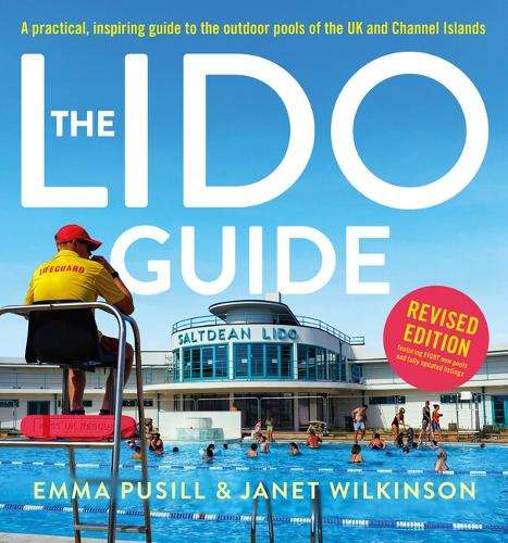
The lido at Gourock was splendid: perched on the edge of the Firth of Clyde with views of the Trossachs, salt water and heated to 29 C (oh bliss). Those at Shap, Hunsonby and Ilkley were ‘refreshing’ (typically 16 C). The Trinkie just south of Wick was a sea-pool (concrete walls retaining the tide) rather than a true lido, but it had been damaged by Storm Babet in October 2023, so only a brief slippery paddle among the seaweed.
So, onward to Orkney Mainland by the Scrabster-Stromness ferry, and to Kirkwall. The second purpose of this trip was to go to some of the Orkney Folk Festival with acts from around the world performing across the islands between 22 and 25 May: https://orkneyfolkfestival.com/. We had done well to arrange accommodation well in advance, as everywhere was fully booked – several musicians were camping in tents on Market Green in Stromness. The main opening and closing concerts had sold out within minutes of going on sale, but we went to events in Tankerness, Stromness Parish Church and the Pickaquoy Centre. Particularly superb was the folk band Frigg from Finland. Don’t miss them if they perform anywhere nearby: https://frigg.fi/en.
And to the cycling. I had known that the islands are not particularly mountainous, with rolling farmland and few trees. Slightly unusual conditions as well: wind from the north but not cold. It wasn’t as windy as it can be, but I still found myself buffeted and riding leaning to compensate.
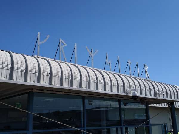
Ride 1: Southwards from Kirkwall, past the small airport with its name “Krimsitir” (Grimsetter) in runes above the small terminal building. Onward to the WW2 Italian Chapel, and continuing to Olad summit (119 metres elevation) with its view across Pentland Firth to Caithness – the plaque emphasising that it is closer to Bergen (316 miles) than London (520 miles).
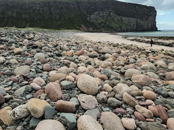
Ride 2: Westward this time, stopping briefly at the Stones of Stenness then into Stromness ready to cross to Moaness on the Isle of Hoy, the small passenger ferry (MV Graemsay) bucking vigorously as it crossed the wake of the larger incoming Northlink ferry Hamnavoe. Continuing westwards on Hoy to the remote village of Rackwick, its crofters’ cottages scattered in the shelter of Moor Pea, and the small beach edged with giant pebbles. The most remote of these cottages, Dunnertoon, was the home of composer Sir Peter Maxwell Davies from 1971 until 1999: https://hoyheritage.co.uk/portfolio/sir-peter-maxwell-davies/. Back to the east side of the island, and south before taking the small car ferry (MV Hoy Head) from Lyness to Houton – perishingly cold when perched on the high-level open side deck while crossing Scapa Flow.
Ride 3: Northwards this time, and still a slog with the wind shifting more towards the west. I was grateful to find the Birsay tea rooms (open Thursday to Monday only), before visiting the ruins of the Earl of Birsay’s palace. Partly wind-assisted ride back around the east of Mainland, and past one of the vast cruise ships that stop in Inganess Bay; this one I think was the Fantasia-class MSC Preziosa (capacity for 4,345 passengers) that had travelled from Akureyri in Iceland and was due to sail on to Hamburg. I enjoyed using the MarineTraffic app to see what ships where in harbour.
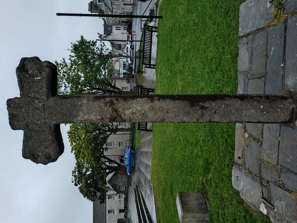
One final memory: while walking along Albert Street in Kirkwall, we were surprised by tooting of the horn of a van as it passed with several young women smiling in the open back, one of whom wore pyjamas covered in molasses. A resident explained that this was a “blackening,” the rural Scottish wedding custom where the “captured” bride-to-be is decorated and paraded publicly – see Wikipedia. We later saw the laughing intended bride being tied to the Mercat (or market) cross with clingfilm. Fortunately, this is a replica of the 1621 cross; the original is now inside St Magnus cathedral.


Made in the Cotswolds. Published by Éditions Système D Ltd.
Log in with your cycle.travel account:
| Password |
Or simply use your account on:
