Raining again at the start, and following the extension of yesterday’s cycle route on a rougher track. Here it is L163 and is designated as “Pré-RAVeL”, a splendid statement of intent: this is not yet to RAVeL standard, but will be. Raining heavily in waves, the route meandered northwards to La Roche en Ardenne, a very pretty town that I would want to revisit in sunnier weather. Stopped and into Bourivain Patisserie/Café for coffee and tarte rhubarbe. Stepped outside to ride on, saw the rain continuing heavily, and shared laughter with the lady in the patisserie as I darted back inside for a second coffee – “bon courage” when I finally did depart. The cycle route crosses the Ourthe several times, then follows the river valley onwards, alas the cycle path beginning to resemble the adjacent river in flowing with rainwater.
Departed from the Ourthe at Hotton, and climbed up out of the village to another military cemetery, the rain fortunately easing briefly. The Hotton Commonwealth cemetery is unusual, as it is from WW2, and there are graves of paratroopers and airmen. At the back of the cemetery is the single memorial to James Short who had been gardener at the cemetery from 1949 until his retirement in 1978.

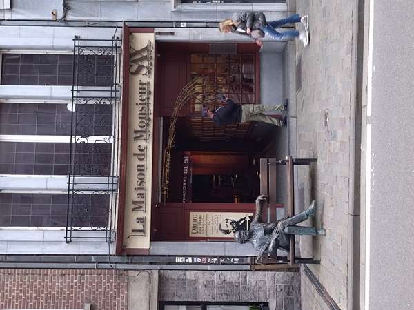
The rain finally easing, and onwards through Marche en Famenne, then a big climb up and over to Ciney, before a gradual descent to the Meuse valley and Dinant. Crossed the Pont Charles De Gaulle and along Rue Adolphe Sax to La Maison de Monsieur Sax, once home to Antoine-Joseph Sax, the inventor of the saxhorn, saxotromba, saxtuba, and (cue Baker Street) the saxophone; many people stopping to take photos with his statue. Continued along the lively Dinant waterfront to Le Rocher Bayard (Bayard’s rock), a cleft in the cliff said to have been created by Bayard’s hoof (the horse last seen leaping over the river downstream at Namur). This was also the furthest point reached by German forces during the December 1944 counter-offensive. Distance 130 km, elevation 1190 m (cycle.travel estimate 980 m).