

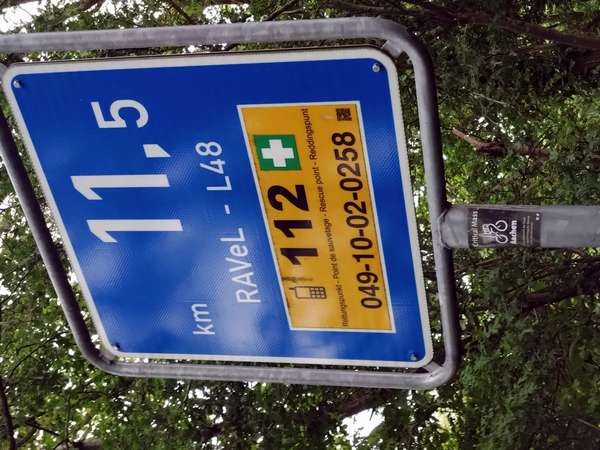
An early start, and drizzling or raining on and off throughout the day. Immediately onto the Vennbahn (Fen Railway, see www.vennbahn.eu), another repurposed railway line which is now a 125 km smooth surface cycle path, badged as RAVeL Ligne 48. The RAVeL, or Réseau autonome des voies lentes (autonomous network of slow ways, see www.ravel.wallonie.be) is the Wallonia network of walking and cycling routes, often converted railways, and in my limited experience seems to be at its best in the east of Wallonia (provinces of Liège, Luxembourg, Namur) and is perhaps less well sustained in the more industrial west (Hainaut), but it is a fantastic achievement.
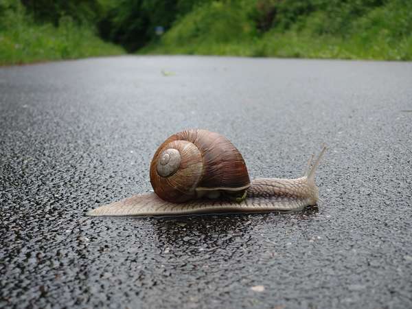
The Vennbahn route climbs gradually, 1-3% gradient (what cycling commentators call false-flat), and early morning cycling commuter traffic soon gave way to an empty path, shared only with several slow-moving fauna. As the morning drew on, several pairs of older touring cyclists in wet-weather gear passed in the other direction towards Aachen. A couple of groups (2x5) of young racers, all dressed in black Castelli clothing, overtook me in a chaingang. There are a few small cafes along the Vennbahn, but none were open – perhaps weekends or in the summer holiday – so I struggled for food supplies.
Tim Byrne’s wonderful YouTube channel “The Tim Traveller” has a video about the history of the Vennbahn. The fen railway was built by Germany, but passed to Belgian control after WW1. In places, this gives a sliver of Belgian territory with Germany and a sequence of German exclaves on either side. The smallest exclave, at Rückslag, is just one house. South of Roetgen, one house appears to be in Wallonia, while all their neighbours are in Germany. At Mützenich the border exhibits a peculiar fold – is it just me, or does this look faintly, ahem, anatomical? After WW2, Mützenich was briefly a hotbed for the smuggling of coffee between Belgium and Germany (see Wikipedia), the anti-smuggling efforts becoming violent, and 47 village residents were convicted – the past truly is a foreign country.
The Vennbahn rail track is still in place alongside most of the northern section of the Vennbahn, and there are sidings and modern train shed with water pump at Roetgen, suggesting that there is still some steam train activity here, although it was deserted as I rode through. After the last of the exclaves, at Leykaul, part of the rail line has railbikes in the summer (they were all parked and padlocked as I passed) – these are four-wheel carts propelled by two pedallers with up to two passengers (see www.railbike.eu).
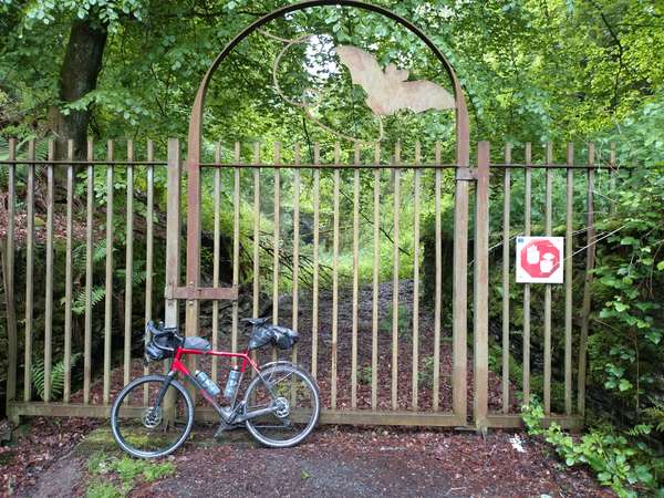
At Bosfange I took a detour from the Vennbahn in order climb to the highest point in Belgium. Until 1919 La Baraque Michel was the highest point, at 674 metres, but following the redrawing of boundaries it has been usurped by the Signal de Botrange at 694 metres. Alas, I discovered that the café/restaurant and the Baltia viewing tower were both closed due to ongoing building works, so back down and continued across the upland, exposed to the prevailing wind making this hard going. Desperate for coffee I looked to stop in Sankt Vith (Saint Vitus) but everything seemed to be closed, so carried on in steadier rain to Lengerlach and the Belgium-Luxembourg border, where the railway formerly went through a short tunnel. However, when the bicycle path was being constructed, the tunnel was found to have been colonized by bats (“at least 13 species” apparently), so the tunnel is gated but with an electronic display board nearby.
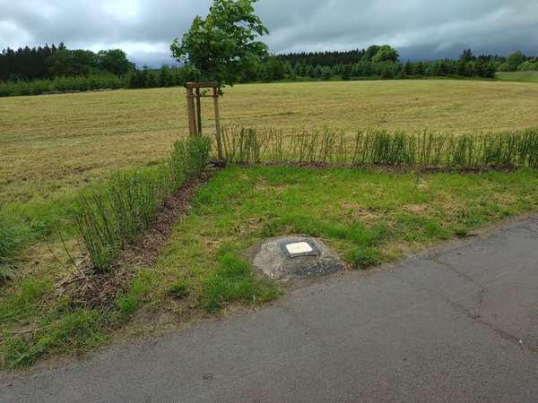
Cyclists are therefore routed up and over, which gave an opportunity to complete the set of Benelux highest points (I know, yawn…) by visiting two just into Luxembourg. Two, I hear you ask? Until 1997 this was believed to be Buurgplatz at 559 metres, and is marked with a tower. Amusingly, new GPS technology revealed nearby Knieff to be one metre higher, and this is marked only with a painted stone.
After Sankt Vith the landscape noticeably changes, with steeper-sided wooded river valleys, and the Vennbahn terminates at Trois Vierges. From there to my overnight stop at Clervaux, on a fold in the river Clerve. In retrospect, this was too much to have ridden in one day, and I would recommend breaking the route at Monschau. Distance 162 km, elevation 1204 m (cycle.travel estimate 1060 m).

