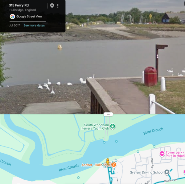
This journey is from a proposed ride in Essex. CycleTravel indicates an unpaved path crossing the river Crouch at South Woodham. But when I look with Google Street View this is what I see. My bike hasn't got water wings, so I had to re-route to Battlesbridge, two miles upriver. The street on the south side of the river is called Ferry Rd so there was once a ferry, but I don't think it still functions. Can someone modify OSM appropriately?