

I'm planning a journey out using the website, and adding a waypoint for the first day of the trip increases the elevation (but not distance!) for the last day.
With via 14 on https://cycle.travel/map/journey/756716, the last day elevation is 2400m: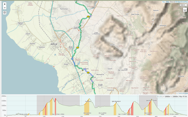
Delete via 14, and the last day elevation drops to 1600m: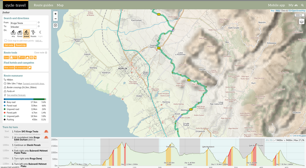
Am I doing something wrong?


Comments
That is definitely a bug. The issue seems to be that the descent on the last day is on the edge of a steep hillside, which always makes elevation calculations difficult. c.t usually applies a smoothing algorithm in these cases but, for some reason, it’s not kicking in here – if you zoom in to the elevation profile you’ll see lots of little ups and downs, which are causing the bogus figure.
For now if you break the route into individual days then it’ll show up correctly. I’ll look into it and work out a fix, but it’s unlikely to be immediate I’m afraid as I’m about to head out on tour myself!
Never say never…
I’ve tweaked it and I think it’s better now. I’ll need to give it a proper once-over in due course but this seems good for now.
Woah awesome! I refreshed the page and it was back to normal. Thank you Richard!
This is by far my favorite tool for planning bike trips.