

I've just started using this website for routemapping, which is super helpful.
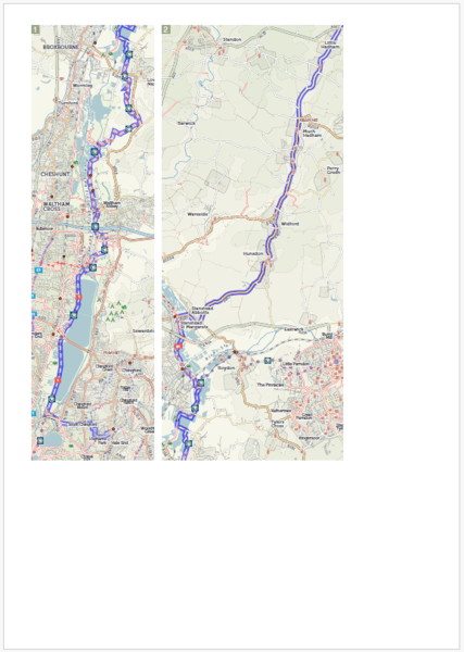
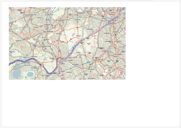
When I download PDF 'touring scale' maps, the maps themselves are approx 70% of the page size, so when I print them at A4, they're small and not very legible. Ideally, I'd like the maps to fill all/most of the page. I tried to copy and paste them into a Word doc to edit, but the images don't come out.
Does anyone have a workaround please? Thanks! e.g. https://cycle.travel/map/journey/629315


Comments
Each scale option (touring, city etc.) is a fixed scale. The site then works out a set of rectangles that will cover the whole route. It puts as many rectangles as it can on one page, then moves to the next page once it can’t fit the next one in.
I think with this example you should be able to tell your browser or PDF reader to print at (say) 125% – not entirely sure how this would work on Windows, but certainly on the Mac it’s an option.