

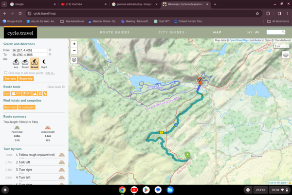
Hello, I'm having some issues with route planning in the Trossachs - the route I want to follow is not one the route planner wants to 'land' on, no matter how much I try with via points, the route doing all sorts of loops and jumps either side of the marked cycle route on the map. The screenshot shows the issue (outdoor map, and also easy to see using the OS map layer) - I want to follow the Rob Roy Way which is a cycle route in the area shown, but I can's get the route to follow it at all! Am I doing something wrong, or is there an issue with the route in the area?
Cheers,
Tris.


Comments
Interesting – I’ve just looked into this and there was a specific issue with the way some OpenStreetMap tags were interacting for tracks in Scotland. I’ve just fixed that and it’ll show through in the next map update. Thanks for spotting!
Awesome! I thought it might have been my usual luck with IT equipment and expected it to be something that only impacted me. I've been using the Android App once or twice for navigation recently, so far with good results on an old phone kept for just this purpose. I'm very impressed!