
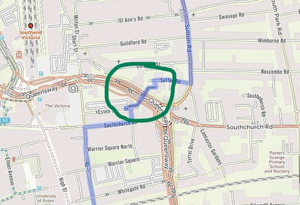
Hi, the bridge circled has been closed to all traffic indefinitely so no longer an option for crossing Queensway

Become a supporter
cycle.travel now has Ordnance Survey maps
Plan multi-day adventures easily
Thanks to Swaledale Outdoor Club!
We’re now in Australia and New Zealand too
Stick to tarmac with our new routing option
cycle.travel expands to Scandinavia and Eastern Europe
Smart Turns – new on cycle.travel's route-planner
Hi, the bridge circled has been closed to all traffic indefinitely so no longer an option for crossing Queensway


Made in the Cotswolds. Published by Éditions Système D Ltd.
Log in with your cycle.travel account:
| Password |
Or simply use your account on:
Comments
The closure is a morbid one. It is popular with jumpers. It is a high bridge over an underpass. So it's been closed to prevent people using it for that. The redline would probably be the best (or least worst) way of making the same trip.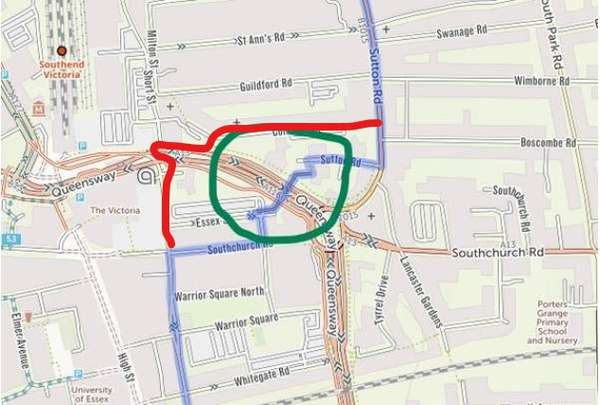
Hi, some more local knowledge. I was planning a route from Hadleigh Park to home and saw that the planner suggested going the wrong way on a dual carriageway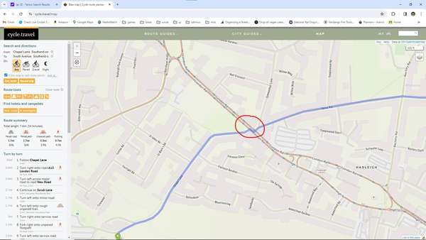
I’ve marked the bridge as “no access” in OSM and c.t will pick that up on the next routing update.
On the dual carriageway, it’s actually suggesting that you walk your bike across the road there (using the pavement) – you can see a little red pedestrian symbol in the turn-by-turn directions for that part.