

iOS app 1.9
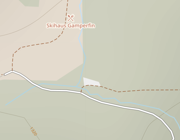
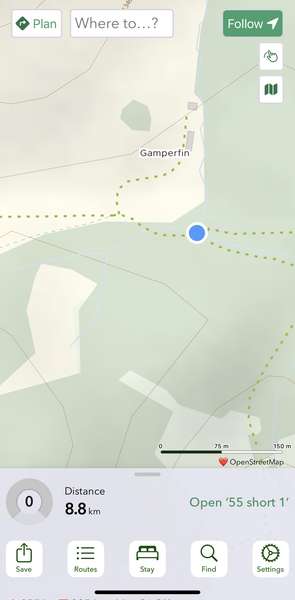
In Switzerland, I noticed that many (most?) of the track/land access roads were showing as green dashed lines in the app ("footpath - no cycling" per the website key). The roads were in fact legal double tracks.
Example: The roads converging at this intersection are double-track and either compacted or paved - They seem to be represented correctly on the website. They are shown as foot paths in the app.
(I am assuming that the key for the app map is the same as the key for the website map.)


Comments
Ah, this is a bit of an OSM rabbit-hole!
It’s tagged as a bare highway=track with no access tagging. This is not particularly good OSM practice; whether or not bikes are allowed on such a route tends to differ from country to country (whatever the OSM documentation might say) and it’s always best to tag it explicitly.
c.t’s router is smart enough to interpret it country-by-country, and so is the website cartography (though the latter is a little less smart). The app cartography is younger, and doesn’t yet have all these nuances. That said I don’t think this one will be too hard to add.
Thanks Richard. It makes sense that the sole “track” tag is vague. In my (tourist) experience all of these tracks I encountered in Switzerland are legal for bicycles.
Good to know that the routing engine interprets it correctly. 👍