

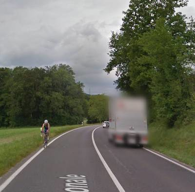
Hello, I wonder if there is a way (in OSM?) to document roads that are not "primary" according to definition (not connecting major cities), but very busy with lots of trucs and quite narrow, hence very unpleasant to bike on (to say the least). Screenshot from google street view.
Thanks!
Cécile


Comments
OSM doesn’t record traffic levels, but cycle.travel does try to use real traffic data, where available, to cope with situations like that. Whereabouts is that example?
It is this portion of road:
https://cycle.travel/map/journey/581109
It is not necessary mega heavy traffic in terms of number of vehicles, but there are many trucks, the road is narrow, the visibilty not always top. There is a cycle route not far away, but it is not asphalted
I think in this case it might be because the cycle route is shown as having a bad surface in OSM, and there are comparatively few other options. (In particular parts of it are marked as “grade 3” and I wonder if they should really be “grade 2”.) In the medium term I’d like to add a way for c.t users to flag up problematic roads like this but not yet I’m afraid!
OK, thanks, I'll check. The cycle route is indeed suboptimal. It is an easy ride with a suspended bike, but I recently took it with my heavy, non suspended compact-cargobike, carriyin a brompton on the rear rack and it wasn't fun :-/. On the other hand it is hard, the main issue being that it is quite bumpy with lots of stone showing out. So it seems to me to be better described by grade 2 than 3. However, I was directed to the unpleasant road (did not take it bc I know it) when trying to ask for paved only. And I agree, if somebody is after "paved only" the cycle route isnt an option either.