
Become a supporter
2 miles, 10-15 minutes. Easy: Cycle lanes and quiet roads, with two traffic light crossings. A route updated with local feedback and we've tested this and prefer it. You can preview the route on YouTube.
Notes: Thornhill is the Park & Ride to East of Oxford.
* Start in front of P&R on cycle path and head west towards city.
* This merges on to a quiet 'service road' (London Road).
* Before the ring road, turn left onto Ridgeway Road, continue to the ring road crossing near Kiln Lane.
* Proceed down Trinity Road, past the Weyland Arms and left onto Quarry Hollow.
* Follow round onto Quarry Road and soon right on Mark Road.
* At the bottom, left on York Road then right on Rock Edge to enjoy the nature reserve.
* At the end, left on Windmill Road to turn right into Old Road at the traffic lights. On the far side, there is a cycle lane on the pavement, which runs to the hospital entrance on the left.
4.3 miles, 25-30 minutes. Intermediate, a fairly long route for the city, with a moderate climb on the ring road track, but mostly traffic-free cycle lanes.
Notes: Oxford Parkway is the Rail station and Park & Ride to the North of Oxford.
* Start in front of P&R. In the first part of this route there is the choice of the pavement (shared with occasional pedestrians) which is poorly surfaced and interrupted by side turns, or the Bus Lane.
* Before reaching A40, turn left on Harefields - look carefully and you will see the NCN51 signs on the posts of the 20mph signs.
* Follow NCN51 and cross the A40 on the excellent cycling bridge.
* Double-back on yourself and follow the ring road cycle track eastward for just over 2 miles. Take care at the crossings of Elsfield Road and the B4150 slip road - traffic can come from multiple directions. (These will be improved as part of the Bayswater development).
* At the Barton Fields junction turn right on the bus and cycle lane into Meaden Hill then Gouldland Gardens.
* Slightly to the left you will see the hospital entrance for buses and people cycling or walking.
* A JR site map showing cycle parking is available in JPG or PDF here (although parking by the heart centre is not currently in use). Cyclists are asked to dismount in some places, which may be difficult for disabled cyclists.
3.0 miles, 15 to 25 minutes. More challenging. A couple of busy roads near the start and a big climb near the end.
The route crosses the University Parks for a green and quiet route, then has a short but fairly steep climb on a quiet road to reach the the hospital on a hill.
* Out of the station, turn left and at end of Frideswide Square. You can use the shared pavement on the left, outside the Business School (the signs are subtle, but there).
* Turn left along Hythe Bridge Street (sadly this can be busy).
* Caution on crossing of Worcester Street onto George Street.
* After a section on Marston Road, turn right on Jack Straw's Lane and climb. We're sorry about this, but the hospital is on a hill and we had to get you up there somehow. At least this road is usually quiet.
* If you are heading for the north/west of the campus e.g. the Childrens Hospital or Eye Hospital, after crossing Headley Way go in the main entrance.
* Otherwise, crossing onto Staunton Road then left on Woodland Road brings you on a quiet route into the main hospital campus.
* If you are able and have a solo bike, you can take Sandfield Road and there is a lane halfway down that accesses the hospital, near the main entrance, but through a barrier.
* A JR site map showing cycle parking is available in JPG or PDF here (although parking by the heart centre is not currently in use). Cyclists are asked to dismount in some places, which may be difficult for disabled cyclists.
2.9 miles, 15-20 minutes. Intermediate, Busy roads near the start and The Plain.
* Out of the station, turn left and at end of Frideswide Square turn left along Hythe Bridge Street (sadly this can be busy).
* Caution on crossing of Worcester Street onto George Street.
* After Broad Street, this route heads down the twisty and delightful Queens Lane to avoid traffic, but be aware of pedestrians, in this area.
* After crossing the river on Magdalen Bridge take the middle cycle lane and head for the 2nd roundabout exit, Cowley Road.
* Warneford Lane is difficult at present - giving parked cars safe distance means you need to 'hold the lane' and no traffic can safely pass you, which sometimes causes frustration for drivers who do not understand this. In July 2022, the parking will be removed and replaced with a protected cycle lane.
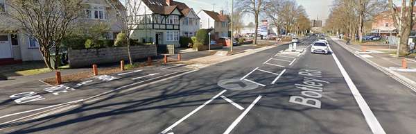
1.3 miles, under 10 minutes. Intermediate, this route has good new cycle lanes more of the way, and just a couple of busy places where they are not present.
Notes: Seacourt is the Park & Ride to the West of the city. This route is very straightforward and has recently been improved with new cycle lanes/tracks.
* Leave the Park & Ride to the south, if convenient, use the exit behind the car dealership. Then turn left (east) towards Oxford.
* At the bridge under the railway, take caution as the cycle lane is narrow, paint only, and the surface is poor. You may want to 'take the lane'.
* Just past the station is Frideswide Square, where you have the option of cycling on shared pavements. (The signs for this are small or embossed in the paving).
* At the end of Frideswide Square, turn right into Park End Street. (If you want to head towards Broad Street, turn left here instead).
* On the return journey, the turn right is by a 'jug handle'. Fork LEFT on to the pavement just before a traffic island (signed 'Park & Ride only'). Then cross the road, in two stages if necessary, using the traffic island.


Made in the Cotswolds. Published by Éditions Système D Ltd.
Log in with your cycle.travel account:
| Password |
Or simply use your account on:
