
Find out more about how to use our map and cycle route planner.
It’s this easy:
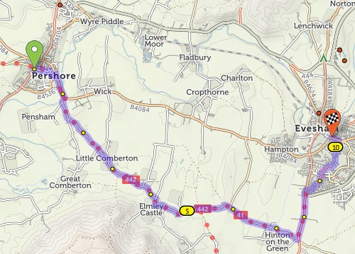
If the route doesn’t go the way you want, you can simply drag it. A new numbered ‘via point’ will appear.
You can also extend the route by clicking points on the map. On desktop: Tick the option on the left that says ‘Click map to add more points’, then click at the new end of your route. On mobile: Quickly double-tap (iPhone) or long-press (Android) the new end of your route.
You can remove a via point by clicking on it and selecting ‘Remove via’ in the popup.
You can type street or town names for the start/end of your route. A pop-up menu will appear as you type – choose the matching place. Click ‘Get route’ when you’ve chosen the start and end.
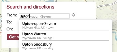
Our map data doesn’t have house numbers recorded, so just type the street name and town, not the number.
You can add a via point at a named place, too. Click ‘Add at…’ and type the name.
We aim to choose a balanced route that prefers smooth surfaces, but sometimes go off-road to avoid hills, busy roads or long detours. If you’re on a road bike, you might prefer to stay on tarmac at all times. Flick the switch from ‘Paths & roads’ to ‘Paved only’ to change this.
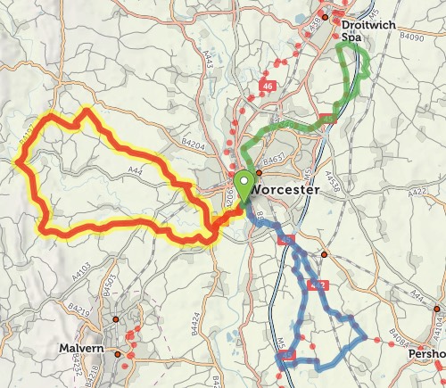
Journeys don’t have to be A–B: you can plan circular round-trips too. Choose your start and end points as per usual, then click ‘Round-trip’. We’ll try to find you a different journey for the way back. (Note that sometimes it won’t be different, particularly on short journeys or in areas with few roads.)
If you just want a ride but you don’t mind where, we can do that too. Click just one start place on the map, or type it next to ‘From:’, then click ‘Suggest a ride’. Up to three circular routes will show on the map:
Choose the one you want by clicking on it. You can drag the slider to change the distance.
All things being equal, we choose paved routes. But if a dedicated cycleway is unpaved, or it’d save a stretch on a busy or hilly road, we’ll sometimes choose an unpaved route instead.
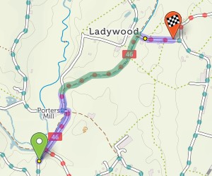
On the basemap, unpaved trails are shown with brown dots or dashes; unpaved roads have dashed edges. When you plan a route, the unpaved sections are highlighted in green, contrasting with the usual blue.
If you want to stick to paved sections only, then change the toggle beneath the from/to places. You can even restrict just the section between two via points to paved-only: click the first via point to bring up a popup, and change ‘Go any way’ to ‘paved’.


Made in the Cotswolds. Published by Éditions Système D Ltd.
Log in with your cycle.travel account:
| Password |
Or simply use your account on:
