
Land’s End And so it begins! There’s not much in Land’s End aside from gift shops and a good view, so we’d suggest you stay in Penzance the night before, then take a bike-friendly taxi to the start. Get your photo in front of the signpost, then set off up the A30 (quiet at this point) for Penzance.
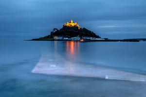
Cornwall and Devon are renowned as the toughest parts of any LEJOG. To save a few unnecessary hills on the way to Penzance, our route follows lanes and B-roads rather than clinging to the National Cycle Network. After a brake-testing 16% descent to the busy fishing port of Newlyn, we finally pick up route 3 at the seafront, now a smooth tarmac path from Penzance to Marazion. Look out for St Michael’s Mount just as you leave the coast, crossing the peninsula to the coastal village of Hayle.
A glorious B road hugs the north coast to Portreath, and taking lunch in one of the seaside cafés dotted along here will give you more time to soak in the views. At Portreath we hop onto the lovely little Cornish Coast-to-Coast route, built on old mineral railways, for a couple of miles: it’s unpaved but you can follow parallel roads if you’re on skinny tyres.
From here we take a succession of tiny lanes, bereft of traffic and with wonderful views but also a few unavoidable climbs. Try the welcoming Miners Arms at Mithian for a fuel stop: their beer garden is an oasis on a sunny day. Among the highlights are the narrow valley road into Bolingey, the vista of Perranporth Bay, the secret passage under the busy A3075, the unexpected steam railway at Lappa Valley (after St Newlyn East), pretty little St Columb Major, and the high lanes leading to the Camel Valley. It’s tough going at times, but rewarded by the descent to Bodmin and the Camel Trail.
Bodmin (65mi) Day 2 starts easily with an old railway trackbed, the celebrated Camel Trail to Wenfordbridge. If you can, set off early before the trail becomes too crowded: you can take your morning coffee at the Wenfordbridge trailhead.
This day has the highest climbs until Scotland. The first one starts right away, from the end of the trail up to Bodmin Moor above Camelford. You’ll climb over 250m to the highpoint at Davidstow Airfield. The open views and narrow lanes of Bodmin Moor more than repay the effort, and with any luck you’ll get a tailwind following the straight road through (yes, through!) the airfield. You can get a good speed up over the next five miles before stopping for a rest at the isolated Rising Sun inn.
The valley-side lane along the River Kensey provides respite from all the climbing. Launceston’s attractions are up a steep hill and most cyclists will choose to save their legs for perhaps the second toughest climb until Scotland. (You’ve already done the toughest!) After an uninspiring but endurable stretch on the A388, dip onto tree-lined lanes for the long ascent to Lydford.
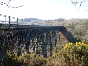
It’s plain sailing from here. At Lydford we hop onto the Granite Way, a renowned cycle path (part of the Devon C2C) following the former railway along Dartmoor’s northern edge. The magnificent Meldon Viaduct leads to the preserved Dartmoor Railway which we follow into Okehampton – take a look at the beautifully restored railway station.
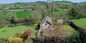
Okehampton (118mi) If you’re not staying overnight in Okehampton then you can cut out a bit of climbing by following a track alongside the railway. Otherwise, barrel down the steep hill to the town centre.
And that’s it – the worst of the climbing is over now. Sure, there’s the odd lump and bump, but you won’t encounter another taxing hill until Scotland.
The former A30, still busy despite being superseded by a modern dual carriageway, takes us efficiently (save for the hill at Sticklepath) to Whiddon Down, from where it’s a spectacular long descent to Crediton along tiny lanes. Here we take a renowned LEJOG shortcut through Thorverton, sometimes known as ‘Rob’s Passage’ after the cyclist who popularised it; this cuts out a few tough climbs while staying on quiet, pretty country roads. Win-win!
The A396, busy but not dangerous, runs along the Exe valley past Bickleigh Mill and onto Tiverton, a useful town to pick up supplies. Follow the NCN 3 signs here to pick up the Grand Western Canal towpath. Conceived as a major commercial artery speeding traffic across the peninsula, the canal never became more than a watery byway for local traffic, and its towpath is a tranquil delight. It’s mostly a good gravel surface, but becomes a rougher track on occasion. Touring bikes won’t have any trouble, but if you’re riding 23mm you might want to divert on-road on occasion. It’s on-road through Halberton, too, to cut out an extravagant loop in the canal.
Undulating lanes take NCN 3 from here into Taunton, Somerset’s county town. Though rarely pretty, it’s a practical overnight stop with good refuelling options. (But don’t try all 15 ciders at the Plough…)
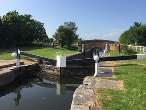
Taunton (178mi) This is a wonderfully level day: you’re rarely far above sea level. First comes the Bridgwater & Taunton Canal, another sleepy Somerset waterway where you’ll see more cyclists than boats. There’s a bike-friendly café and visitor centre at Maunsel Lock.
Don’t follow the canal into the centre of Bridgwater, but take the new road bridge over the river to rejoin NCN 3. Little lanes, paths beside drains, and old railway paths take you to the straight roads and right-angled bends of the Somerset Levels. With any luck, the wind will be behind you to speed progress. We had a 30-minute delay here due to cows being herded along the road… now you don’t get that on the A30. Look out for Glastonbury Tor to the east.
The looming shadow of the Mendips may give you cause for concern. Worry not: the route navigates its way past courtesy of the Strawberry Line, a firmly gravelled railway path which, as NCN 26, takes you close to the Somerset coast at Clevedon. You’ll pass Thatchers’ cider orchards along the way.
This is Sustrans’ heartland: the cycle charity behind the National Cycle Network is based in Bristol, and as such has greatly influenced cycle provision locally. Beyond Nailsea (a good spot for a late lunch), it’s mostly traffic-free into Bristol, starting with a fine path beside the Great Western main line. But if you’re not fussed about exploring the South-West’s own capital of cycling, you can cut a few miles off by heading via Clevedon, Portbury, and the cycleway beside the M5 Avon Bridge to rejoin the route near Avonmouth. Accommodation options are plentiful in Bristol, less so in Avonmouth.
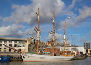
Bristol (235mi) Our aim with this route is a genuine UK tour, not just a mile-munching exercise ride: and so we couldn’t miss Bristol. It’s one of England’s most fascinating cities, picturesque, industrial, cultured and commercial in equal measure. To save your legs from the tough climb up to Clifton, find yourself a place to stay near the riverfront (there’s a good youth hostel and several hotels). Stroll around the docks and the narrow city streets, check out the cathedral and museums, or venture into the Bohemian enclave of Stokes Croft.
It’s another flat day to follow. The route takes a while to shake off Bristol’s hinterland, but don’t be tempted to take a shortcut on the map: away from the river, Bristol can be mercilessly hilly. That’s why we head down the spectacular Avon gorge, cut through the industrial area of Avonmouth, and end up on NCN 41 up the Severn valley.
By Olveston we’re back on the lanes, ones which are justifiably popular with cyclists. Enjoy the views over the Severn estuary to the Forest of Dean; the hedges close in as you approach Gloucester. Berkeley Castle (where Edward II was murdered with a red-hot poker) gives the little market town a late-medieval character.
At Slimbridge, by the renowned bird sanctuary, the route heads onto the tolerably bumpy towpath of the Gloucester & Sharpness ship canal for a while. Look out for Frampton’s huge village green and the river views at Epney.
Gloucester is our second historic city of the day. The route goes straight through the historic docks, but it’s worth taking a short detour (still signposted as NCN 41) to see the magnificent cathedral, one of the finest in England.
NCN 45 continues upriver with a modest hill near Hartpury. The old river pubs are always worth a visit, particularly the Lower Lode near Tewkesbury, which until recently operated a ferry for a shortcut to Tewkesbury. Sadly, it’s currently out of order thanks to theft. Curse the thieves as you pedal the short detour into the town – after all, swearing makes you faster.
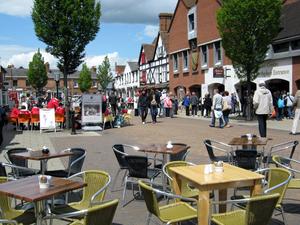
Pershore (308mi) Pershore isn’t a frequent stop on the tourist trail, but it’s a charming and old-fashioned little town with its abbey, riverside and friendly inns. We pick up NCN 442 here towards Evesham, its big brother on the Avon, to begin two days of riding through the central Midlands.
The main event is of course Stratford-on-Avon, a tourist trap par excellence but none the less attractive for that. You’ll ride past the Royal Shakespeare Theatre, Holy Trinity Church, and the famous riverfront. The entrance to the town is via the Stratford Greenway, a cycleway conversion of the old railway line from Cheltenham. We leave on the rather less enjoyable A439, but a couple of miles of traffic soon lead to relaxed riding on country lanes. After crossing the M40 and passing Hatton Country World, look out for the Grand Union Canal and the fearsome flight of locks just below.
A brief busy stretch on the A4177 points us towards Meriden, the traditional “centre of England”. Here you’ll pass the National Cyclists’ Memorial which honours cycle messengers killed in the Great War. The route is a little more undulating around here, but only a little, and it’s easy riding on country lanes to Atherstone.
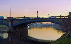
Atherstone (367mi) Its short-lived attempt to reinvent itself as a book town (à la Hay-on-Wye) might have foundered, but Atherstone is a pleasant market town with useful supplies and an attractive market square. The Coventry Canal passes through the town at the top of a flight of locks.
Before long, we pick up NCN 52 to guide us through quiet Leicestershire countryside, and some amusingly down-to-earth placenames: Sheepy Magna and Shepshed point to the agricultural heritage, Coalville to 19th century industry, and Gotham… well, try as we might, but we can’t find Batman.
The route through Nottingham is almost entirely on cycleways, including enjoyable sections beside the tram line and River Trent. If you want to visit the city centre, continue up the canal path: otherwise, follow Meadow Lane until you meet the busy A612, where a roadside path delivers you away from suburbia to the village of Lowdham. From here it’s a fairly busy but fast road to Southwell.
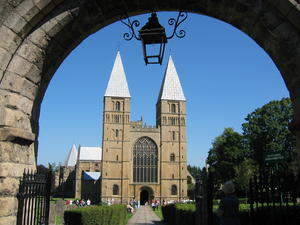
Southwell (419mi) Southwell is a one-trick pony of a town, but it’s quite a trick – a magnificent cathedral which lords it over the larger towns of Nottingham and Newark. The streets are lined with attractive buildings, independent shops, and coaching inns which will put up the tired cyclist for the night. Note that today’s ride passes through few places of any size, so you might want to buy your lunch in advance here in Southwell.
After the busy roads of the Nottingham suburbs, the route becomes quieter again as we head down the Trent valley. Cottam and West Burton power stations are colossal landmarks: a third, High Marnham, was recently demolished. The route passes through little redbrick villages, eschewing the dubious charms of Gainsborough on the opposite bank, before finally coming out onto the mighty Trent at the canal port of West Stockwith.
Our second bout of fenland comes with the Isle of Axholme, which isn’t actually an isle but, rather, moody flatlands reclaimed by the great Dutch engineer Cornelius Vermuyden. Busier roads around Snaith lead to NCN 62, which follows the railway and canal into Selby.
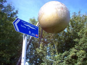
Selby (489mi) Selby is a market town with an old-fashioned air, dominated of course by the riverside Abbey. We’d recommend an early start the next morning so you can enjoy a little sight-seeing in York, just 15 miles along an excellent traffic-free route. The cycleway was established on the course of the old East Coast Main Line after the railway was diverted to make room for the 1980s coalfield. It has scale models of the solar system along its way, just like the ones on the Bridgwater & Taunton Canal earlier in the tour!
York, one of Britain’s great cycling cities, is every bit the tourist draw you’d expect. The medieval streets, the Minster, and the railway museum are all just a short way from the cycle route, which follows the attractive riverbank. It’s another flat day’s riding today, so give yourself a couple of hours to explore before carrying on.
From York we carry on up the wide Ouse and Swale valleys on quiet lanes running parallel to the railway. It’s 35 very easy miles to Northallerton which you should polish off in a few hours.
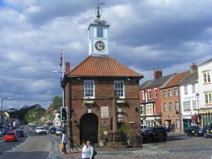
Northallerton (543mi) Our East Coast route takes us through the mighty conurbation of the North-East – Middlesbrough, Sunderland, Newcastle. Don’t fear busy city roads: this day is, gloriously, almost all traffic-free. This is one of the heartlands of the National Cycle Network, with railways that once served collieries now repurposed as beautifully level cycleways.
First, though, comes Northallerton, a bustling market town with a wide High Street full of independent shops. There are plenty of accommodation options for your overnight stay. Once again we stay close to the railway, following country lanes to Yarm, one of the nicest towns in this part of the world and a good alternative overnight stop. You may want to pick up provisions here as there’s otherwise not much until Sunderland.
At Stockton, just after Yarm, we pick up the National Cycle Network’s traffic-free routes. By and large these are unpaved but, after a sketchy first mile, firm and well maintained – not something that should give you any problems on a loaded bike, though you might want mudguards if it’s been raining. The paths were adapted from former industrial railways, and you’ll see plentiful evidence of collieries, shipyards and works.
We follow NCN 1 (or EuroVelo 12, if you’re feeling European) for the rest of the day, eventually meeting the coast at Sunderland… for the first time on this “East Coast” route. Look out for the sculptures marking the end of the popular C2C ride. From here a roadside path leads on to the Shields Ferry across the Tyne, which runs all day but finishes early on Sundays: check out the timetable.
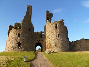
Tynemouth (603mi) The Guardian called Tynemouth “pretty near perfect”. They might be right. Banish all thoughts of Tyneside industry: this is a historic town whose ruined priory and castle overlook the North Sea. Good food and accommodation are plentiful, making this an excellent overnight stop. And if you want to visit the bustling centre and famous bridges of Newcastle, it’s only 20 minutes away on the Metro train.
For the next three days, we’re following the Coast & Castles route up the coast, one of Sustrans’ finest. You can read the detailed mile-by-mile breakdown in our dedicated route guide, so we’ll just precis it here. The first 30 or so miles through Whitley Bay, Blyth and Ashington are suburban, post-industrial even, but have a certain appeal of their own with constant coastal views. It’s after this that the route really takes flight, with seaside tracks and quiet roads rarely bothered by cars. Shortly after Amble comes Warkworth, the first castle of the route and a must-visit. Alnmouth, a few miles further on, is a picturesque spot for afternoon tea.
Although most of the Coast & Castles route is tarmaced, a few sections are rougher tracks. Loaded touring bikes should generally be fine, but if time is pressing on and you want to get the miles in, you might be better advised to divert onto nearby roads. This is the case for the coastal route after Boulmer, for example.
Take a quick diversion at Dunstan to visit the fishing village of Craster – yes, it’s an extra mile’s ride, but it’s worth it. From here it’s quiet inland lanes all the way to an overnight stop at Seahouses.
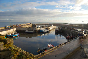
Seahouses (659mi) Seahouses is a cheerful little seaside town – a bit of a resort, perhaps, which means that accommodation is easy to come by. The old branch line is now a cycleway which takes you to the town centre. The harbour is, of course, the most attractive part of town with some very comfortable B&Bs nearby. Alternatively, you might like to stay a few miles further on at Bamburgh, where the imposing bulk of a castle is worth visiting.
Quiet lanes keep you away from the busy A1 for the day. Sleepy Belford was once a thriving coaching stop until the main road bypassed it. Crossing the A1 again, NCN 1 carries on up the coast, but you may choose to visit the monastic retreat of Lindisfarne on Holy Island. It’s eight miles there and back, and you’ll inevitably have a stiff headwind on the causeway in one direction, but if time’s on your side then it’s an enjoyable visit.
The approach to Berwick-upon-Tweed has the roughest tracks of the whole route, a notorious grassy path across a field. Those with skinny tyres could choose to head to the A1 (shiver) and then take the A1167 into the town centre, but for most people, the coast path is worth riding – even if you do have to get off and push on occasion.
Take a break at Berwick: it’s all road riding from here on. NCN 1 heads inland, but we continue on the coast, largely following NCN 76. We deviate slightly after Berwick, avoiding the loop to Eyemouth (again, an enjoyable visit if you have time to spare) and minimising climbing. Unusually the NCN follows an A road for a while, but it’s a quiet one with wonderful views to sea. Back lanes and a passable cycleway along the A1 take us to Dunbar, a pretty, sleepy coastal town with three harbours to its name.
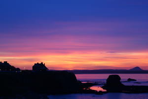
Dunbar (719mi) This is the shortest and easiest day of the route, with just over 30 miles’ riding and only a couple of trivial climbs. That’s because our destination for the day is Edinburgh, which merits a full afternoon and evening to explore. It’s also the 750-mile mark, and if that doesn’t deserve an afternoon off then I don’t know what does.
The route leaves Dunbar via the old A1, now rebadged as the A199, and although there is a roadside cycle path you might find it quicker and more comfortable to stick to the carriageway. A lovely rural lane through farmland leads to Haddington, where a railway path returns us to the seaside. Easy coastal riding through Prestonpans gives way to prosperous suburbs, and after a busy path at the foot of Arthur’s Seat, the NCN signs deliver you to Princes Street and the heart of Edinburgh.
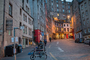
Edinburgh (751mi) Lock your bike at your hotel and head out for an afternoon of unabashed tourism and relaxation: you’ve earned it. There’s no need for us to do a full tourist guide to Edinburgh: a million and one guidebooks and sites will fervently recommend the top sights. But riding down the Royal Mile on your loaded bike? That’s a pleasure that few tourists get to experience.
Back on the bike, it’s a long one today at 75 miles… assuming you’re well-rested. NCN 1’s escape from Edinburgh is well designed on railway paths and residential roads, even if the adjacent tenements are a little less glamorous than the city centre.
The Forth (Road) Bridge is reserved for bikes, buses and pedestrians, now that a new motorway crossing has opened just inland. NCN 1 takes a utilitarian route through Inverkeithing and the outskirts of Dunfermline before emerging into the countryside. We’ve chosen to follow B roads through Kelty to save climbing, but if your legs are in good shape, do take the official route through Townhill and Craigencrow: it’s an extra 50m climb, but the narrow, twisting road through forestry is a delight. The same applies to NCN 775 towards Bridge of Weir, where we duck onto the A912 for a few minutes to avoid a stiff climb over Balmanno Hill, but the NCN route is prettier if you’re feeling energetic.
Perth is 45 miles into the day’s riding, and its stately waterfront is a good place to lock up for a late lunch or afternoon snack. A lovely riverside path takes the route onto quiet wooded lanes, following NCN 77, until the views open out near Bankfoot. We rejoin the Tay valley at Dunkeld, following it on gloriously quiet roads all the way to Pitlochry.
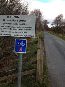
Pitlochry (828mi) Pitlochry has been a tourist destination since Victorian times – partly for hillwalking, also for salmon fishing, but mostly, frankly, for drinking whisky. It’s also the start for the Étape Caledonia, the biggest closed-roads cycling event in Britain, held in May. You’ll start to see more LEJOG cyclists on the road from here, as those who’ve stuck to the western side of the country often come this way from Glasgow and Callander.
Today’s stage has one purpose: getting over the highest hill of the entire route.
The A9 has been rebuilt and straightened over many years to take Highland holidaymakers’ traffic, leaving the old road largely to cyclists and a few locals. It’s signposted as NCN 7 throughout. As the valley narrows, we move onto a purpose-built cycleway in the shadow of the A9.
From here, it’s a long, steady climb, rising from 120m at Blair Atholl to 450m at the Drumochter Pass. Fortunately, you’ve got 20 miles to make up that height, so it’s a forgiving gradient. Stop for a photo at the top, then enjoy easy riding downhill again to Kingussie, with the cycleway soon giving way to a virtually traffic-free quiet road down the Spey valley. Between Kingussie and Aviemore our route follows the old A road (the B9152) to save on climbing, but if you still have some strength in your legs after Drumochter, take NCN 7 along the B970 for a scenic alternative with a little more ascent.
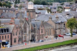
Aviemore (887mi) Aviemore, the capital of the Cairngorms, is a winter sports destination par excellence. Assuming you’re not riding LEJOG in the depths of winter, you should have no problem finding accommodation here. The outdoor superstores and sprawling car parks can’t match the scenery you’re riding through, but it’s a comfortable, practical overnight stop.
NCN 7 is an unpaved track for five miles towards Boat of Garten. It’s fine on touring bikes, but if you’re on a lightweight road bike you might choose to follow the B970 on the other side of the valley, or even the A95 which is better than it sounds. From here we resume our journey on quiet B roads and the occasional cycleway paralleling the busy A9. You’ll frequently have the wide old A9 to yourself while the traffic roars away a few hundred yards away. It’s never short of scenic, and sporadic humps aside, it’s downhill all the way to Inverness. Enjoy.
Inverness is a friendly, bustling place, regularly voted the best city to live in Scotland. Our route goes straight down the High Street, and at 36 miles in, there’s a chance you might be there in time for lunch. Being on the coast means it’s up whichever way you leave, and even the cycleway on the windswept Kessock Bridge can feel like a bit of a slog, but in fact there’s only one significant hill in the next 70 miles.
That’s on the Black Isle, the peninsula out to Cromarty that follows Inverness. NCN 1 provides an adequate roadside cycleway over the hill. Our chosen route follows the north side of the Black Isle, partly to keep the climbing down but also because the views are better. But if you’d prefer a tiny quiet road, NCN 1 follows the southern edge.
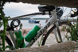
Cromarty (950mi) Cromarty is a tiny port town with a limited selection of accommodation. We’ve suggested it as an overnight stop to keep the mileage manageable, but if you’re thinking of staying here, do book your bed in advance. Alternatively, you can continue a few miles to Tain where there’s plenty of B&Bs, or take the inland route via Dingwall and Alness.
At Cromarty, a ferry takes you across the narrow strait for a modest fee. The ferry runs from June to mid-September only: if you’re LEJOGging at another time of year, follow NCN 1’s inland route via Alness. For ferry times, see the Highland Council website.
There have been some remote moments on this route so far, but today’s stage is where it truly heads into the wilds. After Tain, the route follows the Dornoch Firth inland, with the occasional rattle of trains below as the railway clutches the waterside. Note that there’s a flight of steps on NCN 1’s river bridge at Invershin; if you’re laden, follow the (quiet) A roads from Ardgay through Bonar Bridge to Invershin instead. Continuing up the glen, the Falls of Shin café and visitor centre (on the B864 before Lairg) is a handy stop for lunch or afternoon snack.
The A836 from Lairg is like no A-road you’ve ever seen. Single-track with virtually no traffic, it heads across peatland with wide, open views to the hills beyond. It’s an unforgettable experience and an essential part of any LEJOG. And, above all, it leads to the Crask Inn.
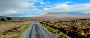
Crask Inn (1008mi) The Crask Inn is a LEJOG legend. They don’t offer online booking, so we can’t provide our usual pop-up accommodation link, but you can phone or email to book. It has four rooms plus camping pitches, and home-cooked dinner every night. This will, without doubt, be one of the most unforgettable memories of your tour.
It’s also the last place over 200m on the route. Yes, the roads are sometimes undulating from here to JO’G, but the days of climbing are over.
Heading north, NCN 1 continues along the A836 to Tongue, but we prefer the B871 by Loch Naver – a tiny single-track road, no wider than many cycleways and about as heavily trafficed. This emerges onto the north coast near Bettyhill. The success of the North Coast 500 touring route has made the coast road rather busier than it used to be, and in peak summer months you’ll be buzzed by marauding motorhomes whose hirers have hopefully figured out the length of their vehicle by now.
If you have time, take a few brief diversions to the coast villages – Armadale, Portskerra and the like – where little dead-end roads lead to stunning sea views. At Reay, we follow NCN 1 along a quiet road inland, which returns to the coast at the port of Thurso.
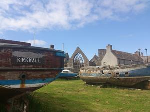
Thurso (1070mi) Thurso is an endearing, unpretentious little port town, the departure point for the Orkneys and terminus of the Far North railway line. There’s plenty of accommodation and the hoteliers are, of course, used to putting up LEJOG cyclists. Take the chance to buy a celebratory bottle of something to crack open at John O’Groats.
The end is in sight. It’s just 20 miles from Thurso on tiny roads to John O’Groats. Even though you’re never far above sea level on this last day, there’s a real “top of the world” feeling to the ride. You’ll see more sheep than cars (quite possibly more bikes than cars, in fact) as you trace your course across the coastal landscape on a succession of flat, straight roads.
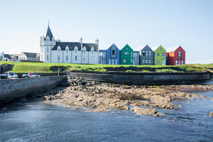
John O’Groats (1091mi) John O’Groats itself is just as underwhelming as Land’s End, with a series of low-rise ‘craft shops’ selling tourist tat scattered around a car and coach park. But the destination isn’t the point – the journey is. You’ve done it!
If you’re making your way home via train, you can either retrace your steps to Thurso, or ride south 17 miles to Wick along the A99. All trains stop at both stations. We’ve got more about the logistics of homeward transport in our guide page.
Log in with your cycle.travel account:
| Password |
Or simply use your account on: