
Become a supporter
Hello,
In Belgium we still have quite some 'cobblestone' roads and they can be incredible frustrating when cycling, especially when you are packed. For people having physical health issues it can even be a no go, or imagine family trips with small children.
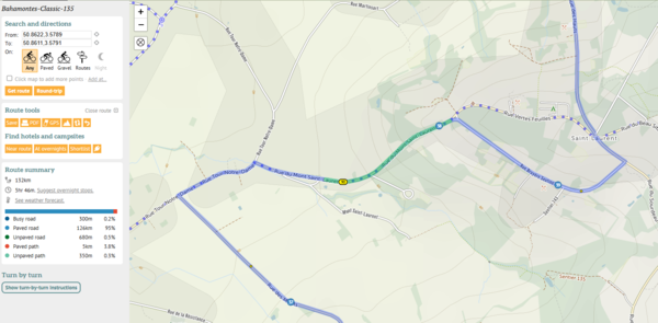
Previously these roads were marked in 'green' on the route planner, which was very handy to spot them.
Example from an older route I took around km 90 - near Saint Laurent:
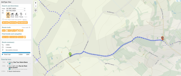
On my last planned ride last weekend, to my surprise I ended up doing a long stretch of cobles (Google streetview link), because I checked the route before and I didn't see any green.
Indeed, when I now plan a test route on the same stretch as in the screenshot above, I don't see any green:
This might be a change at cycle.travel, or maybe somebody (or an algorithm) changed the Openstreetmap source to 'sett', as 'cobblestone' is now discouraged (I think unfortunately), from their Wikipedia page:
"cobblestone is an unclear value, and was widely used for sett and actual cobblestone. Please adopt a more precise value, like sett or unhewn_cobblestone (described above)."
Now the problem with the type 'sett' is that this can mean perfectly straight cut off stones at the top (more recent & popular with cities with money), but also very bad 'Paris Roubaix' like cobblestones!
The two examples shown on the wikipedia page illustrate this:
https://wiki.openstreetmap.org/wiki/File:Pflastersteine_1.jpg
https://wiki.openstreetmap.org/wiki/File:Granite_Setts.jpg
See also:
https://wiki.openstreetmap.org/wiki/Tag:surface%3Dsett
And the linked discussion here:
https://wiki.openstreetmap.org/wiki/Tag:surface%3Dunhewn_cobblestone
Like the Koppenberg very known from the Tour of Flanders, is also labeled as 'sett' and currently not shown in green.
But the surface is horrific (Google streetview for ref)
Same for the famous Paris-Roubaix segment 'troué d'Arenberg' :
I think it's a bad decision from Openstreetmap to put all this under the label 'sett' which actually can mean anything for the surface...
For cycle routing, I thus would prefer that the type 'sett' be labeled in a different color to warn cyclists or that this can even be excluded from routing when 'paved' was chosen or introduce a different category/checkbox.
What do you think?
All the best!
Dominique - long time user - doing > 12 000 road km per year.
Hi
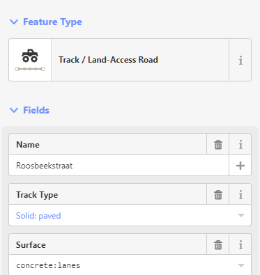
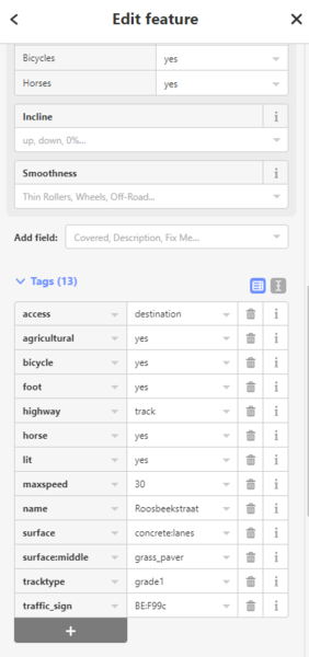
In Belgium, we have added a lot of "double concrete tracks" in the last 20 years, which are now an important part of the cycling network.
The way the are currently (mostly) set up in Openstreetmap, they show up as "green" unpaved in the routing.
This would exclude them from the "paved" routing, which is not what I would expect.
So, is this a something that can be fixed in cycle.travel, or are the tags/track type wrong?
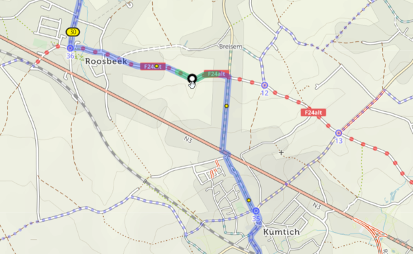
Example:
Oude Baan in Roosbeek:
Shows up as "unpaved":
These are the properties in Openstreetmap:
https://www.openstreetmap.org/edit#map=16/50.8307/4.8858
Many thanks for looking into this!
Dominique
Hi all, Richard
I cycle a lot in Belgium and abroad with all kind of bikes 'm really a big fan of the website & routing!
However, there is one point that I find annoying enough to write out here :)
I even have a colleague who stopped using cycle.travel for his long distance routing because of it.
Sometimes the routing algorithm takes a main road, but then whenever there is a even a very short road alongside, it takes that one to return to the main road just a few hundred meters further. This complicates the ride unnecessarily, slows you down and you loose your right of way. Also, quite often the smaller road is in bad shape. It is especially annoying when you are going downhill, or when you have to cross the main road twice. In a hilly environment, the main road is also generally the least steep.
I have this on almost all my longer routes that I plan, and you really have to zoom in to see those deviations, most often I only discover them when doing the tour.
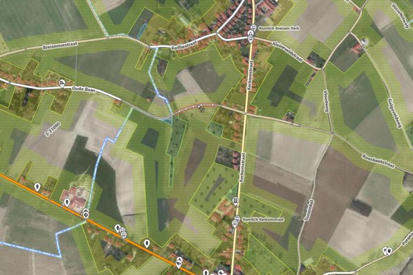
Example of today is this fragment, you need to cross the road twice, see picture,
(I'm not talking about the avoidance of the Kerkstraat which is in cobble stones so OK):.
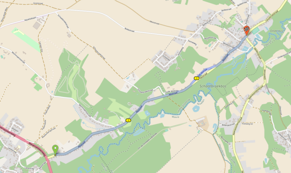
What I would suggest is to set some kind of minimum length to deviate from main route, and if possible, if going downhill or if you have to cross twice set that length even longer.
I hope something is possible here!
And many thx for all your efforts!
Dominique
Van het boek 'Fietsen door de mooiste landschappen van België" -Daniël Leroy & Robert Declerck - Ward van Loock


Made in the Cotswolds. Published by Éditions Système D Ltd.
Log in with your cycle.travel account:
| Password |
Or simply use your account on:
