
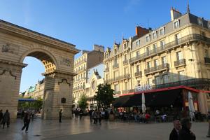
Dijon You can start this circular route anywhere, but Dijon, the historic capital of Burgundy, is the most obvious place because it’s so well connected – particularly by the useful TER train from Paris Bercy, which doesn’t require bike reservations. It’s not one of the great tourist cities of France, but the museums, churches and unspoilt city centre are all worth exploring.
The 15km from Chenôve, on the outskirts of Dijon, to Chambolle Musigny are being finalised and signposted as we write (early 2020). Dubbed the Voie des Vignes, this route follows lovely quiet roads through vine-growing country. After Chambolle Musigny the signs are already in place, directing you down tiny farm lanes on an easy, flat parcours. Nuits-Saint-Georges is renowned for its AOC-protected wine, and a good place for your breakfast or lunch (wine optional).
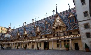
Beaune (46km) The route clings to the edge of the Côte d’Or before arriving in Beaune, the wine capital of Burgundy. Although the signs don’t take you through the centre, this is an exceptionally attractive town and a detour is pretty much compulsory. (You could consider Beaune as an alternative start point to Dijon).
From here, the tiny lanes resume on a twisting but well-signposted route. The vines you see on either side are destined for Montrachet, sometimes said to be the greatest white wine in the world (New Zealand readers, look away now).
Santenay (69km) The pretty railway-bisected village of Santenay has little wider significance other than as a cycle route. A fine greenway heads off into the hills, while we join EuroVelo 6 and, crucially, the towpath of the Canal du Centre.
Canal towpaths are the defining feature of the Tour de Bourgogne, and there’ll be many more kilometres of waterside riding. Here you get to enjoy flat, easy riding on one bank while the busy D974 occupies the other. Saint Léger sur Dheune’s waterfront feels almost Dutch with tall houses looking onto the canal. This is a popular centre for boat hire, which no doubt helps to keep the village shops afloat.
A brand new cycleway begins here, sometimes following the canal, sometimes venturing closer to the road and railway. This replaced a moderately hilly section on country lanes, which should tell you how keen the promoters are to make life easy for you. A steady succession of locks illustrates your slow ascent up the Dheune valley: the tree-lined section around Saint Julien is particularly appealing. The arrival of the fast N80 road means that the D974 is relegated to a rural lane following the canal bank, and we follow this to the useful town of Blanzy.
Montceau les Mines (115km) The route chooses not to go into the centre of Montceau les Mines, a former mining town which has seen better days. Although the Canal du Centre continues with the quiet D974 alongside, the Tour de Bourgogne and EuroVelo 4 instead choose to follow still more gentle winding lanes.
This is the Charolles region, internationally known for Charolais cattle (one l) and Charollais sheep (two ls), and you’ll see plenty of them over the hedges. While you’re in peeping mode, look out for the elegant 18th century château behind the estate wall at Digoine. All ornamental pillars, marble paving and artistic ceilings, it’s worth a visit if it happens to be open when you pass.
There are few facilities on this section of route, though you can detour into Ciry le Noble or Génelard if you need supplies. The route returns to the waterside for the approach to Paray le Monial.
Paray le Monial (163km) Paray le Monial is on the Bourbince, a little tributary of the Loire. Monial means “monastic”, and the main attraction here is the imposing 12th century church – a site of pilgrimage for many years.
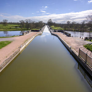
In short order, the towpath delivers us to the banks of the Loire itself in Digoin. We’re a fair way upstream of the classic Loire à Vélo route; the river is so twisty here that following the riverbank would double the distance to be ridden. Instead, after crossing the Loire on an 11-arched aqueduct, we join the towpath of another canal – the Canal Latéral à la Loire. You won’t see much of the Loire itself after the aqueduct, but its influence is felt in the easy, level riding. The sleepy village of Pierrefitte-sur-Loire has a pleasant square around the church, and a cheerfully painted canalside restaurant in La Péniche.
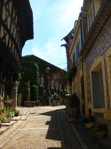
Diou (197km) Although the canal continues down the Loire valley, the Tour de Bourgogne takes a different course from Diou. A pristine tarmac rail-trail leads to Bourbon Lancy, a small town whose striking medieval centre has been lovingly preserved. It’s one of the most photogenic sights on the whole route.
The next 40km are all rural lanes, with a very mild climb to test your legs followed by a return to the increasingly wide Loire. Once again, there’s not much in the line of facilities along here, so stock up in Bourbon Lancy.
Champvert (254km) The bustling port town of Decize is just off the route, situated at the junction of two canals: our old friend the Latéral and the Canal du Nivernais. It’s the latter which we join at Champvert. Often considered the most picturesque canal in France, it’s deservedly busy with pleasure boats throughout its entire length to Auxerre, and the Tour de Bourgogne follows it all the way. (Note the twisted church spire before leaving Champvert!)
Cercy la Tour, a few miles on, has an interesting waterfront where the canal and river Aron merge in a wide “port” area. It’s worth climbing to the church square for the views over the valley. Châtillon en Bazois is still more endearing, its château situated on a promontory of the infeasibly winding canal. Its bike hire centre is winningly called Hello Vélo, with cycle-friendly accommodation and the promise of “Family-Friendly Bimbles To The Boulangerie”. We approve.
The everyday scenery is appealing enough, but there’s much of extra watery interest. First you’ll pass a series of staircase locks: if there’s a boat passing, watch for the traditional French method of operation in which water is cascaded through the chambers. At la Collancelle, the canal passes through three tunnels in quick succession, with the bike route passing over the top on lanes.
Chitry-les-Mines (331km) Look beyond the wide canal basin at Chitry-les-Mines and you’ll see a sturdy, towered château. This was the headquarters of Les Loups (the Wolves), a WWII Résistance cell. There’s a campsite here, and if you need supplies, the little town of Corbigny is just a few kilometres away.
In general, this section is peaceful and remote, with just a few sleepy villages. Rural cafés, bars and bistros are a pleasing sight, serving canal trade whether by boat or bike. The tree-lined canal bank, intended to minimise evaporation from the waterway, is a blessing for the sweltering cyclist on hot afternoons.
There’s a short diversion after Marigny onto lanes, but otherwise it’s towpath all the way. Look out for disused locks which once connected the canal to the River Yonne.
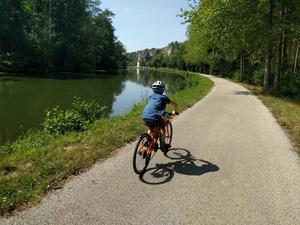
Clamecy (364km) There aren’t many towns of any size along this canal, so Clamecy, with its winding back streets lined with half-timbered houses, makes a welcome change from the winding rural waterway. The hilly, cobbled streets make this a town best explored on foot rather than by bike. The banks of the Yonne valley are heavily forested, and timber was once the heart of Clamecy’s economy – floated down to Paris in temporary rafts which were disassembled and sold once they reached the capital.
Although we continue to follow the canal towpath, the river takes a greater role from here. The canal merges with the Yonne for a while in Clamecy, and continues to cross back and forth as we head downstream. It’s rather less remote than the section south of Clamecy, with more village facilities to hand. Chalk cliffs at places like Merry-sur-Yonne provide an unexpectedly dramatic backdrop to the otherwise pastoral scene; you might see high-wire climbers trying their luck here.
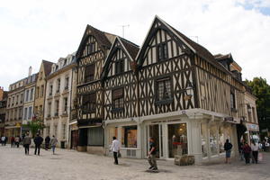
Auxerre (427km) Auxerre is the largest city en route after Dijon, and easily the most characterful. Its riverfront is magnificent, the equal of anything on the Loire, dominated by the 11th century cathedral and 9th century abbey. A network of narrow streets and timber-framed buildings converge on the clock tower, an intricate pile rather reminiscent of a 15th century Disneyland castle. Do stop here, and allow some time to explore rather than just relegating it to a brief overnight.
This marks the end of the Canal du Nivernais. The River Yonne takes up the role of waterside companion from here, as we follow (occasionally gravelly) roads beside the river and a short cut-off canal.
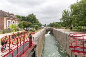
Migennes (452km) Migennes owes its prominence to two great 19th century transport endeavours. First, the Canal de Bourgogne, which leaves the Yonne here; then, some 50 years later, the great Paris–Lyon–Marseilles railway. When Auxerre said “non” to the railway engineers, Migennes welcomed them with open arms. Unsurprisingly, it has a rather more workaday air than Auxerre, but retains its importance as a transport hub: the station is still busy with regional trains, though the expresses have forsaken it in favour of a new TGV line, and it’s a popular port for canal holidaymakers.
The Canal de Bourgogne is much of a piece with the Nivernais, and some claim it’s even more picturesque. The towpath is mostly unpaved but wide and in good order, and you’ll make good progress along the long, straight pounds. The cheese-making town of Saint Florentin is worth exploring, with stone buildings climbing up the valley side to the commanding hilltop church.
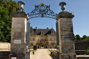
Tonnerre (496km) Tonnerre doesn’t turn its best face to the water, but persevere. The town centre, a short way to the south, is much more attractive with numerous pavement cafés along the fine town square.
The canal’s course becomes rather more winding as it slowly ascends the Armançon valley. All you have to worry about is a moderate incline at every lock, but the gently rolling landscape reminds you that this is hilly country, and the obstacles the canal-builders faced were not negligible. Tanlay’s château, owned by the same family for 300 years, is popularly said to be the finest in Burgundy. Occasional signs of old canalside industry add variety to the ride.
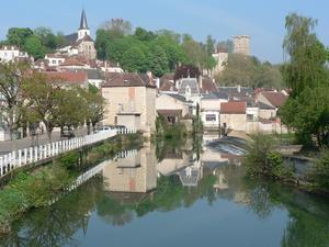
Montbard (554km) If you can, plan your arrival at Montbard for a Friday morning. The town’s weekly indoor market has an array of local produce so tempting that you’ll wish you had refrigerated panniers. At the very least, you can assemble yourself the finest baguette you’ve enjoyed all holiday.
Landscapes change slowly on a canalside ride, but you can’t help but notice that the distant hils are getting higher, the valley a little narrower. For a while after Montbard the slow ascent continues at much the same pace, but then you reach Veneray les Laumes, and it kicks up into another gear. The bane of holidaying boaters, 56 locks raise the canal and towpath to the summit at Pouilly-les-Auxois. Fortunately, it’s rather less taxing for the cyclist.
Take a short break at Éguilly to admire the rustic château, restored by its private owners over two decades. It’s not open to the public but its farm-like bulk sits perfectly in the Burgundy setting, even despite the hum of the adjacent autoroute. Both canal and road engineers aimed for the same natural ‘gap’, but we know which we think is the more enjoyable route.
Pouilly en Auxois (609km) The Canal de Bourgogne marks its summit with a rock-hewn tunnel at Pouilly en Auxois. Since the bore is too narrow for a towpath, we need to depart from the canal for a moment – at first following a tree-lined road directly following the line of the tunnel, then diverting alongside the autoroute until a safe underpass crossing comes into view.
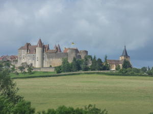
Scenically, the long descent from Pouilly is universally agreed to be the canal’s finest hour. You’ll note the repeated passage of well-heeled hotel barges, which in themselves must account for several vineyards’ annual output. Singling out the tourist highlights would take all day, but assuming that your climbing legs haven’t ossified through lack of use, then the 2km detour to Châteauneuf is unmissable. (We say 2km – you can get there in 1.4km, but the direct ascent is punishingly steep.) This medieval fortified village appears little changed from the 12th century, and its hilltop location gives superb views across Burgundy. There are a handful of restaurants, and occasional art and children’s events, but it’s more remarkable how this miracle has managed to avoid becoming a tourist trap.
For almost 40k, every village is ‘sur Ouche’, taking the name of the river in this heavily wooded, hilly valley. By Velars, canal, road, autoroute and railway are all sharing the valley floor. At the entrance to Dijon, the river widens into a lake – the end of a magnificent 665km circuit of some of the finest countryside France has to offer.
Log in with your cycle.travel account:
| Password |
Or simply use your account on: