
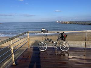
Brise Lames Even if you arrived by train in Bayonne, a few km inland, head out to the Atlantic coast at Brise Lames to begin your sea-to-sea journey. Toast your departure at the seafront café, though you might want to put off swimming until the Med. From here to Bayonne there's a decent enough roadside cycleway, with no fewer than three bike shops in case anything's not fully fettled. Bayonne is historically a port town, and though it's mostly pleasure cruisers on the river Adour now, you'll pass the shipyard where the 18th century sailing frigate Hermione is being painstakingly restored.
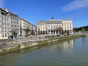
Bayonne (6km) Plan your ride to include a little time in Bayonne, the medieval city where the Basque country meets Gascony. At the confluence of the Adour and Nive, it has four waterfronts and three centres, though you'll probably spend most time on the left bank of Grand Bayonne and Petit Bayonne – warrens of narrow streets between timber-framed buildings, and a delight to get lost in.
The route leaves town on a boardwalk cycleway cantilevered out over the Adour. (Don't take the signposted cycle lift up to a rail bridge: that's for those following the Vélodysée coastal route.) It broadly follows the river for the next 25km, soon leaving edge-of-city industry behind to settle into a rhythm of quiet roads, gravel tracks and towpaths. Eventually we leave the Adour to join a lovely tree-lined path beside the Bidouze, an extravagantly looping tributary.
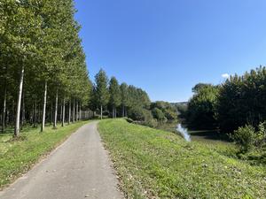
Bidache (42km) It's all been pancake flat so far, but here’s a brief chance to test your climbing legs in preparation for the hills to come. The hillside village of Bidache is an ideal lunch stop at the excellent village bistro, serving platters of wonderful Basque pork. Bidache's main attraction is the half-ruined Château de Gramont, 15th century in origin though burned down twice since then.
Soon afterwards, the route leaves the Bidouze to head through farmland on a series of tiny, virtually traffic-free roads. There’s a little climbing up to the sleepy villages of Labastide-Villefranche and Escos. Here EuroVelo 3 (the Pilgrims’ Route) heads off to the south, while the Vélosud continues east on the first of many excellent railway paths.
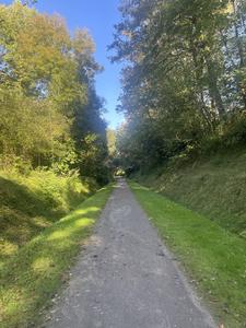
Salies de Béarn (70km) Salies de Béarn is an old-fashioned spa town where people still visit to take the waters, though a chateau repurposed as a casino is probably a busier visitor draw these days. (There’s also a friendly bike shop, Bik’in 64, whose swift repair saved our trip!) The rail path continues through cuttings and well-lit tunnels towards the valley of the Gave de Pau.
The V81 then follows a minor road clinging to the hillside while main road, autoroute, river and railway share the valley floor below. One final climb brings the route into Orthez.
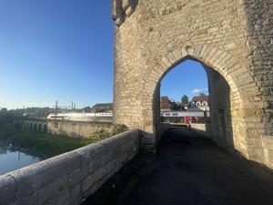
Orthez (88km) For the best entrance to the town, follow signs to the medieval bridge over the river rather than faithfully continuing along the V81. Orthez is a fairly typical provincial town which has arguably seen better days. Still, the compact town centre is pleasant enough and has decent eateries, plus a museum of the area’s long Protestant tradition.
After the usual semi-industrial suburbs, the route heads off on little twisty roads through a barely populated valley. There’s no sightseeing to do, just pure enjoyable bike riding.
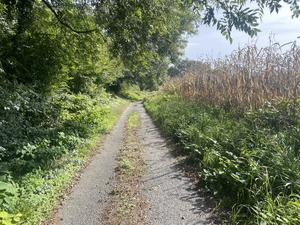
Mourenx (111km) A sudden switchback and climb up to Lagor is followed by one of the strangest parts of the whole route: the town of Mourenx. Looking for all the world like a cross between Runcorn and Bucharest, this isolated town was designed by 1960s urbanists to serve the new gas industry. It’s still a centre of energy production today, with the route threading past solar farms and sites of gravel extraction.
Normal service is resumed near Tarsacq, from where narrow roads and new riverside cycleways head towards Pau. At the time of our visit (2024) the riverside path wasn’t fully constructed, so there’s a diversion via Arbus and Artiguelouve with a couple of unconvincing underpass crossings of the busy D2.
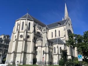
Pau (141km) Gravel cycleways lead into Pau, the self-styled ‘Capital of the Tour de France’: only Paris has hosted more stages. The route sticks to the valley floor and the city centre is up a very steep hill, but don’t let that prevent you from visiting. Find your way to the station and push your bike up the path beside the funicular railway, which emerges close to the church of Saint Martin. You could spend several days exploring its paving-stone streets, grand squares, chic shops and countless restaurants. And endearingly, despite the sharp climb, there are bikes everywhere!
Pau’s elevated position is a fine place to survey the looming Pyrenees. They’re ever present as the ride continues on along the river valley, a mixture of newly improved paths and farm roads which are implausibly winding at times.
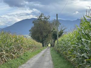
Nay (163km) The small town of Nay is ‘home of the beret’, with the obligatory museum. Soon after comes the historic religious community of Lestelle Bétharram, where a giant saintly portrait sternly monitors your approach.
The valley road passes a spectacular cave attraction, the Grottes de Bétharram. At Saint Pé de Bigorre we pass the tiny station (one train per day) before a brief but tolerable stretch on the main road. Returning to the south side of the valley at Rieulhès, it’s a steady climb through the woodland of the Forêt de Lourdes before a speedy descent to the holy bedlam that is Lourdes.
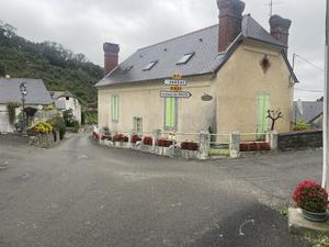
Lourdes (188km) What can we say? A unique combination of sacred and profane, of temple and money-lenders, Lourdes continues to attract pilgrims in their thousands every week. Riding into town on the quiet forest road, all of a sudden the street is thronged as you round the corner to the Sanctuary of Our Lady. Rows of shops selling gaudy nicknacks turn their pleading face to the holy site. Push or ride slowly along the Avenue Bernadette Soubirous, taking care not to mow down any elderly pilgrims, before crossing the Pont Vieux to the main town.
Lourdes has a bit of a reputation as the town that put the grot in grotte, and yes, there is a fair amount of tat here. But if you wander onto the back streets it can be pleasant, even charming, with some half-decent places to eat and more (cheap) hotels than you would have thought possible. There’s a handy bike shop on the riverbank, Bike & Py.
Lourdes also marks the end of easy valley riding, and the beginning of the hills. The first one is soon after you leave town, a short but gruelling ascent to the village fleurie (floral village) of Bourréac. It does at least make for a long joyful descent down the valley of l’Echez to the outskirts of Tarbes, through a string of villages each one with its proud mairie. At Louey the route becomes busier and more suburban, taking an uninteresting course through industrial estates before rejoining the main road at Tarbes’ university.
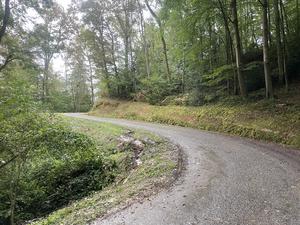
Tarbes (218km) The département of Hautes-Pyrénées is better known for its mountains than its towns, and Tarbes shows no signs of challenging that perception. If you love traffic lights then this might be the town for you, but otherwise treat it as a place included on the route because the tourist board insisted.
This is where the climbing kicks in, punctuating a series of plateaus and valleys – never mountainous but leg-taxing none the same. Two climbs straight after Tarbes are separated by a reservoir in the Arrêt Darré valley: they’re easier than the climb out of Lourdes though the traffic is a little heavier. Another climb at Peyraube is entirely enclosed by forest, such that you have little idea of your progress along the twisting, turning road until you emerge into sunlight at the summit.
There’s a brief respite as you descend through Bonrepos, before the 13km (8mi) slog up to Lannemezan: it starts gently enough, but the entrance to the village of Clarens has a real kick.
Navigational note: This is arguably the least compelling stage of the whole route, and you may decide to plan an alternative route between Lourdes and Lannemezan. A southerly course via Bagnères de Bigorre would be more scenic and have the same amount of climbing (~1100m), though with some sharper ascents. Alternatively, you can turn south some time after Peyraube and head directly to Lannemezan to cut down the climbing.
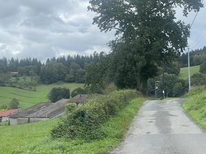
Lannemezan (273km) After the quiet settlements of Lannemezan and La Barthe de Neste comes a pleasantly undulating 10km, the first time the route has really ventured into the foothills of the Pyrenees. The scenery here is genuinely delightful if not spectacular, and as the road twists from south to north and back again, the view from the handlebars switches between valley vistas and Pyrenean peaks. Three climbs in succession aren’t negligible but nor are they too demanding, and the final downhill to the Nistos valley is glorious.
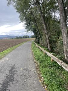
Saint Bertrand de Comminges (309km) Nicknamed the ‘Mont Saint Michel of the Pyrenees’ (by the tourist board, at least), Saint Bertrand de Comminges is a must-visit hilltop village whose population of just 250 can boast a 13th century cathedral, a set of Roman ruins, and some welcoming cafés. The rather looping route takes in a handful of interesting churches before dropping down to the valley of the river Garonne, which after a few twists and turns will head for Toulouse and Bordeaux. (Note that the route here is signed as the parcours cyclable de la Garonne rather than V81.)
A brief diversion in the village of Pointis de Rivière is worth doing for the attractive waterfront. From here the road becomes quieter and narrower – a de facto cycleway – winding through woods and fields along the valley to Valentine.
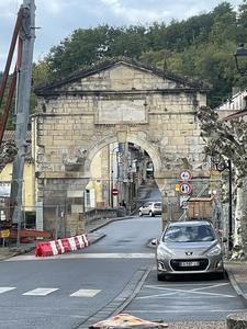
Saint Gaudens (334km) Saint Gaudens isn’t entirely without touristic interest, but the route ignores it in favour of a slog along the main road by the railway. (Pop in at the cycling café opposite the station if you’re in need of coffee or other fuel.) Happily this dismal interlude is only short and you’re soon back onto agricultural roads which take you back to the banks of the Garonne. After a climb into Estancarbon, it’s easy, flat cycling along the valley, with rarely a car to be seen until you cross the river at Lestelle de Saint Martory.
The short climb to Montsaunès gives way to some fabulously tiny roads, barely wider than a cycleway; the first descends sharply to dive under the autoroute, the second loops around the back of Saint Martory. This is an unexpectedly interesting village with a magnificent, Loire-like château, medieval gates guarding the main roads, and a fine church. From Le Fourc an easy railway path takes you to Salies du Salat.
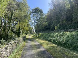
Salies du Salat (369km) Another sleepy spa town nodding to modern commerce with a casino, Salies du Salat is a useful pit-stop with hotels, boulangeries and, unexpectedly, some excellent little restaurants showcasing local produce. From here the wide, smooth railway path keeps close to the river Salat, occasionally ducking over and under the busy main road. You'll not see much of the lineside villages unless you divert off the track, but there's a handy supermarket at Lorp.
At Saint Lizier the route gives up completely: no signs, no cycle track. This is a blessing in disguise, because otherwise you might be tempted to ride past this tiny town – once a Roman fort of some importance, then a medieval cathedral city, and now unknown to all but a handful of pilgrims. Cross the bridge from the main road, take a look around the two (!) cathedrals, then continue along the quieter D3 on the east bank to Saint Girons.
Saint Girons (393km) After just 2km you reach this delightful market town, perched on either side of the Salat – "perched" being an appropriate word for the tall houses that line the riverside. Tie up your bike, explore the narrow streets on foot, and if at all possible, time your visit for Saturday morning when the town is subsumed in a gloriously chaotic market. If you had any space in your panniers beforehand, you won't now.
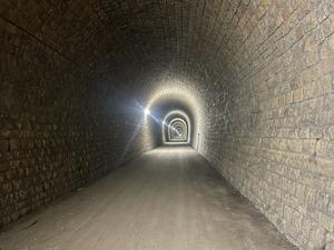
The cycle route restarts on the edge of town, with 40km (25mi) of uninterrupted rail path to take you to the edge of Foix. It's not an effortless ride. The gravel, not always well manicured, can be a little energy-sapping, and the hilly terrain necessitates two long railway-grade ascents and descents. It's all worth it, not just for the views, but the rail heritage. Old station buildings punctuate the line; cuttings, embankments and tunnels preserve your climbing legs; and best of all is a high, curving viaduct steering you south towards Foix.
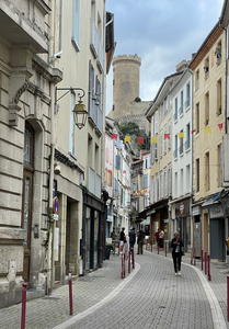
Foix (439km) A cursory glance at the map would suggest you could skip Foix and save yourself a few km. Don't. On a route studded with fine towns, this is by some distance the finest.
The castle, which dates from the 10th century, towers over the densely packed, twisting streets. On a warm evening, with smells of cassoulet drifting from the bustling restaurants, the dim shadows of mountains overhead and the river Ariege roaring past the town on its descent from the Pyrenees, you could be anywhere but the 21st century. If possible, plan your route to arrive here early afternoon, giving time to explore.
There is as yet no signposted route from Foix to Pamiers, but we've joined the dots with cycle.travel's route-planner recommendation. Leave Foix following the railway, and continue through Crampagna with its chateau and ornamental arch on the valley side. A short unpaved road takes you towards the edge of Pamiers, where the route resumes.
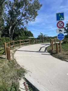
Pamiers (459km) The birthplace of Gabriel Fauré, Pamiers is a busy market town with a Gothic cathedral that has the misfortune to be overshadowed by its historic neighbour. Though the cycle route skirts its edge, do visit if you have time to spare.
The signs resume here along a brand new greenway, beginning with improved farm tracks before returning to the familiar territory of a tree-lined, gravel-surfaced rail trail. Compared to the glorious undulations of the scenery before Foix, this is an unchallenging ride along a gentle valley.

Mirepoix (484km) “Soyez héretiques!” Graffiti on the way into the town recalls its past as a stronghold of the Cathars, the insular Christian sect brutally suppressed in the early 13th century. The town you'll ride through is newer than that… but not much.
Catastrophic floods in 1289 led to its rebuilding, and it has remained little changed since. Push your bike through the archway, and along a narrow street crowded by top-heavy buildings, until you emerge in the glorious town square. Yes, it’s touristy with restaurants at every turn and a carousel in the centre, but architecturally it’s unforgettable. Don’t leave without a look round the cathedral, and if you have time, use the freedom of your bike to get lost in the narrow grid of streets.
Find your way to the Super U on the eastern edge of town to resume the rail trail, which is flat and unchallenging up to Moulin Neuf. At this former railway junction, the V81 route takes a sharp turn south. (The other line continues for 32km traffic-free kilometres to the Canal du Midi.) As you leave the valley of the river Grand Hers behind and slowly begin to climb, it really feels as if you’re approaching the Pyrenees proper. Impressive earthworks and viaducts maintain a steady gradient over the hilly country below, and the ruins of Cathar castles on distant hills give a remote feel unlike anything on the ride so far.
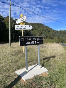
Chalabre (505km) Here’s where the climbing starts. At Chalabre, you leave the rail trails behind. From here, the route will be on-road almost all the way to the Mediterranean.
Turn off the trail by the church at Chalabre, and take the opportunity to fill up your water bottles at one of several public fountains. At first it’s an easy valley ride, with (for now) fewer bikes and more motorbikes as companions. The climb kicks up to 6% a short way either side of Puivert, but after a few almost-hairpins, it flattens out greatly for the final approach to the Coul des Tougnets.
And almost without noticing, you’ve conquered your first Pyreneen col. Not too tough, was it?
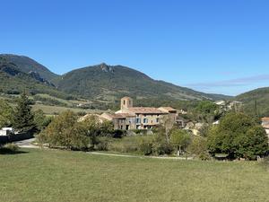
Espéraza (532km) The 15km (9mi) descent to Espéraza is every bit as enjoyable as you’d expect, and there are several cafés and bars to mark your achievement with a cold beer. Note the rather forlorn-looking station on a railway that is currently closed but set to reopen in 2025.
Couiza has a boulangerie and supermarket to fortify you for the climb to come. At first it’s a slow ascent up a wide valley, passing through the touristy single-street village of Rennes les Bains. But gradually the valley closes in, the gradient notches up and the road begins to twist back and forth. At the artsy village of Bugarach (a world centre for UFO enthusiasts), you’ll be riding a 6% climb or more as the Pic de Bugarach looms to the right.
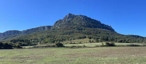
Col du Linas (556km) And then, suddenly, you reach the Col du Linas. It’s the literal high point of your route if not the figurative one – there are no panoramic views, no mountain-top café, just a car park, some recycling bins and the obligatory sign festooned with stickers. The descent to Cubières sur Cinoble is pure joy as you drop 200m within 8km (5mi). Don’t miss the right turn here onto the D10.

Gorges de Galamus (565km) This is the figurative high point of your route – one of the most enjoyable roads you’ll ever cycle.
The Gorges de Galamus are a classic ‘balcony road’, a narrow road carved into the side of the cliff. The deep gorge is winding, high-sided and only a few metres wide at its foot. The road is too narrow for many cars and a challenging drive at any rate, so motor traffic is low, particularly off-season. And because you’re still descending, it’s an easy ride as well as a spectacular one. Take it slowly and savour every moment.
Eventually, the gorge opens out giving a view to the far Pyrenees, which you can enjoy from a café chair. We guarantee you’ll still be smiling all the way along to Saint Paul de Fenouillet.

Saint Paul de Fenouillet (573km) Saint Paul has a cycle-friendly café, le Pouss Café. You might think the climbing is over and it’s plain sailing down to the Med, but this route has one or two surprises left in store.
You might have spotted the tell-tale words “itinéraire alternatif” on a cycle route sign. The final route along the valley floor hasn’t been constructed yet. So the route sends you up hill and down dale. It’s far from trivial, with the gradient topping 5% at times, but it is at least scenic. The road up to Lesquerde feels like a classic Tour de France ‘medium mountains’ climb. Then, after the whitewashed houses of this Mediterranean-flecked village, you begin a long descent through vineyards and wild scrubland… only to emerge back at the same altitude you left in Saint Paul.
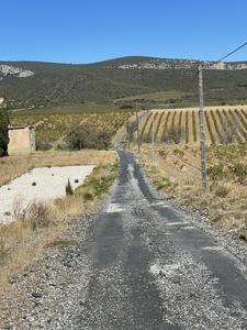
Maury (584km) Maury was clearly once a village of some import along the valley road, and still has useful facilities including camping and food. Here the route embarks on some of its tiniest roads yet, little more than farm tracks for the local vineyards. Some have been resurfaced with pristine new tarmac in readiness for this cycle route; others remain stony and potholed. This undulating section is nonetheless easy and enjoyable, and you’ll barely see a single car.
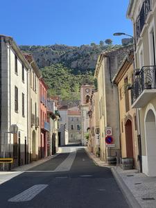
Tautavel (599km) One last hill. Another breathtaking road carries you up from Tautavel, full of hairpins which seem undecided as to whether to cling to the hillside or head ‘inland’ to the rocky wilds. Eventually it chooses the latter, and you pass quarries and more vineyards before a looping descent into the very steep-sided valley of the river Agly.
Cases de Pène bridges the river: note the colourfully painted mairie. The modest climb out of the village seems gratuitous given that the Med is in sight, but no matter.
The route faffs around on roadside gravel tracks at Peyrestortes, and you may find it easier just to stick to the D road. A rough track just before the roundabout provides safe (if puncture-prone) passage under the busy expressway, or you could carefully follow the D614 towards Rivesaltes, taking care not to be lured onto the dual carriageway.
Rivesaltes (621km) Rivesaltes is a lovely nest of narrow streets, medieval in atmosphere though most buildings are newer, and renowned for its fortified wine. Even if you’re not intending to stop, do divert from the route to pass through the old town centre, crossing back onto the route on the low-level river crossing.
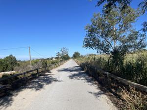
The last 15km (10mi) couldn’t be easier – assuming there’s no headwind, that is. A comfortable concrete cycleway follows the north bank of the tidal Agly, busy with sport cyclists, families on bikes, skaters and joggers. There’s a boulangerie/café just below the path at Saint Laurent.
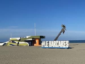
Le Barcarès (638km) A succession of campsites and caravan sites heralds your approach to the tourist hotspot that is the Mediterranean. Le Barcarès is certainly touristy, lining the coast with hotels and pizzerias. But it’s also a classic Med beach, and you can dip your wheel in the sea here to mark your arrival from the Atlantic.
EuroVelo signs offer you tempting options for carrying on along the coast, east to the Riviera or south to Spain. Perpignan is an easy ride from here, too, a fascinating city in itself and one with good train connections across France.
Log in with your cycle.travel account:
| Password |
Or simply use your account on: