
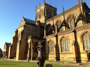
Salisbury Route 45 starts in the shadow of Salisbury Cathedral, just across from former Prime Minister Edward Heath’s home. A visitor reputedly once called the view from Heath’s house one of the ten finest in Britain, to which Heath replied “Why, what are the other nine?”. You can see his point.
The route threads through the city on shopping streets and a pleasant riverside pathway. (It’s the River Avon. No, not that one. No, not the other one either.) Fairly busy country lanes take it past the hillfort of Old Sarum, which is worth a visit if you have time and want to snap up the second great view of your holiday.
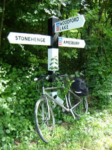
Amesbury (9mi) The green-fringed lane continues up the Avon valley, swapping sides at the foody Bridge Inn at Upper Woodford. As you approach Amesbury you’ll see a tempting sign to Stonehenge, just a couple of miles away. It is (obviously) a big draw, but the A303 is lethal and there’s no easy crossing. Should you want to visit, your best bet is to follow the footpath on the south side of the road to the crossing, then push your bike along the grassed-over old road to the entrance.
Back on NCN 45, all routes through Amesbury are traffic-clogged, and there’s no formal route across the town yet. It’s pretty obvious if you look at the map, though; continue straight across to London Road, then duck and dodge via Ratfyn Road to a bridge over the A303, emerging at a roundabout on the north side of town.
Though the route still follows the Avon, the remote feeling of Salisbury Plain is much stronger here. You’ll start to see signs of the military presence at Bulford, and even more once you’ve turned right at Haxton, heading uphill on an old, straight road interspersed with tank crossings. There aren’t many other places on the National Cycle Network where you’ll see “Danger – tanks” signs!
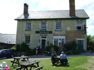
Pewsey (26mi) Pewsey is a friendly, well-heeled village with a handy mainline railway station. We share the route with NCN 4 for five miles of country lane, parallel to the railway on one side and the Kennet & Avon Canal on the other. You can get up close and personal with the latter at Honeystreet, where the legendary Barge Inn is a few yards down the lane. “Legendary” may sound like hyperbole but it’s a fair description of the tales you’ll be told here. It’s a centre for crop circle enthusiasts, boaters of a more alternative tendency, musicians, scrumpy drinkers… and it has a campsite which is ideal for your first night’s stop.
The toughest climb of the route so far is just afterwards, up onto the Wessex Downs at Knap Hill. A short descent takes us to the Kennet valley.
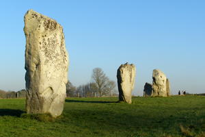
Avebury (37mi) At Avebury, the route takes a turn for the prehistoric. The stone circle here is the antithesis of Stonehenge: free, uncorralled by pathways, visitor centres and parking arrangements, and, frankly, huge. You could spend the afternoon wandering around the stones.
But it’s not the only ancient sight. The other is the Ridgeway, the ancient track along the edge of the downs with superb views all around. Said to be Britain’s oldest road, it is as rough and rutted as that description might suggest. That makes it wholly unsuitable for road bikes, which will need to follow the busy A4361 to Swindon instead. You can manage on a hybrid or adventure bike, but even then there’ll be a few places where it’s faster to get off and push. Worth it? Absolutely.
At Chiseldon the route ducks onto a comfortable cycleway past Coate Water, the reservoir built to supply the Wilts & Berks Canal, and into Swindon.
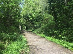
Swindon (53mi) Swindon is famed as a railway town, the engine-room of the Great Western Railway. The GWR is of course continues in full pomp today, yet Swindon also had a lesser-known crosscountry railway, the Midland & South Western Junction. This fell victim to the cuts of the 1960s, but happily, much survives as a cycle track. It takes the route efficiently and attractively through Swindon, though there are a few diversions onto residential streets. The rock in the cutting is 150 million-year old Jurassic, a rare outcrop of Portland rock this far north. (Who’d have thought the prehistoric theme would continue into Swindon of all places?)
The railway path is the core of the route from Swindon to Cirencester, though again, it’s not uninterrupted. In the northern suburbs of Swindon itself, the trackbed has been claimed by a small preserved railway operation, which you can see from the parallel road. We return to the rail path after Cricklade, a town now bypassed by the main road but with old coaching inns and a historic position as head of navigation on the Thames. (These days, only canoes reach the town.)
The railway path from Cricklade towards Cirencester can be rough and muddy. Take care especially after rain. Road cyclists will probably want to follow the minor road along the A419 dual carriageway before returning to the signposted route at South Cerney.
The old gravel workings of the Cotswold Water Park are much in evidence around South Cerney. You might also see traces of the old Thames & Severn Canal, slowly being brought back to life as the ‘Cotswold Canals’ by a dedicated volunteer force. Busy back streets take you into Cirencester.
There’s an alternative route through Swindon, signed as (45) in brackets, which takes you past the railway station and near to the town centre shops.

Cirencester (71mi) Cirencester is a charming town, if utterly car-clogged. Its history goes back to the Romans, of course (you can visit the amphitheatre earthworks on the edge of town), but latterly it’s become a centre for the well-to-do Cotswolds. As such you’ll find artisan delis, clothes shops and restaurants at every turn. The approaches to the town aren’t too enjoyable, and you can cut four miles off the route by heading west from Siddington and missing out Cirencester entirely. But that would be a pity.
With the railway gone, Kemble is the town’s railhead, reached a few miles further along the route. From here NCN 45 takes a lonely, lovely course along quiet Cotswold roads, staying high on the plateau with only sheep for company.
The magnificent descent, hairpins and all, begins at the picture-postcard little town of Minchinhampton. This takes you into Nailsworth and another densely wooded railway path.
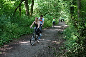
Stroud (90mi) The Stroud Valley was the industrial centre of the otherwise agricultural Cotswolds. Mills clustered along the Stroudwater Navigation and competing railway lines. The cycle route follows one of those railway lines, bypassing Stroud itself on its journey down the valley. (Stroud is worth a detour if you have time, an arty town with a fabulous Farmers’ Market on Saturdays.)
As an alternative to the railway, you can drop down onto the towpath of the newly restored canal – a little rougher and slower, but more photogenic. The waterside church of St Cyr’s near Stonehouse is one of the all-time classic canal scenes.
A busy minor road over the motorway leads to the winding lanes of the Severn Vale. Frampton-on-Severn, just off route, reputedly has the largest village green in England, overlooked by two fine pubs. Saul Junction is a hive of canal activity with boat trips, a renowned boatyard, and a marina, all at the junction of the (as yet incomplete) Stroudwater Navigation and Gloucester & Sharpness Ship Canal.
It’s the latter which we’ll follow, more or less, into Gloucester. Most of the route is on lanes, but the final approach to Gloucester takes to the canal. The finest moments are when the lanes draw near to the wildly winding Severn tideway, prized spectator spots for the Severn Bore.
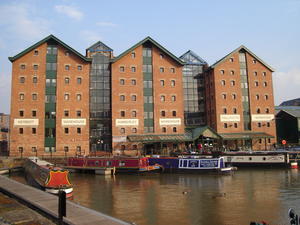
Gloucester (107mi) It’s quite a claim for a route bookended by Salisbury and Chester, but Gloucester is the architectural highlight of the tour: the magnificent cathedral, the preserved docks, the medieval inns of the city centre. The cathedral is actually just off route (it’s on another cycleway, NCN 41) but only by half a mile. The shopping streets are admittedly a little down at heel, but you weren’t planning on loading your panniers with shopping, were you?
NCN 45 arrives by the Gloucester & Sharpness canal and leaves by the old dockland railway. Gloucester keeps a safe distance from the capricious River Severn: you cross one branch just after leaving the docks, but it’s not until Over, two miles on, that you’ll meet the main stream. Telford’s river bridge is worth a look here, and there‘s a good farmshop beside the A40 just beyond.
Our route follows a riverside cycleway to Maisemore, after which the country lanes return. The unusual geology of the Severn vale manifests itself in an unexpected climb on the way to Hartpury. The riverside Lower Lode Inn, before Forthampton, is a very distracting detour and a good location for camping. There was once a summer ferry here which offered a more direct route to Tewkesbury town centre, but it hasn’t run for a few years.
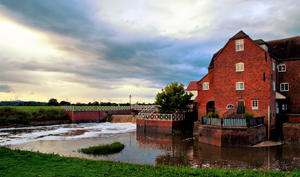
Tewkesbury (123mi) Tewkesbury is just off piste, but again worth a visit. Black and white half-timbered buildings line the streets while the Avon riverfront is full of interest. Tewkesbury Abbey, parts of which date back to the 12th century, is visible for miles around.
The town’s situation at the confluence of Severn and Avon limits routes in and out of the town, with the result that the Mercian Way follows the busy A38 for two miles before the lanes resume. From here to Worcester it’s a country lane route through little villages, devoid of steep gradients. The M5 makes a few appearances but is rarely too intrusive. The Cotswold Line route (NCN 442) joins for the entrance to Worcester, where an excellent new bridge has recently been installed across the bypass.
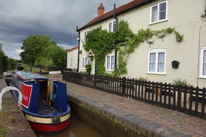
Worcester (140mi) Worcester’s cycle routes are all about the water: one on each bank of the Severn, plus another following the canal towpath. The Mercian Way is the towpath route, a popular greenway through the city delivering you safely by the outskirts when the traffic has dissipated.
This starts at Diglis Basin, the junction of the Worcester & Birmingham Canal with the River Severn. Take a detour here if you’d like to visit Worcester, a fine, prosperous city with its cathedral looming over the river; the riverside cycleway will take you to a gate from where you can walk up. There are daily services of Choral Evensong, sung by the professional choir of ‘lay clerks’ and boys, to best appreciate this wonderful building.
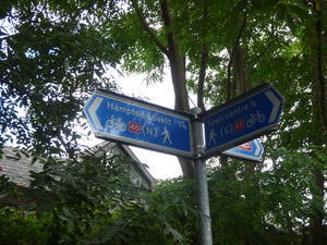
Droitwich (149mi) After Offerton Locks on the canal, a quiet lane and short bridleway section take you into Droitwich. The town streets can be a little confusing, so keep a close eye on the signage, making sure not to end up on NCN 46 which crosses here. The independent shops along the High Street are the highlight of the town, together with the nearby Vines Park through which the restored canal runs. The lowlight, meanwhile, is the industrial estate which forms the route out.
More lanes lead to Hartlebury, where there isn’t currently any access through the grounds of the castle (a bishop’s palace, really), so cyclists have to dodge traffic on a busy B road for half a mile. Eventually we reach a short stretch of railway path into Stourport-on-Severn, once a busy inland port on the Staffs & Worcs Canal, now a popular day-trip destination for West Midlanders – funfair, casinos and all. The route drops down onto the canal towpath for a minute before taking off towards the unexpected climb of Burlish Top. Here there‘s a really lovely short traffic-free cycleway towards the edge of Bewdley.
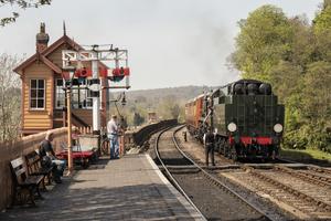
Bewdley (163mi) The Severn becomes wilder from here, the sole domain of canoeists and kayak travellers. Bewdley is a sweet riverside town, furnished with good pubs and a stop on the preserved Severn Valley Railway.
It’s a tough climb up from the valley, leading eventually to a railway path through the Wyre Forest. The rail trail is unpaved but generally in good nick. After three miles, the route turns north along forest tracks: these too are usually in good condition, though can be very muddy in wet winter weather when the Forestry Commission trucks churn up the surface.
From here it’s an undulating route all the way to Bridgnorth, crisscrossing the Severn several times – you’ll be envious of the level railway trackbed, firmly claimed by the steam-train operation. Between Highley and Hampton Loade there’s a fabulous, smoothly tarmaced path close to the railway. It is a little narrow, so watch out for pedestrians. The following section at Chelmarsh Reservoir can be muddy.
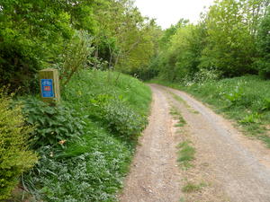
Bridgnorth (185mi) The railway ends at Bridgnorth, and the cycleway can finally claim the trackbed. Note that this section may be closed in winter months, and that the surface isn’t road-bike friendly: an alternative route is signposted via Broseley.
The route is wooded, but with occasional views over the river. Early accounts of pleasure cruising in canoes often talk about the rapids to be found on this stretch.
Coalport is the entrance to the Ironbridge Gorge – the cradle of the Industrial Revolution. The cycle route passes through the heart of it all: the tileworks, the historic riverside inns, and of course, the Iron Bridge itself.
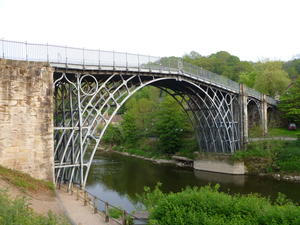
Ironbridge (194mi) The industrial archaeology of Ironbridge and Coalbrookdale, and the modern museums that retell the story, could detain you for a day or more. That’s not always a luxury that cycle tourists have, but do at least allow an hour for an unhurried stroll. There’s plenty of accommodation and restaurants should you choose this for an overnight stop.
And being rested is a good idea, because this is the location of the toughest climb en route. After passing the impressive low-lying viaduct at Coalbrookdale, the route ascends steeply up to Little Wenlock, on the slopes of the Wrekin. At 220m it’s not far off the heights reached on the Wessex Downs, and starting from river level makes this much more of a challenge. (If you’d rather have an easy life then you can take the B4380 instead, which is moderately busy.)
A tiny lane through Eyton-on-Severn leads to Wroxeter. In the Roman era, this was the fourth largest city in Britain. Now it’s a little village with a very nice line in ruins: you can cycle straight past them if you carry straight on past the Wroxeter Hotel, subsequently turning left at the B road crossroads.
Note that this section is no longer officially part of the National Cycle Network, so don’t expect to see signs here.
Upton Magna (208mi) Here the route crosses NCN 81 aka Lon Cambria, the Birmingham–Shrewsbury–Aberystwyth route. If you want to visit Shrewsbury, heading this way via Uffington is a much better bet than taking the direct road from Atcham.
Modest climbs over Haughmond and Ebury hills offer good views over the Wrekin should you look back. Dropping back down to the Roden valley, the route flattens out again, passing the attractive old cottages of Shawbury – and its less photogenic but handy shops.
The road past RAF Shawbury is slightly uncomfortably busy, but it’s worth it for the tiny lanes after Moreton Corbett. Lean your bike against the hedge and wander around the ruined complex of stately home, manor house and castle; the adjacent church is better preserved and very fine. Stanton-on-Hine-Heath has another notable church and a real gem of a pub in the Stanton Arms.
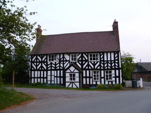
The half-timbered houses continue, but slowly, the narrow lanes and enclosed hedges of Shropshire fade into the wide, open farmland more characteristic of Cheshire. After Prees, keep an eye out for two crossings of the Llangollen Canal on the way into Whitchurch – good spots for a relaxed picnic.
Whitchurch (238mi) The cycle route approaches Whitchurch on a short railway path, part of the old line from Ellesmere which joined the (still operational) main line here. The town centre, a short ride away, is less characterful than others in Shropshire but has all the facilities you might need.
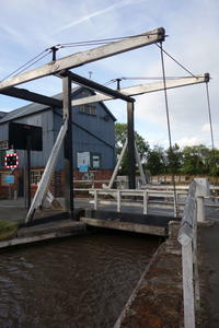
Quiet lanes, where tractors are the main traffic, take the route to the busy canal village of Wrenbury. Have pity on boating holidaymakers struggling with the lift bridge!
After crossing the busy A49, Cholmondeley (inevitably pronounced ‘Chumley’) has an excellent farm shop. The climb up to Bickerton is the last one of any significance on the whole route, though the descent is rather spoiled by having to stop for the main road at the bottom.
The attractive redbrick village of Tattenhall marks the start of the final run into Chester. At Waverton, the Mercian Way joins the Shropshire Union Canal, which it follows all the way into the city centre and a particularly dramatic cutting.

Chester (267mi) NCN 45 continues for another mile or two to the northern suburbs where it meets route 5, on its way from Reading to Holyhead. But Chester city centre makes a more fitting end to the route. The canal basin after the railway bridge, by the Telford’s Warehouse pub, is a good place to toast your achievement. From here you can head into town for the many attractions of Chester, including the last cathedral of the route.
Log in with your cycle.travel account:
| Password |
Or simply use your account on: