
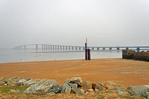
Saint Brevin les Pins The mouth of the Loire is 2km north of Saint Brevin town centre, but starting here is worth it to get a good glimpse of the Atlantic before you head inland. The route’s first kilometres are on a breezy gravel path beside the Loire estuary, with views from your saddle over the low banks. The fishing village of Paimbœuf has a faded old-world charm to it, a real contrast to the opulent châteaux that characterise the inland route.
From here it takes up a pattern that will become familiar over the next 630km: a tarmac trail that’s nominally a country road, but the frequency of cyclists (and paucity of drivers) means it’s effectively a cycleway. After 15km beside an old ship canal, no longer navigated, the route briefly returns to the main channel at Le Pellerin. There’s a ferry to the north bank here, but the official route stays on the south bank, taking twisty gravel tracks to the next ferry amidst industry at Indre. From here, unmemorable roadside cycle tracks take you to Nantes.
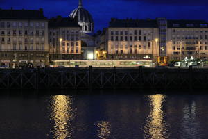
Nantes (58km) Nantes has a real buzz about it these days, celebrated by several newspapers as France’s up-and-coming tourist city. As with pretty much everywhere on the Loire, you can begin by ticking off the castle and cathedral boxes, and follow up with the medieval city streets. But there’s a contemporary art scene taking root, too, encouraged by the ‘Voyage à Nantes’ festival trail staged every summer. It’s pretty much a compulsory first night stay.
A faultless riverbank tarmac cycleway takes you away from the historic quays towards Mauves sur Loire and the first of many lattice girder bridges you’ll encounter during your trip. You have two choices here: stay on the north bank for a narrow gravel track sandwiched carefully between the electrified railway and the river, or cross to the south bank for tiny untrafficked (but tarmaced) lanes. The routes are reunited at Oudon, where it’s worth making a slight detour from the route to see the medieval castle ruins. The track under the cliffs continues until a short way before Ancenis.
Ancenis (97km) Ancenis (pronounced with just two syllables) is a former port that’s now a useful service centre for the passing cyclist, if perhaps not the most memorable town of your holiday. Again, from here, you can choose between the gravel track on the north bank or country lanes on the south bank. We have a slight preference for the south bank purely due to Saint Florent le Vieil, a medieval village whose abbey stands on an imposing bluff overlooking the river. You can camp here on the Ile Batailleuse, a low-lying river island, though the gravel processing plant makes this less idyllic than you might think!
The routes reconvene by the lovely 1920s suspension bridge at Ingrandes.
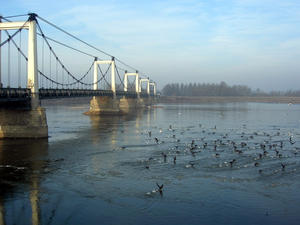
Montjean sur Loire (125km) For the next 10km, you’re cycling along another low-lying island, the Île de Chalonnes. There’s hardly anything here – no villages, no châteaux or churches, just arable fields and… the Lenin Café. Yes, really. This eccentric café is full of Soviet memorabilia that you can peruse over a coffee or local beer. A good opportunity to refuel before a few more (pedal) revolutions…
Beer and vodka aside, this is the beginning of the Loire’s wine heartland, as you’ll see on the way to Savennières – the appellation for a very respectable dry white. (You can sample some at the bar-restaurant in the attractive cobbled town square.) Close acquaintance with the railway brings you to the mouth of the Maine at Bouchemaine.
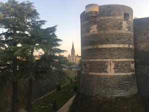
Angers (154km) Angers isn’t on the Loire, though its suburbs spill onto the banks. It’s on the Maine, a major tributary that joins here at Bouchemaine. This historic city is, however, far too good to miss. It’s not just the castle, though that’s a great draw. The cathedral, Musée des Beaux Arts, medieval houses, and a fine array of independent shops and restaurants are worthy of a short break in their own right.
If you do choose to make the detour – and we’d strongly recommend it — then simply continue up the Maine towpath, following the Vélo Francette signs. You can return to the Loire either via a signposted route through Trélazé to La Daguenière, or cycle.travel’s routeplanner can plot you a faster journey along city streets and cycle paths to Les Ponts de Cé.
The core Loire route is a little characterless along here, skirting Angers suburbs for a while then taking a fast, straight road close to the riverbank. Things perk up at La Daguenière, the route twisting and turning along appealing little farm roads until re-emerging onto the river at Saint Mathurin.
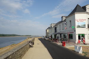
Saint Mathurin (180km) Saint Mathurin has the air of a forgotten river port, one where you can imagine bargemen collapsing into a riverside bar after a day wrestling with the uncertain channels of the Loire. There’s a useful supermarket in the town square.
Here we cross another girder bridge onto an enjoyable, fast D road that clings to the riverside on its way to Gennes. The fine river villages of Saint Maur and Le Thoureil are characteristic of this section of river, the road serving as a riverside promenade for the elegant houses looking across the Loire. Gennes wins full marks for its bike station, combining repair facilities, tourist info, e-bike charging, water, picnic tables, and even a bar.
Here the route splits and you can follow the road on either bank of the river. (There’s also a third option a short way ‘inland’, but we prefer the riverside routes for their outstanding views.) The south bank clinches it with Chênehutte’s outstanding riverside, lovingly tended gardens separating the fine villas, church and castle.
On the approach to Saumur, the route takes an undulating tangent away from the main road to dodge the busy traffic. Should you want to visit the famed caves of this wine-producing area, stay on the D road.
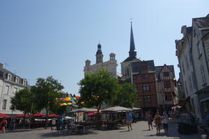
Saumur (211km) Another of the Loire’s fine medieval towns, Saumur is a maze of narrow streets between the rivers Loire and Thouet. (Look out for the elegant wooden boats and disused lock on the Thouet.) A distinctive pale stone characterises its buildings, particularly the château and cathedral.
The entrance to the town is complex and it’s easy to take a wrong turn: use a GPS/phone if you can. The bike route through the town itself seems almost to have been designed as an architectural tour, though you may choose to dismount on the very narrowest streets. If you can plan your visit for a Saturday morning, don’t miss the sprawling market.
Leaving Saumur, once again there’s a high-level route on country lanes, and a more relaxing low-level riverside route on gravel tracks. Villages such as Parnay and Turquant are prime wine country: by the roundabout in Turquant, an enormous model of a bottle of wine makes the point as if the vines weren’t enough of a clue. Best of all, though, is Montsoreau, a ludicrously pretty riverside village where boat trips run from the quayside. Here, the route takes a prolonged diversion away from the Loire onto quiet lanes, not so much for scenic variety as to avoid the Chinon nuclear power station.
Avoine (238km) Avoine is a useful village for provisions and cafés, with cheerful sculptures in the town square. When the Loire à Vélo finally returns to the river of its name, it’s on a lovely, peaceful, and well-surfaced track, so deeply wooded that you only catch occasional glimpses of the water.
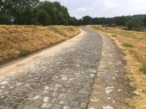
This gives out to a paved levee road – something you’ll be riding in abundance over the next days. As the levee bends back and forth, there’s a new view at every corner: the river, farmhouses, church spires and cultivated farmland. Bikes far outnumber cars, making this a blissful cycleway in all but name. Peak bikeyness is reached at Bréhémont, where hire bikes issue forth from the long-established Loire Vélo Nature: a Cyclo Café also operates at the site. For the full French cycling experience, there are even a few sections of Roubaix-style pavé (cobbles). But describing this wonderful section of route as “hell” is far from the mark.
The route detours onto another Loire tributary, the Cher, for the 20km to Tours. Savonnières was once a busy port: you’ll still see sailing vessels tied up to the riverbank, and the site of a derelict watergate which once allowed navigation onto the Loire. The riverside cycleway alternates between concrete, tarmac and gravel but is never less than smooth, easy riding.
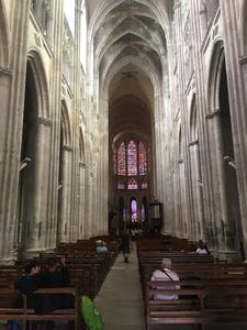
Tours (293km) Even France’s busiest bike route must have a sub-par section somewhere, and it’s probably the approach to Tours. The Loire à Vélo enters the city on an anonymous greenway passing a golf course and polytechnic, before climbing up to a roadside cycleway beside the main Avenue de Grammont. The sheer quantity of traffic lights and road crossings makes this a more stressful ride for the bewildered cyclotourist, especially as Tours’ hardened urban bikers zip past in true courier style.
Once the busy Boulevard Heurteloup is crossed then life gets a bit more relaxing. We’d suggest tying up your bike by the cathedral or on the riverfront, then walking west to the pedestrianised city centre (Vieux Tours). It’s unapologetically touristy, but then the medieval frontages of Place Plumereau couldn’t be anything but. These creaky-looking timber-framed buildings were restored in the 1950s after the depredations of WWII. If you’re hotelling along the Loire, this is an excellent choice for an overnight stay.
Utilitarian but pleasant enough cycleways speed the Loire à Vélo out of the city to Montlouis sur Loire. There’s a bit of a climb to the village, but the village square bistro is a good spot for a bite to eat if you didn’t refuel in Tours. From here, a succession of paved farm roads through vineyards take you to a track beside the Loire once more. You’ll see cycle route signs offering a 20km detour to Chenonceau, which as the greatest château of the Loire valley deserves consideration.
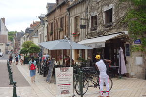
Amboise (320km) Amboise is no less crammed with tourists than Vieux Tours, and for good reason. The town at various points of its history housed the French royal court, Leonardo da Vinci, and Mary Queen of Scots. Its hulk of a castle, built on a steep outcrop, dominates the town – and on your bike, you’ll see it from both below and above, for this is the sharpest climb on the whole route.
The signposts direct you along a tortuous route under the river bridge to avoid an unpleasant crossing of the main road. You’ll then cycle (slowly!) in the shadow of the castle past restaurants and souvenir shops, before the gradient steepens sharply and a hairpin turn takes you to a superb viewpoint over castle and Loire.
You have 10km on high rural roads to enjoy the fruits of your labour before a sharp descent to Mosnes, from where riverside tracks resume the route. There’s another climb after the old bridge at Candé-sur-Beuvron, and an easy ride on to Blois.
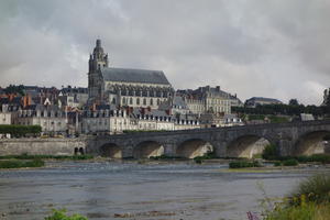
Blois (362km) The Blois waterfront is one of the most impressive on the river, dominated by another royal château. The steep streets of the compact town centre are best explored on foot rather than by bike.
For an antidote to all this chivalry, try the Fondation du Doute, a massive contemporary art gallery that provides some reassurance the Loire Valley isn’t just frozen in a heraldic timewarp. But if you do need more châteaux, then stay on the south bank of the river rather than taking the official route on the north bank, and follow the signposted route to the great 16th century Château de Chambord – the largest in the Loire Valley, an intricate wedding cake of a building.
It’s mostly paved levee riding from Blois to Beaugency, with a handful of gravel tracks.
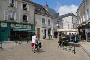
Beaugency (397km) Pretty Beaugency, perched on the side of the valley, is a must-stop. Its narrow streets lead to a compact cluster of shops, cafés and restaurants around the market square. The walls of the old fortified town can still be seen, including an 11th century tower. The Loire à Vélo remains on the north bank and doesn’t cross the fine medieval bridge, though there’s a handy riverside campsite on the south bank.
Instead, it crosses at Meung sur Loire as the route continues to follow the levees. Watch out at Saint Hilaire, where it’s easy to miss the turning on the approach to Orléans.
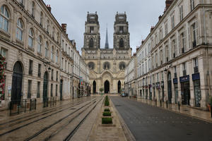
Orléans (425km) We could spend five paragraphs describing Orléans and only scrape the surface. There’s probably more to see here than any other city on the route: the countless battles fought over this strategic crossing point mean that it’s a collection of different architectural styles rather than a preserved medieval town. (Mercifully the city doesn’t hold a grudge against les cyclistes anglais, despite Joan of Arc’s attempts to drive the English out in 1429.) We won’t enumerate every historic building – Wikipedia does that for us – but suffice to say that this deserves an overnight stop.
EuroVelo 3 heads off here on its way to Trondheim (Norway), leaving us on EuroVelo 6 alone. After a few yards on the Canal d’Orléans, the route spirals up to the railway bridge – don’t miss the turn! — and crosses to the south bank for some pleasant cycleways above a lake. More levees lead to Jargeau, a useful market town with shops and restaurants.
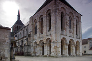
Châteauneuf sur Loire (457km) Châteauneuf hosts the Musée de la Marine de Loire, an interesting recap of attempts at navigating this tumultuous river. As often, the more expensive restaurants are on the riverside, the cheaper eats in town. There’s a peaceful campsite on the south bank.
Meanwhile, the cycle route on the north bank continues its quiet course; its determination to avoid traffic is such that, at one point, there’s even a new cycleway at the foot of the levee while motor traffic takes the high road. Fleury Abbey, at Saint Benoît, was founded in 640 and continues today with some 40 monks; its church is cathedral-like for such a small village. There’s a wonderful riverside spot for camping by the old port.
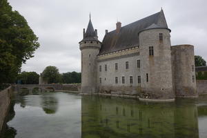
Sully sur Loire (476km) Many of the Loire’s most scenic châteaux are some miles from the river. That’s not the case at Sully sur Loire, where the fairytale moated castle is right by the cycleway. The busy town is worth exploring – we were delighted to find one of those boulangeries where the bread is so good there’s a queue halfway down the street. The river crossing currently takes a fairly busy road, but the old railway bridge is currently being renovated to become a cycle and pedestrian crossing.
Wonderful river views from the levee continue to Lion en Sulias, where the route detours ‘inland’ on minor roads to Saint Florent. There’s no great scenic reason for this, just that there’s currently no traffic-free alternative to the main D road. Still, the lakeside café in Saint Florent benefits from the passing cycling trade. Descending through Saint Gondon, the route picks up the river again: look out for the glorious old N-road sign relocated to the village exit.
Gien’s waterfront is pure café culture along the Quai Lestrade, on the north bank. The town itself suffered greatly from WWII bombing but its château is still an imposing sight. The route on to Briare forsakes the waterfront for some exceptionally well-chosen country lanes and tracks, winding downhill through Saint Brisson onto 4km of lovely wooded tracks.
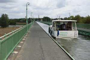
Briare (516km) The entrance to Briare is spectacular: an unusually long canal aqueduct over the Loire. Briare’s navigational history is complex, with this new (1896!) aqueduct replacing an older canal that made a precarious on-the-level crossing of the Loire. After a sharp turn at the harbour, the cycle route runs high above the old canal, unnavigable but kept beautifully with attractive stone bridges. The old lock into the Loire is still standing and festooned with flowers.
You can choose to cross the Loire again here and follow the new canal for a while, but we prefer the route on the north bank, a perfect tree-lined promenade past the village of Ousson. (This preference may be influenced by the wine fête taking place at Bonny sur Loire, the next village, during our visit…) This eventually crosses onto the south bank for a short stretch on the Canal Latéral à la Loire. Sadly this only lasts to Belleville, after which the route takes an underwhelming circuit of the Belleville nuclear power station. (Is it too much to hope for the towpath section to be extended?) From here, happily, normal service is resumed with quiet roads towards Cosne sur Loire.
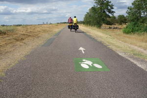
Cosne sur Loire (551km) Cosne Cours sur Loire (to give it its full name), on the opposite bank, has little to detain the tourist other than a handful of friendly cafés and a railway station. The Loire à Vélo instead drops down to the canal towpath for a smooth approach to the village of Saint Satur. Take the signposted detour just before the village towards Sancerre, a renowned centre of wine production high on a leg-busting hill. The cycle route curves over a old railway viaduct high above Saint Satur before the climbing starts: heavily laden cyclists will want to lock up their bikes at the foot of the hill and walk up. Just be careful you’re still capable of riding after tasting the local vintages in Sancerre…
The route leaves the canal here, but the paved levee paths and field-edge roads are still effectively traffic free. Trees on this stretch often obscure the views of the river but offer welcome shade on hot days. Pouilly sur Loire, on the far bank, is another wine village.
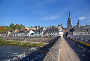
La Charité sur Loire (585km) Of all the towns on this section, La Charité is the one most worth crossing the river to visit. Its monastery and church have dominated the walled town since the 11th century. The old bridge hops onto an island where the municipal campsite is located. La Charité is also a book town, and even if your French isn’t up to much, the prints, posters and colourful comic books are fun to browse. (The impetus came from Parisian book dealers who were fed up of high rents in the capital!)
This is the home straight now, a long, relaxing ride on levee paths with little to interrupt progress. Marseilles lès Aubigny is a canal village: the route follows the towpath for some 2km here, then once again after the Fourchambault bridge. The river Allier appears, and it’s mission accomplished – this is the formal end of the Loire à Vélo route.
Don’t give up yet, because this is an intriguing place to poke around. The canal aqueduct takes cyclists over the wild rapids of the Allier to Gimouille, a one-time port village built on the canal and railways. Plagny is a haven for today’s canal users where the long-established Café du Canal attracts cyclists and barge-hirers in equal measure. At the canal junction by Verville lock, EuroVelo 6 continues on – ultimately to the Danube – while we turn left for Nevers.
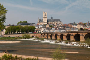
Nevers (628km) Nevers is a fitting place to end your Loire à Vélo expedition. Its cathedral dominates the view from the Loire. Narrow, cobbled city streets might seem old hat by now after your explorations of Tours, Orléans and friends, but there are many fine buildings here, particularly the Palais Ducal and around Place de la République. Nevers railway station has good connections back to Nantes or onwards to Paris. Or you could get back on your bike and continue to the source of the Loire… but that’s another story!
Log in with your cycle.travel account:
| Password |
Or simply use your account on: