
Become a supporter
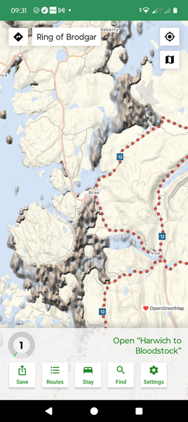
I don't know Shetland's geography personally but this (pictured) looks improbable. Maybe something funny is going on where different datasets are being combined?
When opening any file from a file browser on Android (for example, .pdf - or any other extension), cycle.travel is registered with the OS as a handler for that file type whether or not it can parse it. Is it possible to limit cycle.travel's registration with the OS as a file handler for only the types it supports (.gpx, I suppose)?
In the Android version, a double-tap or pinch zooms in the elevation profile chart on both the x and y axes. Zooming out again by un-pinching is difficult because the chart is so small. This could be fixed by disabling the y-axis zoom (which isn't very useful), and/or by disabling double-tap (which is too easy to do by mistake when using the tap-elevation-to-pan-map function).


Made in the Cotswolds. Published by Éditions Système D Ltd.
Log in with your cycle.travel account:
| Password |
Or simply use your account on:
