
Become a supporter
Hi,
I have a longish route planned with a few overnights. You can see the Journey here.
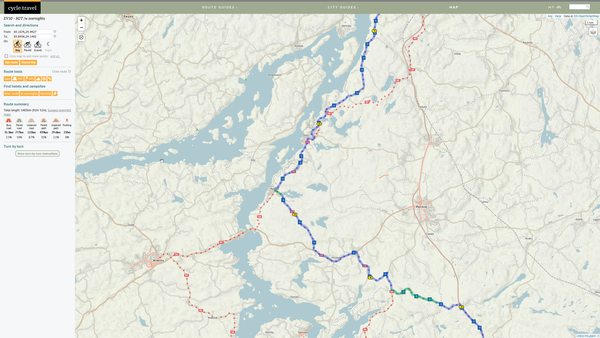
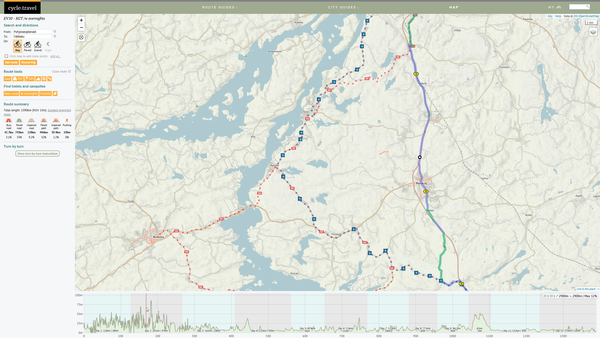
I wanted to see the elevation profile for the whole trip and kinda get a rough idea about the difference between each day. But when I click the "Show elevation" button, the route changes.
See below two images of day 2 from ~30km marker. The first image is without elevation profile and it continues west as it should. The second images if with elevation profile and now the route takes a sharp turn towards north. Any ideas whats going on here?
Br,
Sandman
Hi,
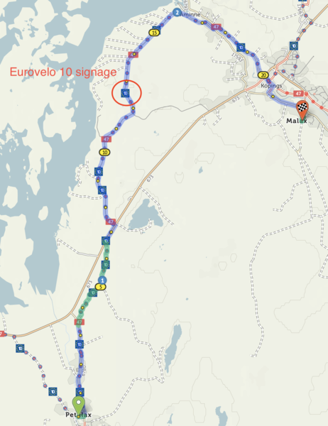
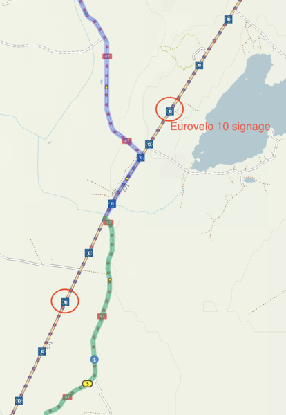
I'm planning a route along the Eurovelo 10 and came across come confusing behaviour on CT. It seems that in some places the path of EV10 depends on the zoom level. Not sure if this is a bug or a feature in the underlying data or in CT.
Take a look at this simple route https://cycle.travel/map/journey/388062
When you are zoomed out a bit, the route I've drawn follows the EV10 displayed on CT base map. But when you zoom in the route of EV10 changes on the base map and it no longer follows the smaller road, rather the signage is now on the big road.
Any ideas whats going on here?
I've also added two screenshots, just in case this is something others can not reproduce.
Br,
Sand


Made in the Cotswolds. Published by Éditions Système D Ltd.
Log in with your cycle.travel account:
| Password |
Or simply use your account on:
