
Become a supporter
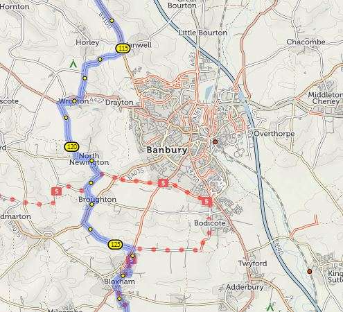
Strange behaviour on this route: https://cycle.travel/map/journey/182694
When I first open the route, it skirts west of Banbury:
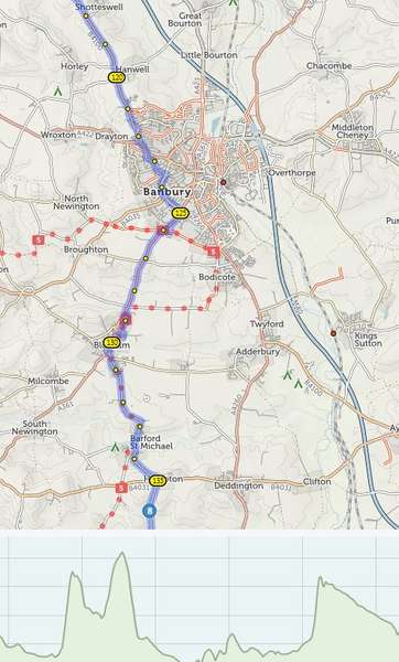
But then if I open the elevation pane, my route changes. It now goes through Banbury.
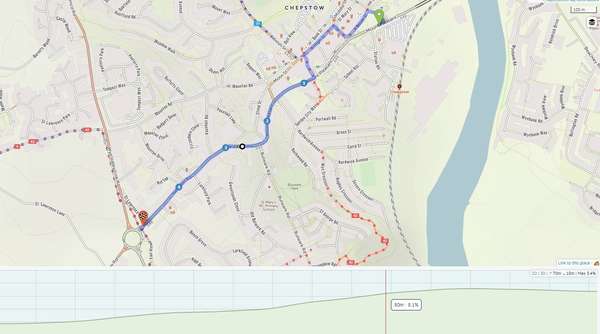
Here's an example screenshot. The maximum gradient is showing as 3.4%, whereas the local gradient under my cursor is showing as 8.1%.
Where does the 3.4% figure come from?
Sometimes waypoints will refuse to snap to certain footpaths.
E.g. https://cycle.travel/map/journey/147632
Between waypoints 9 and 10, there are a couple of footpaths. I can't get the waypoints to snap there, and I can't get the route to follow the paths.
I do realise footpaths are dodgy ground for cycling. But generally it is still possible to force cycle.travel to route along footpaths. I'm just wondering why I can't route along these specific footpaths.


Made in the Cotswolds. Published by Éditions Système D Ltd.
Log in with your cycle.travel account:
| Password |
Or simply use your account on:
