
Become a supporter
I used the Android App on phone with a colour eReader screen (BigMe Chinese phone) to take me from the Hook of Holland to Lauchringen on the border with Switzerland and back. What a fantastic app. This worked flawlessly. I downloaded offline maps to use my phone totally offline. 10/10 for this software - well done.
I have some suggestions to improve visibility:
1) Can the location cursor be made more 'pointy' so that it is obvious from a distance in which direction you are travelling. From a distance the cursor looks very much like an equilateral triangle.
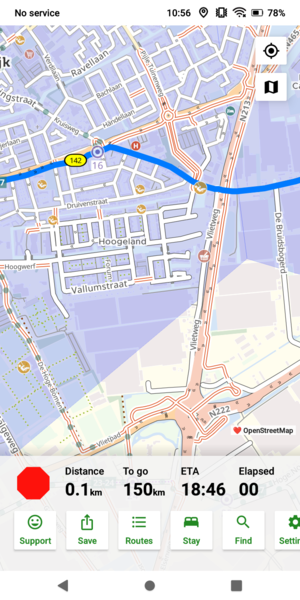
2) I am a big fan of the cycle node numbering system used in the Netherlands (and Belgium and parts of Germany). These numbers are in a very faint colour font. Would it be possible to present the numbers in black so improving contrast?
3) A scale bar would be much appreciated.
I will try to upload scr eenshots (this is my first posting so apologies if I fail to do this)


Made in the Cotswolds. Published by Éditions Système D Ltd.
Log in with your cycle.travel account:
| Password |
Or simply use your account on:
