
Become a supporter
Hello
I have a couple of suggestions:
Cheers,
I often modify a route just to see how long it'd take and check elevation, and cancel if it proved to be too long/steep.
I suspect adding an Undo feature à la RideWithGPS.
I noticed that when drawing a route in the UK, distances are displayed in miles while they are displayed in kilometers when drawing a route on the continent.
Provided there are enough of us metric people using Cycle.travel, I suggest letting the user choose which system to use, or as an an easier solution, just display distances in the two systems.
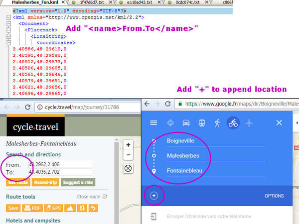
Title says it all: I often need to measure the distance between two locations to have a rough idea of how far they are between each other.


Made in the Cotswolds. Published by Éditions Système D Ltd.
Log in with your cycle.travel account:
| Password |
Or simply use your account on:
