
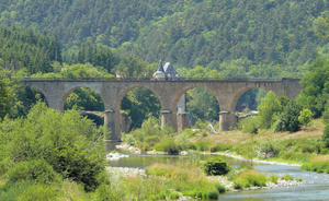
Lavoûte sur Loire The Via Fluvia begins on the Haute Loire just a short way downstream of Le Puy en Velay, at Lavoûte sur Loire, where there’s a railway station on the Lyon–le Puy line. Cross the viaduct over the Loire and follow the gravel trail, slowly climbing up towards the watershed as the hills loom ahead. (Those on road bikes may choose to follow the parallel D 7 road.)
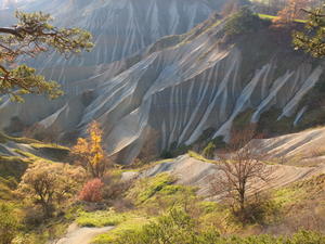
Rosières (6km) The railway path skirts the outside of Rosières, but the town centre is worth a visit. The stunning Corboeuf ravines just after the town are nicknamed the ‘French Colorado’. From here the scenery becomes more dramatic and the route twistier, crossing an impressive viaduct at Chavalamard. This is all good-quality rail trail, though a few sections are shared with cars.
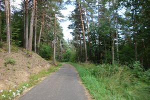
Yssingeaux (21km) The route across Yssingeaux is fairly uninteresting, running beside the busy N88 road before dropping onto a local access road. Yssingeaux is a local centre (sous-prefecture) and its town centre a useful stop-off, just a short ride uphill from the Via Fluvia.
From here, the voie verte is an absolute delight. The smooth tarmac curves through verdant scenery in steep valleys that you would swear had been transplanted across the border from Switzerland. A short missing section in the Lignon valley currently necessitates a brief diversion onto the D 105, rejoining at la Chapelette: the viaduct and tunnel here have been fully restored, cul-de-sac though they may be, so don’t miss out.
The little village of Lapte is especially picturesque and merits the brief detour. The villagers have erected ‘Welcome to Lapte’ signs on the cycleway – a nice touch.
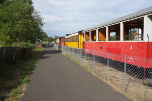
Montfaucon en Velay (45km) Approaching Montfaucon, the rail trail meets a real railway at Raucoules. This is the terminus of the Velay Express, the inaptly named steam railway that rattles along the old metre-gauge line to Tence, Le Chambon-sur-Lignon and Saint-Agrève. (Bike carriage is available on request in a special wagon, so you can connect with the Dolce Via route at Saint-Agrève.)
The preserved railway once continued to Montfaucon and Dunières, but this section was replaced with an excellent-quality asphalt cycleway in 2015. It’s a steady climb across open wooded landscapes to Dunières, from where the route follows another breathtaking river valley through Riotord to the watershed at the Col du Tracol. The old railway tunnel hasn’t yet been refurbished for cycling, so for now you need to take the hairpins of the D 503, with gravel farm tracks connecting it to the trackbed on either side.
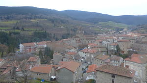
Saint Sauveur en Rue (69km) The most recent part of the route to be completed, this follows the old railway along the valley side. Tree cover comes and goes giving some scenic variety. Though not all this section is strictly a traffic-free cycleway, you’ll hardly see another car. The route keeps its distance from both Saint Sauveur and Bourg Argental, but you can duck into either on minor road should you need provisions.
Saint Marcel lès Annonay (86km) Having descended to the valley floor, the tarmac rail trail continues from Saint Marcel into Annonay. Watch out for industrial traffic in Saint Marcel and on the entrance to Annonay, where it doubles as an access road for a while.
Annonay (94km) The bustling town of Annonay, the largest in the Ardèche, is best known as the birthplace of the Montgolfier brothers – the inventors of the hot-air balloon. There’s an annual balloon festival (in June) to commemorate the town’s favourite sons.
A newly opened section of route continues the railtrail east of Annonay. Head south from here on minor roads towards the D 270, an easy, lightly trafficked, and superbly scenic road clinging to the side of the Cance valley. This brings you to the banks of the Rhône, and the Via Rhona cycle route, at Sarras.
As well as the main route to Sarras, there are plans for a second branch to Serrières (to the north).
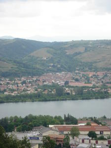
Sarras (115km) At last: the mighty Rhône. A couple of kilometres on the busy D 86 will take you to the Via Rhôna cycle route by the Saint Vallier bridge, but you might choose to continue to the mouth of the Cance on a riverside track. From here, it’s 300km downstream to the Mediterranean – or there’s a train station to take you back to Lyon and the line to Le Puy.
Log in with your cycle.travel account:
| Password |
Or simply use your account on: