
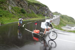
Oberalppass Dismounting from the narrow-gauge train of the Matterhorn Gotthard Bahn into the thin Alpine air, it feels like you’re at the top of the world. The feeling is only slightly lessened by the knowledge that the source of the Rhine is actually a couple of km to the south, along a mountain trail not really intended for loaded touring bikes. So this will more than do as a starting point for our 1,200km ride.
Wobble past the hotel/lodge at the pass and begin your descent, no doubt taking the hairpins carefully at first, then leaning into the bends as you gain in confidence. The infant Rhine is little more than a trickle here, but the spectacular glacier-carved valley speaks of the significance the river will gain.
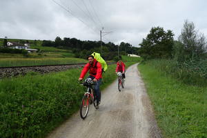
In this high country – you start above 2000m, losing two-thirds of that in the first 50km – do not expect the weather to be forgiving. The pass is closed in winter, and snow can linger well through the spring. Even in high summer it can be very wet (as our photos demonstrate!). But the scenery is breathtaking on the greyest of days. Cherish these Alpine views, as you’ll soon be down in flatter lands.
You can grab something to eat at the pass or in Sedrun, and you’ll sometimes see produce for sale beside the road. The road becomes busier as you descend, but also straighter, making for easy riding.
Disentis (20km) Popular with skiers, Disentis is worth a short stop at any time of year. The gilded extravagance of the abbey is the main draw in summer. Here, the cycle route crosses to the south bank for a quiet, traffic-free amble down the valley. It’s a bit gravelly but generally in good order; you may choose to continue on the main road in wet conditions or on narrow tyres, and although the traffic is fast the views are still fine.
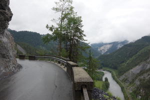
Ilanz is the de facto capital of the Romansh-speaking area. You may think you’ve taken a wrong turn here, as the route heads unexpectedly uphill on a roadside cycleway. This is the toughest climb on the whole 1,200km route. The lane grinds up to the summit at Versam, with its pretty church, before a short hairpin descent to a Rhine tributary. But it’s 100% worth it for the ride through the Ruinaulta gorge, a ‘balcony road’ along the steep valley side, with short rock tunnels and vertiginous drops. It’s the sort of scenery you’d expect to see on a glossy Audi advert, and so thrilling that you might decide to give up on the Rhine and explore the Alps instead.
Still with us? Oh good. We retreat to the valley floor at Bonaduz, a useful village for services. This is where the Hinterrhein joins, the other ‘half’ of the Alpine river. Lovely winding lanes through agricultural land take us to the river crossing at Reichenau.
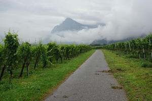
Tamins (75km) It’s easy cycling along barely trafficked lanes and functional roadside paths from here to Chur. There’s a direct route round the edge of town, with a handy roadside bakery/café. An alternate route passes the railway station, but the typically tidy town centre is another detour away.
Following the railway and motorway out of Chur, the well-surfaced track is hardly quiet but pleasant enough. The valley is slowly widening out, but we don’t hug the riverside. Instead, we head to the hillsides and vineyards of ‘Heidiland’. The modest climbs are not too taxing but give fabulous views. Watch out in the complex network of trails between Maienfeld and Fläsch, where it’s easy to miss the right turn halfway along.
After Fläsch, we have the first riverside path proper, a fully tarmaced route along the flood bank from where you can race the canoeists below. Though the Rhine’s course here is straight and slow compared to the mountain stream, the hills close in and then swing away in short order, making for rapidly changing scenery.
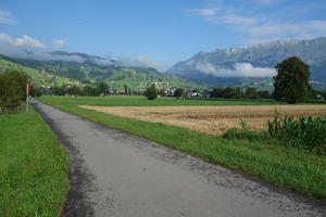
Vaduz (128km) On the opposite bank, Vaduz is the capital of Liechtenstein. The mountain villages of this microstate are rather lovely, but Vaduz? Not so much. So unless you want to tick off a capital city, we’d suggest remaining on the riverside path to Buchs, where it heads towards the town centre on a slightly tortuous route. Buchs has all facilities, and the hotels on the way out are cheaper than those in the centre.
Long, straight agricultural roads mark the transition from the Alps towards the Rhine delta of Lake Constance. As the mountains retreat, the route drops down onto a riverside track, part tarmac, part gravel. Faithfully following the river, it eschews the villages on either side, though taps and toilets are well supplied beside the cycleway.
After Lustenau, the Austrian border marks the line of the ‘Old Rhine’ before the river was straightened. There’s a flood defence museum in Lustenau, which may not sound too exciting but for its steam railway which extends along the levee into Lake Constance.
You can head west here for a shorter, simpler route along the south side of Lake Constance. But we think it’s worth adding the extra kilometres to ride the charming, and popular, north bank. Cross the Rhine at Fußach to a wooded stretch on gravel paths passing campsites and boatyards.
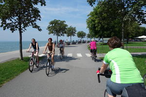
Bregenz (185km) In Bregenz, you might be bemused to see a bank of seating looking out to sea. Watersports? Wildlife spotting? Neither: this is for the world’s largest floating stage, where opera is staged every year at the Bregenz Festspiele. If that’s not surreal enough, look up, and you might see an airship on a sightseeing excursion from Friedrichshafen.
This is your introduction to the delightfully amiable experience of cycling Lake Constance. It’s tourist heaven, always tasteful, and immensely popular. If your itinerary demands steady progress at more than 20km/h, replan it. In high summer, the paths and roads are full of cyclists of all abilities, some trekking across Europe, many more just out for the day. This means the route is well supplied with restaurants, ice-cream parlours, and roadside vendors selling local apples. It does also mean accommodation can fill up early, so book in advance.
Riding beside the railway at Unterhochsteg, we cross from Austria to Germany. The German route doesn’t religiously follow the lakeside, but often ventures a short way inland on quiet roads (where bikes are in a clear majority) and gravel tracks. The medieval island town of Lindau, pristine and opulent, is an easy detour from the main route – go out on the road bridge, back on the railway bridge.
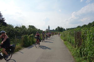
Friedrichshafen (219km) The industrial town of Friedrichshafen owes its prosperity to the airship industry, and ‘Zeppelins’ are still built here. Extensive bombing in World War II demolished much of the historic town, making it a concrete outlier on a shore studded with historic gems. The most interesting survival is the former monastery of Schloss Friedrichshafen, a castle since the 1820s.
The medieval town of Meersburg, on the other hand, is immaculately preserved. It has an Old Castle (7th century) and a New Castle, the latter a youngster at just 270 years of age. Now a rather well-to-do tourist destination, Meersburg is one of the best places to plan an overnight stop on the Rhine cycle route.
You can continue riding along Lake Constance if you like, along the ‘tongue’ that runs to Überlingen and Ludwigshafen. The official EuroVelo route, however, takes the ferry across to Konstanz.
Konstanz (248km) As the largest town on Lake Constance, Konstanz inevitably doesn’t have the tourist charm of the smaller settlements on the north shore. If you’re not in a hurry, though, do divert from the official route to explore the town centre, which was miraculously untouched by WW2 bombing. The fine Gothic cathedral is the stand-out attraction.
After leaving town, we return to Switzerland on a gravel track, following the southern bank of the Untersee – the smaller part of Lake Constance. Road, cycleway and railway all crowd onto the narrow shore of the lake, with schlosses dotting the hillside behind; no longer mountainous, but still affording superb views to the owners of these luxury residences.
Down by the water, the pretty villages are fully focussed on the tourist Euro. Steckborn is the stand-out, its medieval Turmhof (tower house) standing guard over the lake. The route is mostly paved and traffic-free, though with a few short stretches on the main road.
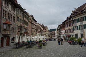
Stein am Rhein (276km) In a route rich in historic medieval towns, Stein am Rhein is the most perfect of them all. The frescoed buildings of the Market Place are breathtaking both in macro, seen together in a glorious assemblage, and in micro, each one full of intricate detail. The medieval buildings would be world-class on their own, but the paintings make them unique.
And then, if that’s enough culture for one day, you can round the corner on your bike and stop off for a currywurst. Stein am Rhein is a Swiss incursion on the German bank, but Germany’s unprepossessing fast food is sold in its thousands to day trippers here. This leg of the route flips confusingly back and forth between the two countries: Büsingen, for example, is a German town on the German bank surrounded entirely by Swiss territory.
Fortunately, you don’t have to worry about navigation: just follow the EV15 signs. After switching to the north bank at Stein am Rhein, the gravel track was one of the rougher ones we encountered on our trip, puncturing our 25mm tyres. You probably won’t be so unlucky, but thin-tyred riders might want to follow the route on the southern bank instead.
A long way from its beginnings as a mountain stream, the Rhine is wide enough here that bridges were a major undertaking; and any village with a bridge became a busy trading point. Tourist boats ply this stretch of the river in summer.
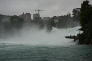
Schaffhausen (296km) Schaffhausen, the largest Swiss settlement on the northern bank, is a bustling, attractive town with an excellent market on Tuesday and Saturday mornings. From the circular fortress of the Munot, there are commanding views down to the river.
The best views in town, however, are just downstream at Rheinfall. Up to 600 cubic metres of water thunders over here every second, and from the roar and the spray, you can well believe it. Though the best cycling here is along the south bank, the best views of the waterfall are from the north side, looking towards Schloss Laufen on the river bluff. If you’re overnighting in Schaffhausen, do ride out to see it – you can even dine at a restaurant below the falls.
Leaving on the south bank, we forsake the Rhine for a while, taking lanes through woods towards another meander at Rheinau. There’s more climbing here than anywhere since the Rhuinalta gorge, with 100m to climb on a wide country road after Flaach. Descend to the lovely riverside track beyond Teufen, continuing to Eglisau with its high railway bridge. An uninspiring but functional cycle path beside a main road leads to Kaiserstuhl.
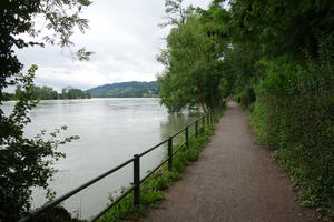
Kaiserstuhl (337km) Kaiserstuhl’s bridge has been rebuilt again and again through the years, and offers another chance to swap between north and south bank routes. Neither is among the Rhine’s finest hour scenically, but since the northern route is mostly roadside path, we’d recommend the more varied southern side.
This is a more industrial stretch of the river, and the railway is ever-present. The spa town of Bad Zurzach has Roman origins. Cross to the German side at Koblenz; the route through Waldshut is a delight, a gravel path separated from the water’s edge by a low fence. It then becomes a track in the middle of the river – well, sort of. The main channel is on your left, with a reservoir and backwater channel to your right. The cycle route follows a wooded gravel track between the two.
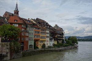
Laufenburg (372km) After Meersburg and Stein am Rhein, Laufenburg is one of the finest medieval towns on the upper Rhine. It’s officially two towns, one in Germany, one in Switzerland, linked by an old bridge. The bridge is now reserved for pedestrian and cycle traffic since a new road bridge was built upstream – a bypass which has given the Swiss town a rather sleepy air. Its maze-like streets snake up the hillside, with traditional restaurants hidden around corners. (Those on the German side are, as you would expect, a fair bit cheaper.)
The route to Bäd Sackingen stays close to the river, followed closely by the railway. Bäd Sackingen is best known for its long covered bridge. The route runs straight through the town centre, past the cathedral, and – winningly – the trumpet museum in the schloss.
There’s not much to call between the north and south banks here. We continued on the north bank, which has more paved sections and cafés – crucial on the hot day of our ride. The southern route to Rheinfelden is largely gravel tracks through fields. Both are easy, flat cycling with frequent views over the river.
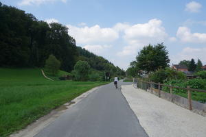
Rheinfelden (402km) A bridge festooned with flags takes us over the river from German Rheinfelden to the Swiss town. This is easily the more interesting of the two, whether or not you fancy a litre of Feldschlösschen – Switzerland’s most popular beer is brewed here. The colourful old town is on your left after you cross the bridge, its buildings spilling out onto the riverside.
Follow the south bank route along to Kaiseraugst, built on the site of an ancient Roman city (Augusta Raurica). The amphitheatre is a short way off the route, but worth finding.
The signposts steer you away from the busy river road to the well-to-do suburbs of Pratteln and Muttenz, comfortable living for the industrial scientists of Basel. It’s a rather circuituous route but avoids traffic for the most part.
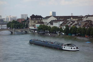
Basel (424km) Congratulations: you’ve reached Basel, and the end of the Swiss Rhine. From here, the river forms the border between France and Germany for hundreds of km.
After following a road along the canalised river Birs, you emerge back on the Rhine under the busy Schwarzwaldbrucke (Black Forest Bridge), road and railway together. Though it’s only a few kilometres since last saw the river, it seems to have suddenly grown up. Boats ply the water, little ferries shuttle from side to side, bridges come thick and fast, and the buzz of the city is all around.
Turn left along the waterfront, then before the next bridge, head up Mühlenberg towards Basel Cathedral – a fitting place to end this 430km leg of the railway. From here, the Rhine cycle route takes on a very different air.
Log in with your cycle.travel account:
| Password |
Or simply use your account on: