
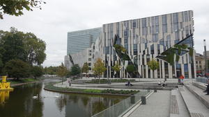
Düsseldorf The capital city of North Rhine-Westphalia, Germany’s industrial heartland, Düsseldorf has undergone something of a renaissance in recent years – startling architecture, world food, and bike-friendly streets. The city centre and historic Altstadt are all on the east bank, but we begin by crossing over to the west bank to begin your Rhine ride.
It’s comfortable and suburban for the first few kilometres past sports clubs and rowing lakes. But the suburbs drop away quickly and you’re into the countryside in no time, with honesty-box wheelbarrows loaded with local vegetables to tempt the day-tripper. The ‘red brick roads’ that follow the Rhine dykes are busy throughout with e-bike riders, some just out for the day, others with full panniers on their way down from Switzerland.
The alternative east bank is an equally pleasant ride along this stretch, passing through the pleasant little town of Kaiserswerth. There are excellent views of the river from the path near Wittlaer. After this, though, we’d suggest that you detour to Mündelheim to cross the Krefeld/Uerdinger bridge to join the west bank route.
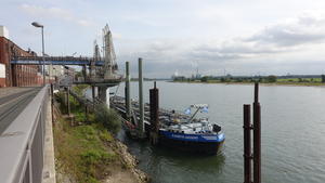
Krefeld (19km) Both sides of the river are heavy on the industry from here on, but we reckon the mixed industrial heritage of the west bank is more interesting than the colossal Mannesmann steel plant that dominates the east side.
First comes the Krefeld suburb of Uerdingen, where you can choose between the Rhine promenade or the neatly paved streets of the sleepy centre. The riverside Bayer works have become Chempark, a centre for the chemical industry – perhaps not picturesque, but certainly characterful, and still served by barges on the Rhine.
Rather less interesting is the endless procession of logistics depots (‘Logpark’) that follow, acres of lorry parks that come to a merciful end at a railway underpass. As you return to the Rhine, look out for the railway bridge busy with Duisburg freight traffic: four bridges have been built on this site and you can still see the remains of the old ones.
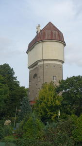
Duisburg (33km) Duisburg itself is on the east bank, and there are cycleway crossings on both the motorway and railway bridges. We stay on the west bank, though not on the riverside itself. A lift-bridge over a barge dock has been closed since 2017, cutting off the riverside route: until it’s repaired, EuroVelo 15 is diverted along a rather suburban course through the suburb of In Den Haesen. It’s not exactly the route’s finest hour, but it’s functional enough and mostly traffic-free.
From here, it’s more or less rural all the way to the border with the Netherlands. As if to celebrate, there’s a lovely new tarmac path through farmland after the village of Baerl, then a curious but enjoyable diversion through farm roads to the useful town of Orsoy. The industry returns briefly on the entrance to Rheinberg, but you’re safeguarded from heavy lorries by another one of the roadside paths that characterise cycling provision here.
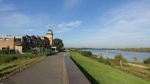
Rheinberg (56km) Rheinberg is a useful town with bakeries and supermarkets for provisions. Here we wave goodbye to traffic and take an easy, gentle ride along flood dykes. The rumble of paving stones underneath your wheels becomes a soothing sound.
For a while you won’t see much of the Rhine. The floodplain separates the dyke from the fairway, an agricultural interlude between cycleway and river. At Büderich the path meets the riverside once again, but you’ll note a new brick wall to provide extra flood security. The riverside Wacht am Rhein hotel/restaurant played host to Churchill, Eisenhower and Montgomery in 1945.
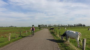
Wesel (69km) Should you want to visit Wesel, a cycleway beside the main road takes you across the river. The town was almost entirely destroyed by bombing during WW2, and as such its historic charms are really only for devotees of post-war architecture. Still, it’s a useful stop for hotels and bike shops.
The old railway bridge, just downstream of the road crossing, was the last Rhine bridge held by the Germans in 1945. Blown up by the retreating army, it was temporarily repaired by the Allies, but now only the approach viaducts remain.
The Bislicher Insel (Bislich Island) leads to Xanten, and could be the most delightful part of the route. A winding lane rolls gently through this wetland area, formed when the river was straightened in the 18th century and carefully preserved in recent decades. It’s a haven for birds – just look to see where the twitchers are pointing their cameras to spot the interesting ones!
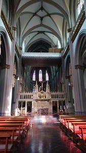
Xanten (81km) So far, we’ve taken a “visit if you want” attitude to the riverside towns: apart from Düsseldorf itself, none are truly unmissable.
That’s certainly not the case for Xanten, a glorious town which absolutely shouldn’t be missed. Its market square is a classic of the type, lined with cafés and bars. Wheel your bike through the archway to Xanten Cathedral, commenced in the 13th century and now a feast of Gothic architecture enlightened by modern stained glass.
Then, on your way out of the town, you’ll pass the Archaeological Park, a reconstructed Roman town built on the site of a real Roman settlement – one of the area’s most popular tourist attractions. (But not its most unlikely, as we’ll see below.) Plan your journey to include an overnight stop at Xanten for the best chance of seeing this lovely place.
Gravel paths twist around the lakes at Wardt and Vynen, a welcome change of pace to the more usual dyke paths. (There’s a paved cycle track on the road west of the lakes if you’re on a thin-tyred bike.) The dykes return afterwards for a pretty, almost Loire-like section with cottages nestled below.
Practical if unexciting roadside paths continue through the Mörmter villages to the curious tourist mecca of Wunderland Kalkar. Built as a nuclear power plant in the 1980s, it was never actually commissioned due to the German public’s uneasy view on nuclear electricity. Ten years later, a Dutch entrepreneur bought the empty site and turned it into an amusement park which now attracts half a million visitors each year. The painted cooling tower you can see is now used as a climbing wall.
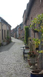
Grieth (105km) A pleasant little village with a friendly café on the main square, Grieth is a popular stopping point for cyclists – there’s a ferry to the east bank (opening times) solely for foot and bike passengers. If you want to visit Emmerich am Rhein on the east bank, another town greatly destroyed by Allied bombing, this is a good place to cross.
Continuing on the west bank, it’s mostly roadside cycle paths from here to Griethausen. At the time of writing, there’s a significant diversion out towards Kleve caused by dyke reconstruction works. Kleve itself (as in “Anne of Cleves”) isn’t on the main route, which heads back towards the Rhine at Griethausen. There’s another old railway bridge here, but not actually over the main Rhine itself. Rather, it crossed a backwater (the Griethauser Altrhein) and ended at the banks of the main river, from where a rail ferry took wagons over to the other side. Look out too for the canal lock at Wardhausen, the start of a short waterway to Kleve.
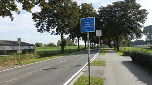
Millingen (130km) From Düffelward, the official route is signposted along roadside paths, but you can actually continue on the paved dyke path which is a little more interesting. Either way, it’s not far to the Dutch border, on the outsides of Millingen aan de Rijn.
Cross on the pedestrian/cycle ferry to the east bank; from here, our guide to the Rhine route in the Netherlands takes you forward to Arnhem and beyond.
Log in with your cycle.travel account:
| Password |
Or simply use your account on: