
Etwall The Pennine Cycleway starts gently, leaving Derby on an old railway track before branching off onto country lanes after eight miles, in the village of Etwall. Derby city centre can be confusing, so print out our map before leaving. (You could also start at Burton-on-Trent and follow NCN54 to Etwall, a similar distance.) The lanes undulate mildly before Ashbourne but nothing too strenuous.
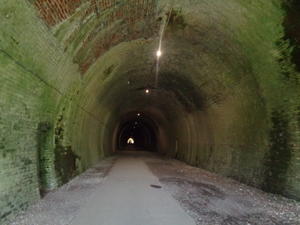
Ashbourne (13mi) Ashbourne itself is a very attractive town and a good place for a café stop. Here, a tunnel takes you onto the 15-mile Tissington Trail, one of Britain’s finest old railway routes. Many rail trails are buried in wooded cuttings with few views. Not this one, which gives terrific views across the Peak District on embankments. It’s a steady climb to the end of the trail at Sparklow, so factor in the need to stop now and then. Lovely little Hartington is a particularly worthwhile diversion if you have time to spare, and space in your panniers for cheese!
Buxton (38mi) A newly improved route into Buxton now bypasses the busy roads and gives great views, until you descend to the village of Harpur Hill. Town roads are busy and winding, so take care. There’s plenty of B&Bs along the route as you enter the town centre.
After climbing out of Buxton on the main road, a tough ascent on a broken road gives way to a glorious, hilly Peak lane. It’s the defining feature of this section: the erratic surfaces keep the cars out, giving us quiet cycling in rough-hewn countryside. Nothing should prohibit road bikes from passing, but you might choose to push now and then.
Whaley Bridge (44mi) Watch out for the hidden right-hand turn heading downhill in Whaley Bridge. The Bugsworth canal basin, soon after, is a surprisingly little-known relic of 19th century industrial ambition; the Navigation Inn here is a great place to catch your breath before the next climb.
Hadfield (57mi) The anonymous route past Hadfield and a muddy ascent (you’ll need to push) lead up to the railway path by the Woodhead reservoirs. Closed in the 1980s, this is Britain’s greatest lost railway, an electrified trans-Pennine route for heavy freight. It’s a little gritty and occasionally muddy, but should pose few problems. At the end, you’ll see the portal of Woodhead Tunnel, now used for National Grid cables.
The climb over the brow of the Pennines is partly uncyclable unless you’re an extreme MTBer. Persevere if you’re on a adventure or cross bike, but on thin tyres, stick to the (very busy) main road.
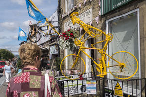
Holmfirth (74mi) Fortunately it’s just 1.5 miles to the moorland lanes that take you over to Holmfirth. There’s an exhilarating descent to this, the home of Last of the Summer Wine, and with all the tea-rooms and antique shops you’d expect.
This area is the purest Pennine experience of the whole route: country lanes between dry-stone walls, hillside villages and mill towns, and climbing, up and down, valley to valley… starting with the haul out of Holmfirth, which is brutal.
Slaithwaite (81mi) Slaithwaite (pronounced ‘Slaw-it’) has the Huddersfield Narrow Canal running along its High Street, and a handy railway station. Over the next hill, the M62 crossing is slightly improvised, a footpath along a reservoir dam and then in a low culvert under the motorway. The ride across the moors to Calderdale, however, is more than worth it.
Sowerby Bridge (90mi) From Sowerby Bridge to Hebden Bridge there’s a choice of routes: NCN68 is a high-level hillside passage on country lanes, or you can follow NCN66 along the Rochdale Canal towpath.
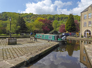
Hebden Bridge (96mi) Whichever route you choose, do stop in Hebden Bridge, an organic, sustainable, hippyish market town with two spectacularly good real ale pubs (the Fox & Goose and Stubbings Wharf). You can overnight here, but book in advance.
Anyone who can cycle up the cobbled bridleway out of Hebden deserves our undying respect. It leads to the postcard-perfect Heptonstall, after which the route splits: left to Burnley for 18 miles partly on a canal towpath, right for 10 miles over the moors. We’d strongly recommend the latter, a spectacular ride through isolated countryside.
Colne (116mi) They rejoin at Colne, a mill town where we encountered the clichéd but rather lovely spectacle of grubby urchins playing football on steep, cobbled streets. (Nearby Nelson is the home of Carradice, famed producers of saddlebags and panniers.) This is Lancashire, and proud of it.
The tangle of Colne, its busy roads and municipal parks, leads to Foulridge and the Leeds & Liverpool Canal. The route follows the canal towpath (beautifully upgraded) for five miles, then transfers onto lanes through green hills to Gargrave, but you could ride the whole way on the towpath unless you’re on a road bike.
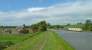
Gargrave (130mi) Spend a while in Gargrave itself, a lovely village with a famous cycling café (the Dalesman) and a superlative butchers: their pies and pasties could fortify you for the whole ride to Berwick.
As you enter the Yorkshire Dales, a false sense of security through the Aire Valley is shattered by the lung-busting climb that takes the route across to Settle. (It’s worse still in the other direction, with cobbles at Settle to sap your momentum.) It’s shared with the Way of the Roses, so you’ll probably meet cyclists coming the other way. Share a grimace, but don’t forget to enjoy the scenery.
Settle (141mi) Settle itself is a robust, welcoming town. Its local shops augmented by a branch of legendary local supermarket Booths, and it is, of course, the start of the famous Settle–Carlisle rural railway. Accommodation here is slightly pricey, and in high demand with cyclists on the Way of the Roses.
A gorgeous four-mile tour up the Ribble Valley gives way to rolling lanes with a distinct Dales character. The route originally followed a notorious cobbled, tunneled track between Austwick and Clapham, but a cycle track has now been provided along the parallel main road. Those with knobbly tyres and an appetite for bumps may want to consider the original route.
Clapham (150mi) Clapham and Ingleton are tourist-friendly Dales villages with cafés and shops for local-flavoured refreshments; Sustrans has long aspired to use more of the railway trackbed at Ingleton for the Pennine Cycleway, but to no avail so far.
The ride up Kingsdale is truly magnificent, taking you high into the hills between Whernside and the Biblical-sounding Gragareth – the highest point in Lancashire.
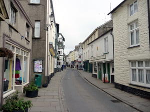
Sedbergh (172mi) Having crossed the watershed, it’s easy cycling along Dentdale to little Sedbergh, which as “England’s booktown” is seeking to emulate the success of Hay-on-Wye.
Three miles beyond, there’s a signposted link to Kendal, gateway to the Lake District, via the Walney 2 Wear cycle route. The West Coast Main Line railway station at Oxenholme makes this a useful halt if you can’t spare the time to do the route in one go. From here onwards, the route will be unremittingly wild and rural – just what you came for.
The next section might feel familiar to anyone who's driven the M6 – but what a difference. As traffic roars along the motorway, just a few hundred yards away at times, the Pennine Cycleway follows delightful lanes skirting the edge of the Lake District. The lane from Roundthwaite, past Tebay, is particularly enjoyable.
Appleby-in-Westmorland (199mi) After little Orton and its gourmet chocolate shop comes an exposed moorland ride where the winds can batter you if you’re unlucky. The steady haul eventually becomes a long, gentle descent to Appleby-in-Westmorland in the Eden valley, a friendly market town with a railway station on the Settle–Carlisle line. From here it's a gentle 20-mile meander along the valley as high crags loom up to the east; there's a bike-friendly Youth Hostel at Dufton, with a stack of Sustrans newsletters on the shelf and a good pub just down the road.
Melmerby (219mi) Melmerby’s famous Village Bakery gastro-café is an chance for the well-heeled cyclist to refresh and recover before the infamous ascent of Hartside. The highest point on the C2C, it’s perhaps a little less oppressive to those who’ve already conquered the Pennine Cycleway in the Peak District. The initial gradient is certainly a shock, but once you’re on the main road, you can slowly settle into the grind. There’s a greasy spoon café at the top, equally popular with cyclists, bikers and car-borne tourists.
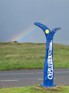
Hartside (227mi) The six-mile descent to sleepy Alston is greatly enjoyable (unless an easterly wind is blowing); don’t miss the right turn halfway down. Alston’s branch line railway was closed in the early 1980s, the last major closure in Britain, after the local road was snow-proofed. The southern section is now a preserved line; cyclists follow a lovely minor road on the north bank of the valley, where you might see red squirrels.
Slaggyford (239mi) After Slaggyford, the cycleway takes over, making a very pleasant railway path. There’s one brief interruption at Lambley, where a home-owner has refused to allow bikes through; exasperatingly, this requires a steep climb and prevents through passage over the impressive (Sustrans-owned) Lambley Viaduct. Is it unfair to hope they might move house?
Haltwhistle (249mi) Haltwhistle, with its butchers and supermarket, is an essential stop; there are precious few facilities in the next 25 miles. It’s a fairly anonymous ride as far as Bardon Mill, but from there you start climbing, past Hadrian’s Wall and the useful hostel and pub at Once Brewed. A few miles further on, the road gives out, with a lone cycle route sign urging you on into the wilderness.
It’s just under 20 miles between Once Brewed and Bellingham, and you’ll barely see a soul. The track through Wark Forest is wild, isolated, and glorious. The tarmac does return, but traffic doesn’t.
Bellingham (274mi) Tiny farmsteads punctuate the gated road until your final descent into Bellingham, a little oasis of a town where the few accommodation and eating opportunities seem like the big city.
There are two routes to choose from here. One is well-signposted, entirely on tarmac, gently undulating and pretty. The other is unsignposted, requires a phone call beforehand, partly surfaced with rough gravel… and it’s stunning.
The standard Pennine Cycleway, signposted NCN 68 as ever, follows Redesdale towards the perfectly picturesque village of Elsdon with its castle, tower house, and tea-rooms. The climb out is the only significant one on this braid before you reach Alwinton.
Alternative route: The upland route is much hillier, but unforgettable. It’s not signposted, so you’ll need to print this map before you go. You leave Bellingham on the Reivers Route (NCN 10) and National Byway, but part company at Lanehead, heading north. Tiny roads thread their way towards Redesdale Forest, slowly climbing all the while. A curious wooden signpost points the way to the remote Presbyterian chapel of Birdhope Craig, now closed. But we plunge into deep forest at Gibshiel, cresting the fell on a gravel forestry track before finally descending into the dale, where an awkward crossing via a campsite (you’ll need to lift your bike over the stile) gets you to the main road.
From here the route passes through Otterburn Ranges. To check the army isn’t shooting that day, consult the firing times calendar when planning your trip, and phone the MoD the day before (01830 520569) to double-check. A relentless climb (turning left near the top) brings you to the top of the Cheviots, half a mile from the Scottish border. But we’re not crossing over to Scotland yet; instead, the route descends through Upper Coquetdale in perhaps the most glorious ten miles of cycle route anywhere in Britain. Hyperbole? We don’t think so.
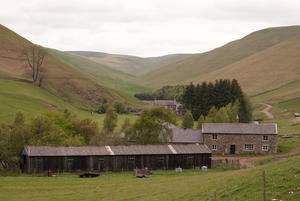
Alwinton (296mi) The Pennine Cycleway is at its muddiest over the next few miles. Unless you’re riding in a dry summer, consider taking an alternative route on the minor roads to the east, rejoining at Biddlestone or after Netherton. It’s an amiable, quiet ride though, with few settlements: little Powburn, just off the route, has B&Bs, pubs and stores. The Pennine Cycleway bypasses it using a footbridge between the confusingly named Branton and Brandon, damaged by floods but restored in 2010. We don’t recommend using the ford here.
But fords are very much the order of the day from here to Wooler. The others are cyclable in normal conditions, with little footbridges should you feel nervous.
Wooler (319mi) Very quiet roads alternate with farm tracks until the sleepy town of Wooler. This leg is a good choice for your final overnight stop before Berwick. From here, it’s a home run to Berwick. There are no more monster climbs, though the Pennine Cycleway still has a few sharp surprises in store.
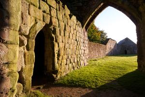
Etal (332mi) Almost all the route is on country lanes, with an enjoyable short burst of riverside path at Etal. Etal itself is a rambling estate with castle, pottery and an uncommonly good café, and makes an excellent lunch stop.
Norham (339mi) At Norham, the Pennine Cycleway meets NCN 1 (the North Sea Cycle Route) for the final 10 miles to Berwick – and promptly throws a nasty short hill at you, the edge of the Tweed valley. It’s worth it for the lovely river crossing at Union Bridge, though, the oldest suspension bridge to still carry road traffic. Here you cross into Scotland for a five-mile slog along a mildly busy B-road… but the end is in sight.
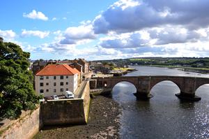
Berwick upon Tweed (350mi) Berwick railway station is the formal end of the route, with a Sustrans signpost pointing the way back to Derby, 350 miles away. But carry on into the town, ride out to the coast, and savour the achievement. You’ve conquered the ultimate challenge of the National Cycle Network.
Log in with your cycle.travel account:
| Password |
Or simply use your account on: