
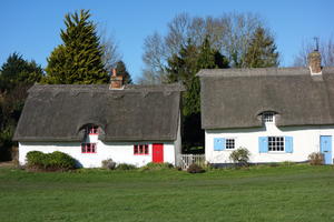
Cambridge We’ll admit it: we’ve cheated slightly here. The National Byway’s (incomplete) eastern route currently begins at an unremarkable crossroads near Saffron Walden, hardly a fitting start to your ride. So we’ll begin in the more auspicious surroundings of Cambridge, arguably Britain’s greatest cycling city. National Cycle Network route 11 leads south from the centre, past leafy Trumpington and along the ‘DNA path’ beside the rail line, to the village of Whittlesford… and it’s here that we pick up the National Byway.
The character of the route is established immediately. It’s not in a hurry to get anywhere, looping back and forth through villages which all conform to the same recipe: thatched cottages, church, pub. Barrington is probably the finest, with its wide village green. The route passes through the grounds of Wimpole Hall before a slightly more undulating section leads to prosperous Gamlingay and the Great Ouse valley at Tempsford.
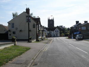
Tempsford (35mi) One look at the map might suggest that the National Byway really doesn‘t want to go through Bedford. Its extravagant, looping course is a tour of the hamlets and villages of Bedfordshire, none of any significant size: Sharnbrook, with a population of just over 2,000, is probably the biggest.
Most of the country roads round here are two-laners rather than little winding lanes, but the National Byway does a good job of picking out a few small routes here and there. The return to the Great Ouse valley just before Sharnbrook is particularly appealing, as are the quieter roads from Stevingdon to Stagsden. Take care at the crossings of the busy A6 and A428.
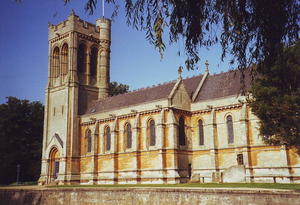
Marston Moretaine (76mi) The Marston Vale between Bedford and Milton Keynes is a slightly messy mix of old brickworks, modern industry and sprawling old villages. The National Cycle Network’s route 51 follows it faithfully into MK, but the National Byway, once again, chooses a less direct course on country lanes.
You wouldn’t think of Bedfordshire and Buckinghamshire as mountainous, but this section of route is surprisingly undulating. One minute you’ll be cycling through woodland next to Center Parcs Woburn Forest, the next you’ll be following a glorious open drive past Woburn Safari Park. Woburn itself is a delight, a prosperous Georgian town whose facilities (pubs, restaurants, shops) belie its tiny population.
You’ll also cross four great arteries of transport history: the M1 motorway after Steppingley, the Roman Watling Street at Little Brickhill, the Grand Union Canal at Soulbury Locks, and the West Coast Main Line railway just half a mile later. Of the four, the most appealing for a coffee break is unsurprisingly the Grand Union, and in particular the Three Locks pub. There’s another transport-themed café stop at Quainton, where the Buckinghamshire Railway Centre is open for coffee and cake even when the steam trains aren’t running.
Once again, the roads are rarely very quiet, but nor are they treacherously busy at any point.
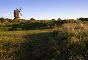
Waddesdon (109mi) One of the National Byway’s distinguishing features is that, as well as being an enjoyable ride in itself, it aims to take in places of historic interest. Waddesdon Manor is one of these, a National Trust property that looks like an escapee from the Loire valley in its sheer ostentatious style. Built for the Rothschild dynasty in the late 19th century, it could occupy a whole day’s visit if you’re so inclined.
The roads in this part of the world are a bit Audi-infested – sadly making it impractical to dawdle on the rolling hills between Waddesdon and Chearsley. It gets a little quieter after that, thankfully. The lovely village of Brill is reached after a steady climb, brick cottages clustered around an expansive village green. London’s Metropolitan Railway, amazingly, once had a steam-operated branch out to Brill in a brave attempt to expand their ‘Metroland’ commuter belt. Look out for the beautifully preserved windmill on the left as you leave the village.
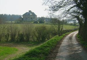
Otmoor (124mi) Until now the route has been signposted throughout. You may even have noticed National Byway offshoots at various points, a series of loops around the ancient Bernwood Forest. After Brill the signs stop for a while… but so do the hills as you descend to Otmoor, Oxfordshire’s wetlands. Crossing the M40, the fields become flatter and the pedalling gets easier. Keep an eye out for wildfowl over the road-free expanses to your left.
At first you follow the River Ray, then the Cherwell, a tributary of the Thames. Take care at the main road junction after Islip, where you’re briefly joined by fast traffic leaving the A34: there’s a narrow pavement here which may be more comfortable. Peace resumes soon after as you’re rejoined by NCN route 51 for the first time since Marston Moretaine. A short while after Hampton Poyle, consider taking the dead-end detour down to the ruined manor at Hampton Gay.
At Kirtlington, where the National Byway signs resume, the route takes a rutted road down to the Oxford Canal at Pigeon’s Lock. The narrow, winding path over the River Cherwell is perhaps easier when pushing your bike, but this is a lovely spot. A stony bridleway, one of the National Byway’s rare off-road excursions, leads up to Tackley railway station.
Soon come two of the loveliest lanes on this whole route. Shortly after you’ve crossed the busy A4260 and joined NCN route 5, a hilly lane peels off on the right passing through fields with barely a car to be seen. Then after a steep downhill into Kiddington and a climb up to the A44, a narrower still road skirts the grounds of Ditchley Park, Churchill’s wartime bolt-hole and now a centre where the great and good meet to discuss geopolitics.
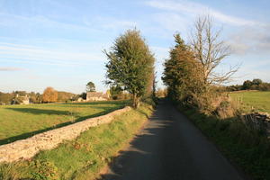
Charlbury (149mi) As the ‘Walkers and cyclists welcome’ signs inform you, Charlbury is where you enter the Cotswolds. A little town with a handful of pubs, cafés and a handy railway station, it’s invariably busy with cyclists in summer months. It’s also the home of cycle.travel, so wave at us as you pass by!
Leaving town past the railway station, it’s a steady climb to the remnants of the ancient Wychwood Forest on another delightful lane. The roads round here are quieter than earlier in the journey, often just the width of a single car. Stop off at Minster Lovell Hall, a ruined 15th century manor house by the banks of the River Windrush, before the narrow descent into idyllic Minster Lovell itself, all thatched cottages and riverside meadows.
From here the National Byway follows the Windrush valley for some ten miles, though with a few climbs as you head up the valley side and down again. Burford, one of the Cotswolds’ tourist meccas, is a pretty town built on a single hilly main street and pretty much a compulsory café stop. Many of the tours in Charles Pope’s lovely book A Golden Age of Cycling, an account of the author’s rides from 1924 to 1933, started in Burford.
More lovely lanes take you gently up the valley to Gloucestershire and the National Trust-run country estate of Sherborne Park. There’s a short, stiff climb into Farmington but otherwise this is easy, unhurried cycling.
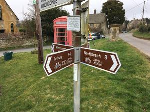
Northleach (173mi) The coming of the bypass was a mixed blessing for the little market town of Northleach. The A40 traffic from Oxford to Gloucester no longer thunders through the town or belches out fumes at the traffic lights. But the publicans and shopkeepers of the town could no longer rely on a steady stream of customers, and for a while the Market Place looked rather forlorn. It’s now taken on the air of a sleepy but charming backwater, with a couple of cafés and pubs now serving more cyclists and walkers than passing truckers.
One of these cafes is the Old Prison on the edge of town, also the headquarters of the Cotswold Conservation Board – the body that looks after this special area. (The route signs in this area were funded by the Conservation Board, making it the most recent part of the National Byway to open.) There’s a short bit on the grim A429 to endure before turning left onto a single-track gated lane through the village of Hampnett.
From here we’re in the high Cotswolds of Gloucestershire, a very different feel to the Evenlode and Windrush valleys of Oxfordshire. The lanes are still narrow and quiet, the views over the rolling wolds often outstanding. There’s more climbing to be done, yes, but with that comes more descending. One particularly enjoyable descent is into the village of Brockhampton, a cycle route crossroads where the Cotswold Cycleway (and another branch of the National Byway) crosses our route. The Craven Arms pub here was excellent but at the time of writing (2023) has an uncertain future.
Then comes the best descent of all, from the edge of the Cotswold escarpment down into Winchcombe. Superb Cotswold views on the higher slopes give way to woodland as you plunge downhill at inclines up to 17%.
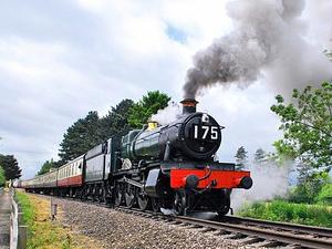
Winchcombe (185mi) Winchcombe is one of those towns that deserves to be better known… but you’re secretly glad it isn’t. A bustling market town at the foot of the Cotswolds, it has plenty of tourist attractions (Sudeley Castle, the Gloucestershire & Warwickshire Steam Railway, cafés and restaurants) yet has somehow conspired not to be overrun with coach parties. In recent years it’s made a name for itself as a walking destination, but you’ll see plenty of cyclists here too – especially if you arrive on the first Sunday of September, when it hosts the notorious Hell of the North Cotswolds off-road event.
A moderately busy road skirts the edge of the hills westwards towards Tewkesbury, closely following the course of the steam railway. Keep an ear out for the whistles that announce the coming of a train, particularly at summer weekends. It’s not the only vintage transport you’ll see hereabouts. The hamlet of Prescott is the location of a famous motorsport hill climb, while Stanley Pontlarge was the home of LTC (Tom) Rolt, responsible for founding both the canal and railway preservation movements in the years after WW2.
After Gotherington the roads get quieter again. The National Byway is signed towards Tewkesbury at Tredington, but we carry straight on along a currently unsigned section through the Severn Vale. After a brief spell on the busy A38 which, oddly, has a prominent painted cycle lane, the National Byway takes another excursion to a historic site – or two. Deerhurst has both an 8th century church and the 11th century Odda’s Chapel, just a few yards from the River Severn.
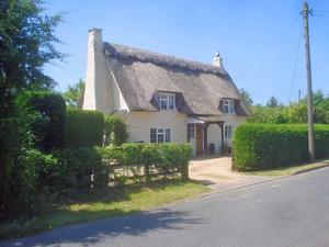
Haw Bridge (202mi) The 1960s Haw Bridge takes the B4213 over the semi-tidal River Severn. Sadly both pubs here have closed – a sunny afternoon pint at the Haw Bridge watching the boats go by used to be a pleasant interlude on a long ride.
There’s a veritable tangle of signposted cycle routes between here and Ledbury, and justly so: this is excellent cycling country. The National Byway isn’t signposted throughout. Instead, start by turning left along NCN route 45 to Ashleworth (location of another closed riverside pub) and Hartpury, then dogleg over the busy A417 to Corsend Road. At a T- junction one mile on, you join the Newent Cycling Loop, a 28-mile circuit devised by local cyclists to follow quiet lanes in this peaceful corner of Gloucestershire. You could follow this either clockwise through Newent or anti-clockwise towards Redmarley. We’ve chosen the latter simply because you’ll pick up the National Byway signs again quicker, but the whole loop is worth riding.
To add extra confusion, the National Byway has its own loop route which intersects with the Newent route. Follow the main Byway to Dymock, best known for a brief flurry of poetry before the First World War: Edward Thomas, Rupert Brooke and Robert Frost were all regulars here. Keep an eye out for traces of the old Hereford & Gloucester Canal and the now-closed railway that replaced it. More lanes take you through cider apple orchards to Ledbury.
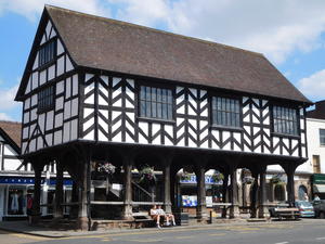
Ledbury (219mi) A path along the old railway route takes you into Ledbury town centre. Ledbury is one of those towns that regularly makes an appearance in newspaper lists of the ‘Best Places to Live’, and its High Street of half-timbered buildings, independent shops, interesting pubs and cafés more than merits it. (There’s even an Italian-tinged backstreet cycle shop, Cycles Clements.) The Cotswold railway line, which we last saw in Charlbury, towers above the town on an imposing viaduct.
We’ve barely been troubled by hills since descending from the Cotswolds at Winchcombe, but you wouldn’t expect to cycle the Welsh borders without climbing, and the route duly delivers. The first climb is into the interesting hillside village of Wellington Heath, a collection of houses from ancient to modern scattered across the steep slopes of this Malvern outcrop, with a CAMRA-garlanded pub hidden away among them. Descending to Bosbury, take a detour into the village to visit the church with its unusual separate bell tower.
The ever narrower lanes thread themselves through the contours, briefly summiting at Fromes Hill – a pub and little else. This is cider country on the lower slopes, sheep grazing in the uplands. An undulating climb towards Pencombe leads to a glorious protracted descent towards the Lugg Valley, with the twists of the road unveiling a new vista at every turn.
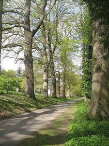
Leominster (244mi) The most down-to-earth of the three border Ls (Ledbury, Leominster, Ludlow), Leominster is nonetheless beginning to rub shoulders with the others in the ‘Best Places to Live’ lists. It’s an important regional centre for this agricultural area, and the town centre mixes everyday chain stores and the obligatory Wetherspoons with local craft shops and antique dealers. The one-way system isn’t conducive to cycling, but it’s worth dismounting for the High Street rather than following the signposted route that misses it out. There’s a railway station here if you want to finish your ride at this point.
For a short while the terrain gets easier as you ride out along the Kenwater valley… but don’t be fooled. You get another stamp on your National Trust card at Croft Castle, an 18th century country house on the site of an 11th century castle. Fuel up here, or at the pub or community café in Yarpole, because it’s here that the hills begin again. The road from Orleton into the woodland above hits 13% at times. It’s the sort of ‘lost lane’ cycling that makes you glad to be on a bike, and you’ll be unlucky to see another car. But bring your climbing legs. (The crucial left turn sign at the top of the hill, where the National Byway splits with another branch going to Ludlow, has been missing for at least 14 years: check cycle.travel’s map on your phone or GPS before you expend any needless energy!)
Another castle, the ruins at Wigmore, marks the start of the tough final section. Between here and Presteigne there are three climbs and two dips. The last climb is up the aptly named Hell Peak, and your legs will feel it even if the bucolic Herefordshire countryside seems a long way from the fires of hell. But then a two-mile descent takes you into Wales and the quiet border town of Presteigne, and everything is all right with the world.
Presteigne (269mi) Presteigne is on the Radnor Ring circular route, signposted as NCN 825 but also once mooted as part of the National Byway – indeed, there are still a few Byway signs on the route either side of Presteigne.
Not many people choose to follow these brown signs for their cycling holidays. The National Byway has been described as cycle touring’s best-kept secret, and if that was true 20 years ago when the route was in its infancy, it’s certainly true now. But its little-frequented lanes and looping course represent the best of rural riding, and perhaps this route will inspire you to try a few of its other branches.
Log in with your cycle.travel account:
| Password |
Or simply use your account on: