
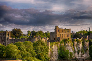
Chepstow For the first 50 miles of this route, we follow Lôn Las Cymru’s alternate ‘braid’ – quiet lanes from Chepstow towards Hay-on-Wye, signposted as NCN 42 and an alternative to the Taff Trail up the Valleys from Cardiff. You could start anywhere in Chepstow, but the best bit is the old town down by the river, dominated by Chepstow Castle. For centuries, the castle was a crucial bridgehead for the Normans’ control of Wales. There are several supermarkets here if you need to stock up on provisions.
We did say that this is a hilly route, and this is apparent from mile 1. The most direct way out of the town is up Mounton Road, but with 10%+ gradients, it’s a tough way to start. NCN 42 is signposted along a more winding course around residential areas that takes the climb more gently.
There’s one more tough climb out of the hamlet of Mounton (after a rather incongruous rural roundabout). The route then settles into a steady climb cresting the watershed between the Wye and Usk valleys. The descent to the Usk at Llanllowell is suitably enjoyable, but consider breaking your freewheeling for a bite to eat at the Greyhound Inn.
Usk (15mi) There’s a lot to Usk, a town of just 3,000 inhabitants. Most of it postdates 1403, because that was when Owain Glyndwr torched the town as part of the great Welsh Revolt. Two years later, his forces were routed at the Battle of Pwll Melyn, just to the north – arguably the turning point in his rebellion.
Usk is a rather more sedate place these days and we’ve never encountered a torching at the Nags Head, though this old timbered pub would probably catch light quickly if you tried. The castle is privately owned and endearingly tumbledown. All the riding around here is on-road, but the old railway tunnel and bridge across the Usk have been proposed as a cycle route, and work is underway on converting the trackbed to Cwmbran to cycle use.
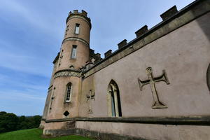
Heading north, the route stays close to the River Usk for a while, with a gradual climb before you reach the 18th century folly of Clytha Castle. It’s harder going after crossing the A40, particularly the taxing climb out of Llandewi Rhydderch. Narrow, hedge-lined lanes take you to the edge of Abergavenny.
Abergavenny (29mi) You don’t have to visit Abergavenny if you’re pushed for time; you can save a couple of miles, and 60m of climbing, by taking NCN 46 north from the white cycle route signpost before you reach the town, then crossing over to NCN 42 again from a T-junction one mile on.
The bustling town is making a name for itself as a foodie destination, with an annual festival (mid-September) showing the best of local chefs and producers. Abergavenny was comprehensively flambéed in 1404 by (you guessed it) Owain Glyndwr; later in the year his bastard son declared independence, not for Wales, but for Abergavenny itself.
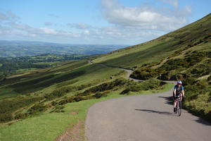
There’s also an annual cycling festival, majoring on road racing. The finest road route out of Abergavenny is up the Vale of Ewyas, and when we say “up”, we mean it. This is the road to the Gospel Pass, the highest paved road in Wales. The gradient is gentle at first, passing the fine ruin of Llanthony Priory. You can stop for a coffee in the abbey buildings, though we’re fonder of the Half Moon Inn half a mile on.
Following the River Honddu up the valley, the road gets progressively narrower and steeper, especially after the hamlet of Capel-y-Ffin (site of a much missed youth hostel). The hardest section is a mile beyond Capel-y-Ffin, touching 15% at times. But we challenge anyone to say it’s not worth it. As you crest the pass, the Wye Valley opens out before you, with views for miles on a clear day.
You can continue downhill to Hay-on-Wye, or take the first left for a shortcut to Glasbury. Hay Castle, in the centre of the town, was successively burned and captured by the English and Welsh between the 13th and 15th centuries. More recently it served as the seat of the eccentric impresario Richard Booth, under whose ‘kingship’ Hay became a world-famous, bohemian booktown. Don’t load up your panniers with books, though… you’ll want to keep them light for the climbs ahead.
Glasbury (53mi) A few miles outside Hay, Glasbury is a small village with pubs, accommodation and an all-important crossing of the River Wye. There was a battle here in 1056, when Gruffudd ap Llywellyn – the only king ever to rule over Wales as one independent country – destroyed an English force led by the warlike Bishop of Hereford.
We join NCN 8 here, the main route of Lôn Las Cymru, for 11 miles along the Wye Valley. At times you might find the lane unusually flat, even for a valley road. That’s because parts of it reuse the trackbed of the Mid-Wales Railway, closed in 1962. The route follows it past Erwood, where the station has been rebuilt as an art gallery and visitor centre.
Aberedw had a 12th century castle, whose ruin survived until the railway navvies repurposed the walls as ballast. Here we leave NCN 8 to turn up a tiny lane, passing the community-owned Seven Stars Inn, along the narrow Edw valley. The river and the road intertwine, crisscrossing on bridges where there’s room. Eventually, the valley sides become so steep that the lane has no option other than to climb. We dip down again to Cregrina – whose non-conformist chapel, the Free Mission, still maintains weekly services – before turning left at the end of the road to join NCN route 825, the Radnor Ring.
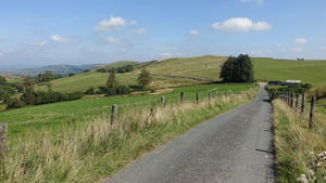
Hundred House (71mi) This tiny settlement, named after the drovers’ inn (still going today), marks a change in the route. The Usk, Honddu, Wye and Edw valleys have been lush, verdant corridors, often quiet but rarely isolated. Here, it feels like we’re setting out into the unknown, following single-track roads over moorland and past isolated farmsteads. You’ll see fewer cars and fewer cyclists, but often wider, more expansive views.
The climb from Bettws Disserth tops out at a sharp right-hand bend, where the road joins an ancient trackway over the hills. Here the landscape opens up before you, and you dive into it with an exhilarating descent. The Radnor Ring heads west to Llandrindod here, but we take the next lane, smaller still, towards the busy road junction at Crossgates.
The A483 at Crossgates is not cycle-friendly, but there’s a footpath on the far side of the road which you could informally use to reach the roundabout. Should you need fuelling, there’s a bikers’ café at the petrol station a few yards to the east on the A44. Otherwise, continue up the A483 for another mile (again, using the pavement while it’s there) before turning left towards Abbeycwmhir.
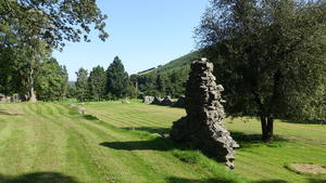
Abbeycwmhir (86mi) After four miles of easy cycling along a rolling valley road, Abbeycwmhir comes as a great surprise. This quiet hamlet is the site of a 12th century abbey, its nave intended to be longer than Canterbury Cathedral though never completed. Though only ruins survive, the altar is still venerated by Welsh nationalists as the burial place of Llywelyn ap Gruffudd – the “last Prince of Wales” – and you may see flags draped over it.
After Llywelyn’s defeat in the late 13th century, the abbey was burned in Owain Glyndwr’s rebellion, desecrated during the dissolution of the monasteries, and its stones purloined in the centuries after. Yet the stillness and peace endure, and it’s hard not to be moved standing in this ancient place. Look out also for the 1830s pile of Abbeycwmhir Hall, and for the Happy Union pub, open only in the evenings (after 8pm) but absolutely unspoilt.
The climb up the valley of the Clywedog Brook begins gently, sharpening suddenly before Bwlch y Sarnau. Smaller still than Abbeycwmhir, it has a community-run café serving walkers on Glyndwr’s Way – and cyclists. The placename means “Gap of the Causeways”, perhaps referring to a Roman road. Still more intriguing is the road we take out, Llwybr y Gath – “Route of the Cat”, a road of incessant undulations and fine views to every side. A long descent with sweeping curves is guaranteed to put a smile on your face.
At a sharp bend to the right, with two dead-end turns to the left, you have two options. Road bikes should continue along the twisting hillside road, which eventually comes out on the busy A483. Follow this for a mile until you reach a left turn signposted to Pentre, an open-sided lane heading up through pasture towards wind turbines ahead.
Gravel bikes can choose an adventurous alternative. Take the second of the two dead-end turns, which climbs steeply to a farmyard. Continue past the end of the road onto a track, where you’ll see traces of tarmac below. A sharp left turn takes you onto an overgrown green lane uphill, densely green but rideable in dry weather. Eventually, this becomes a field-edge byway, with progress regularly interrupted by gates, as you head for an old railway carriage. The final stage is fresh gravel before you emerge onto a minor road; a right-then-left reunites you with the road route.
One final short climb, and it’s downhill from here. A thrilling descent takes you through the hamlet of Stepaside towards Newtown. After the stark moorland above Bwlch-y-Sarnau, the welcoming, verdant slopes of the Severn valley are a scenic contrast and set the scene for some easier cycling ahead.
Newtown (105mi) Now that Newtown has a bypass, you can stay on the old main road into the town rather than the unnecessary hill through the Trehafren estate. Arguably the least glamorous of the mid-Wales towns, Newtown is still a useful overnight stop, and has a couple of good pubs – the Sportsman and the Railway Tavern being our favourites.
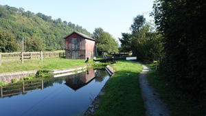
After the exertions of Bwlch-y-Sarnau, you can take a breather now. The route from Newtown to Welshpool follows the towpath of the Montgomery Canal, narrow but generally in good condition with a compacted limestone surface suitable for road bikes. Closed in the 1940s, the canal has been undergoing restoration by volunteers for many years now.
Further north there have been remarkable successes, but the old course is comprehensively built over close to Newtown, and these first few miles are likely to remain a cycleway for the foreseeable future. As you pass Abermule the canal is back in (shallow) water, and mile by mile it becomes more like a navigable waterway, with several of the locks back in working order. Dolforwyn Castle, a short way above the canal at Abermule, was Llywelyn ap Gruffudd’s local redoubt, much to the chagrin of Edward I; Powis Castle, further along the canal, is now a fine country house but it, too, was built in late medieval times for the Welsh princes.
Back on the towpath, the ever-present A483 callously bulldozed the canal’s course as they intertwine along the west side of the Severn. Bringing boats back will require seriously expensive highway engineering – and you rather suspect humpback bridges won’t be permitted these days. After Aberriw/Berriew the waterway is formally navigable through to Welshpool, though you’re more likely to see paddleboards here than narrowboats.
Welshpool (119mi) Enjoyed your respite? Good… the climbing begins again at Welshpool. First, do stroll along the endearing High Street, a practical mix of independent shops and everyday chain stores. We fuelled up here with filling snacks from Rikki Lloyd’s famous butchers and coffee from Coco’s.
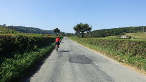
The valley floors are monopolised by busy main roads, so it’s over the hills we go. Narrow lanes cross from ridge to ridge, eventually coming to rest in the Vyrnwy valley and the (not too busy) A495.
For those in search of a tough challenge, you can turn here towards Pontrobert, from where a truly beastly climb takes you 200m up to Llanfihangel yng Ngwynfa. It would be great on an e-bike, but if you’re reliant on pedal power, we’d suggest the more gradual ascent along the B4382 – really just a slightly wider country lane. After Dolanog we turn onto narrow roads which are trying their level best to follow the course of the Vyrnwy, though sadly the topology isn’t as forgiving as it could be. There’s an unexpected village store at Llwydiarth/Pont Llogel for refreshments. From here the little riverside road is particularly fine, gradually gaining height as the Vyrnwy twists and turns below.
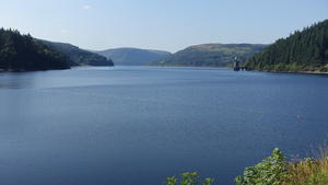
Lake Vyrnwy (141mi) Built in the 1880s to supply Liverpool with fresh water, Lake Vyrnwy is today a popular day-trip destination. The road across the dam is a good-hearted mêlée of walkers, camper vans, bikers and cyclists all tentatively edging past each other. There are two cafés at the far end: stop here for a snack and a water bottle refill.
There’s a road all the way round the reservoir. Most traffic goes anti-clockwise, so by following the south side (clockwise) you’re less likely to have camper vans constantly on your tail. Waterfalls from the steep wooded hillside plunge into the lake while bats dart to and fro; all this and the road is, of course, blissfully flat.
This interlude lasts as long as the left turn up the Eunant valley. This tiny lane heads for Bwlch y Groes, at 546m (1788ft) the second highest pass in Wales after the Gospel Pass. The first mile and a half is undeniably tough, an uneven gradient with short, sharp ramps that reward standing on the pedals. These lift you by 150m, after which the little-trafficed, narrow road flattens out for two enormously enjoyable miles.
After passing the stone marking the boundary of the Snowdonia National Park, the road meets the fearsomely steep ascent from Dinas Mawddwy. Our right turn, too, is steep at first (~18%) but soon becomes a little more realistic, and you should be able to ride up to the summit.
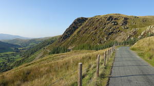
Bwlch-y-Groes (150mi) You’ve doubtless seen those car adverts where a new coupé speeds down an impossibly narrow road along an Alpine hillside. This is the closest you’ll get in the British Isles – but it’s so much more enjoyable on a bike. A sinuous descent etched into the slopes of Moel y Cerrig Duon, it’s protected with fence posts at first, then a sturdier crash barrier as the drop becomes sharper. Though rarely too steep to be hair-raising, the narrow road does attract a little traffic at weekends, so keep an eye out for approaching vehicles.
At the foot of the hill, we join a quiet B road around Llyn Tegid (Lake Bala). An entirely natural lake, unlike Lake Vyrnwy, it’s long been a tourist draw, but particularly since the narrow-gauge Bala Lake Railway was built on the trackbed of the old Bala–Dolgellau railway (closed 1968). You’d think a road along a lakeside and a railway would be flat, but in fact the B4403 perpetually bounces up and down over the streams that flow down from the hillsides. We turn left at the end of the lake, crossing the River Dee, to follow Heol Tegid into Bala town centre.
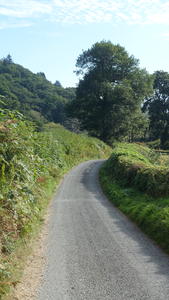
Bala (160mi) For a town of under 2,000 inhabitants and, really, just one main street, there’s a lot in Bala. It’s a predominantly Welsh-language settlement with a long history of serving travellers, with several hotels to choose from. Though once an important railway junction, the closures of the 1960s did for both of its lines… dare we say that the trackbed to Trawsfynydd and Ffestiniog would make a magnificent cycleway? One day perhaps.
Another railway headed to Corwen, and it’s in that direction that we’re headed – at first on the busy A494, but after a while on a lovely valley lane, signposted after Llandderfl as local cycle route 16. This is the Dee valley, already a sizeable river though a long way from the wide waters that flow through Chester. Just before Cynwyd we cross first the river, then the old railway; the trackbed is walkable from here to Corwen and is proposed to become a cycle path. Until then, we join the traffic on the B4401 into Corwen.
Corwen (173mi) On the entrance to Corwen, turn right at the 30mph sign onto a residential road (Pen y Bryn) to avoid the traffic on the A5. Corwen’s recent fortunes are closely tied up with this, the old road from London to Holyhead; it grew prosperous from travellers staying at coaching inns, but now the faster, more reliable cars simply continue without stopping, and Corwen is left with a traffic problem and some fine, but underused, old buildings.
Owain Glyndwr’s rebellion began when he was proclaimed Prince of Wales here in 1400; there’s a statue of him atop his horse, imperiously looking at the English returning from their holidays along the A5. Turn left here for a road that passes the Llangollen Railway’s terminus station to cross the Dee again.
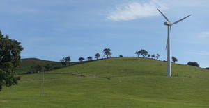
After rounding the Ifor Williams Trailers plant, we head out on narrow lanes once again, climbing past windfarms into an area that seems little explored even by cyclists. The descent into the Clwyd valley eventually brings us out at Pont Eyarth, where we’ve chosen a slightly circuitous approach to Ruthin to avoid the two fast A roads.
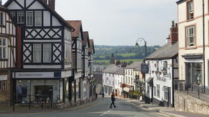
Ruthin (186mi) Ruthin is a delight, an unspoilt market town that rambles down the hillside in every direction. Its historic buildings now house shops, cafés and B&Bs – and pubs, though fewer than when it was said to have “a pub for every week of the year”. Once again, the town was burned to the ground by Owain Glyndwr in 1400, though the castle survived. Ruthin Castle in turn was demolished during the Civil War, and its walls are now incorporated into a hotel.
A roadside cycleway provides a safe if unexciting passage to Rhewl, from where a winding lane takes us along the Vale of Clwyd. Turn back towards the main road at Llanrhaeadr, from where a hilly lane, ducking down to cross the Afon Ystrad on a rough stone bridge, leads to Denbigh Castle.
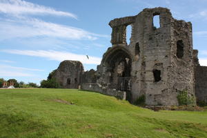
Denbigh (194mi) Denbigh is more workaday, less tourist-friendly than Ruthin. It has the better castle, though, the centre of English control over this contested region. Like Ruthin it suffered in the Civil War, but more survives today, in particular the imposing gatehouse. Step away from the High Street and its charity shops, and there are some interesting buildings on the back streets, not just around the castle but on Back Row too.
Cycle route proposals have been repeatedly rejected in Denbigh, and there’s no great route out of the town. The B road to Henllan is tolerable, though, and from there things get much better as we follow a discreetly signposted local cycle route. The intriguingly named Lon Jack-Ffrwn descends sharply down a wooded hillside before settling into the Elwy valley, just for a moment. Then it’s back up an almost hairpinned road to Cefn Meiriadog, crossing the toe of a ridge for the last significant climb of our entire ride.
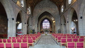
St Asaph (202mi) Bright lights, big city. St Asaph is the only city on our route, which might come as some surprise given that it has a population just north of 3,000 and a handful of pubs and cafés. It does have a cathedral, but so does Brecon, which is a town. At any rate, the fine cathedral is worth climbing the hill for.
Thread your way through the back streets to the riverside cycle route. From here to Rhyl, the route is mostly traffic-free, a Sustrans path with scenic high and low lights in equal measure. The lowlight is the section along the A525 dual carriageway, perfectly safe but rather grey and uninspiring. It gets better when it dives off through a nature reserve towards Rhuddlan, where a pedestrian bridge carries you to the east bank of the Clwyd.
Rhuddlan was once the capital of the Welsh kingdom of Gwynedd; its 13th century castle, proud on the riverside, was built by Edward I to pacify the region under English control. From here, the cycle path follows the tidal Clwyd. All mudflats and wildfowl at low tide, it gives a real coastal feel to the final miles of the route.
Rhyl (207mi) The approach to Rhyl could be more scenic, admittedly. NCN 84 dodges past caravan parks and into residential areas before reaching the North Wales Coast railway; the signposts now send you along back streets to cross the line on a road bridge, but you can push your bike over the footbridge for a more direct route.
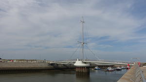
Rhyl/Foryd Harbour is now a pleasure boat marina, crossed by the spectacular Pont y Ddraig (Dragon Bridge). This new cycle and pedestrian bridge, part of Sustrans’ Connect2 project, lifts to allow boats into the harbour. There’s a friendly café on the far side which makes a fitting end to your route – or you can continue east along the traffic-free promenade to the cheerful charms of Rhyl’s seafront.
Log in with your cycle.travel account:
| Password |
Or simply use your account on: