
Become a supporter
Hi Richard,
For this route - https://cycle.travel/map/journey/760248 , why does it changes completely the tour, making it longer, when I select "paved"?
Also, when "paved" is select, it is impossible to make it going on the route I want (like drawn), even though there is no unpaved segments there.
Regards,
Miguel Anjo
Hi,
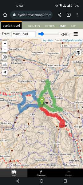
I've create a small city route - https://cycle.travel/map/journey/455353 - which I take often and was what cycle.travel proposed some months ago.
Now the bridge seems to be marked at river altitude and because of steepness, it does not propose anymore this route. Is this something you can do about or is something missing/wrong on the OSM base data?
cheers
Miguel Anjo
Hi,
I enjoy the route suggestion feature, but it is impossible to chose the blue alternative, it is not clickable. Can you check?
Hi Richard,
Found a small bug, when switching to direct route between two way points and then moving something in between.
Image you have way points 1-2-3-4, click on way point 2 and say to be direct to 3. It will create a direct line between 2 and 3. If now I click and move the direct line, to create an extra way point in between, it will create way point 4, starting from 3.
Correct would be to create way point 3, and increment by one all the others.
cheers
Miguel Anjo


Made in the Cotswolds. Published by Éditions Système D Ltd.
Log in with your cycle.travel account:
| Password |
Or simply use your account on:
