
Become a supporter
Hello,
I created a route, named ChrisDeg https://cycle.travel/map/journey/745630 using the website to get me from Chester to Deganwy (to avoid the climb over Holywell). The route directed me along a fairly busy dual carriageway at Ffynnongroyw, just over 37km into the ride, however I opted to take a much quieter road through the village. Just wondering if cycle.travel considers the dual carriageway a better option than the road through the village?
Background: The first leg of our LEJOG ride (which we completed when Covid restrictions, favourable weather and a house move allowed) ended in South Wales, just outside Cardiff. The second leg started at the same point a year later and picked up the Taff Trail just outside Pontypridd. I used my tried and trusted method of using Cycle Travel to plot a route from start to finish, with a few via points to mark overnight stops. This followed the recognised Lon Las Cymru route for most, but not all of the way.
Day 1: the ride becomes much more pleasant once the industrial estates of Treforest are left behind and great surfaces are encountered on the route through the valley to Merthyr Tydfil, which is for the most part traffic free. The climbing to Pontsticill starts after Merthyr, though it is quite gentle at first. After the reservoir there’s a descent all the way to the Usk valley. Cycle Travel took us down the paved road and in hindsight this was not the best option for us, as a fully loaded tandem requires serious braking, and we had to stop just after the steepest section to allow the wheel rims to cool down. I don’t think we were that far from a blowout! Interestingly, if this route is plotted in reverse, the ascent takes you up along the eastern side of Talybont Reservoir, which would have been a better option for our descent. We then had some ups and downs until we got to our campsite at Glasbury. We were well fed at the Harp Inn and needed the sustenance after Strava informed me that we climbed 1039m.
Day 2: the weather was still kind to us as we set off for Llanidloes, first making our way to the market town of Builth Wells on the backroads from Glasbury. We encountered the most challenging surface, an uneven forest track, on a section between Newbridge on Wye and Llanwrthwl, and if I did this ride again I’d probably risk the taking the A470 to avoid this. We’d just finished this section and passed two cyclists with skinny tyred road bikes about to head up to this track. We camped at Dol Llys farm and had a great nights sleep after what turned out to be the greatest elevation gain for the entire LEJOG ride (1212m over 80km, according to Strava).
Day 3: the climbing started almost immediately as we had to grind our way past Llyn Clywedog (we were lucky enough to see the ospreys, who have been raising chicks there for a number of years) up to the top of the Plynlimon range. The cross wind was very strong at this point and horizontal hail on your cheeks was not pleasant. After descending to Machynlleth we wimped out of the official route, which would have included a significant climb, and stuck to the A493 all the way to our campsite in Fairbourne.
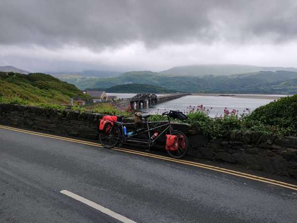
Day 4: the forecast for rain proved to be accurate though we did manage to pack a dry tent which is always a bonus on trips like this. We joined the A496 just after Barmouth and followed this, with a few short detours onto quieter sections, to just south of Harlech and then wound our way down to Porthmadoc, after which we were directed onto the wonderful Lon Eifion cycle path all the way to Caernarfon. Our initial plan was to camp near Caernarfon but given the damp conditions we decided to have an extended day which would enable us to reach home just beyond Conwy. This took us along the Menai Straits on NCN8 to the outskirts of Bangor then onto NCN5 along the North Wales coast to home. This was a great option for the second stage of our LEJOG trip and it was now time to plan stage 3!
Having just completed the Hebridean Way and part of the Great Glen Way I thought I'd add my comments. The idea for the trip came when my wife and I were on the final stages of our LEJOG journey last year, in the north of Scotland, admiring the pristine beaches near Bettyhill. We were told that the Hebridean beaches were even better and with that, the Hebridean Way was filed as one for later. When our calendars aligned, and the weather forecast was generally favourable, we decided to postpone a trip to the Peak District and head north, tagging on a section of the Great Glen Way to extend the trip by a couple of days.
Planning: on a multi-day journey I will usually use CT to create a route from A to B then divide this into manageable daily sections of about 50 miles, which we find is about right for a self supported trip on our tandem. This method does not work too well in the Hebrides as the ferry timetable and location of camp sites influenced our daily distances and routing. The Hebridean Way itself is well signposted and made our GPS, loaded with CT routes, largely redundant, but I opted to use it anyway.
Getting there: from our home in North Wales we travelled by train to Oban, via Warrington Bank Quay and Glasgow. Having to deal with three train operators to book tickets and make cycle reservations was very time consuming, but worth the effort as the journey went smoothly and we arrived in Oban mid afternoon, though this was too late to catch the daily ferry to Barra. Having a tandem with S&S couplings allows us to separate the bike into two, which makes storage on the train so much easier. We camped just outside Oban and caught the ferry to Barra the next day. The trip was largely uneventful but we were entertained by dolphins which appeared alongside the ferry and also sighted what could have been minke whales and basking sharks.
The Hebridean Way: after disembarking at Castlebay on Barra, we turned left at the top of the slip way and headed to the Co-op store to get some supplies. Then it was up and over to Vatersay for the obligatory pictures at the sign which marked the start of the Hebridean Way, near the northern point of the beach. The 12% incline soon after the Co-op was a bit of a shock to the legs after sitting on the ferry for about 4 hours but we managed the climb without too much grumbling. We retraced our route back towards the Castlebay turn off and then turned to traverse the west coast of the island to the Wavecrest Campsite which was our base for the night. The following morning we had a short ride to catch the 0925 ferry for the hop to Eriskay. Most of Barra consisted of gentle rolling hills and, other than the steep climb out of the port, Eriskay was very forgiving and we made good progress to our campsite for the night in Carinish. We then had an early start to get to Beneray for our 0925 ferry Leverburgh on Harris. The best views of the trip were found on the west coast of Harris and we were helped by a kind wind which gave us some assistance on the climb before our final destination of the day, Tarbet.

The Tarbet to Stornoway section had the most climbing and by now the legs were starting to feel a little tired.

The initial plan was to set up base camp in Stornoway then have a day return to the Butt of Lewis to complete the ride, but given the horrible forecast, we decided to have a rest day in Stornoway before leaving for the mainland. The weather in Stornoway did turn out to be pretty grim and after hearing stories about constant headwinds from other cyclists who went all the way to the Butt, we certainly didn’t regret our decision to have a day off from cycling.
Getting back: we had an early departure from Stornoway and caught the ferry to Ullapool, arriving about 1000. Then it was a surprisingly pleasant ride on the A835 for the next 64km. CT had guided us off the main road onto a couple of forest tracks however as the main road was fairly quiet, we decided to stick to tarmac en route to our Inverness campsite. The following day we had a gruelling ride to Fort William which started with riding into a headwind, making the climb up General Wade's military road towards Fort Augustus a bit of a slog. After leaving Fort Augustus, there was a temporary diversion to avoid the forestry harvesting just south of Cullochy Lock, where we opted to join the dreaded A82 instead of what looked like a hiking trail through the woods until North Lagan (we must have timed it well as this stretch wasn't too bad). Further south, a new stretch of NCN78 replaces the original route to avoid some ground works for a hydro electric project (the CT route directed us along the old route through the ground works, so I guess the OSM base map hasn't been updated when I created the route a few days before the trip). Both of these diversions are mentioned on the Sustrans website but of course I only found this information once we returned home. The headwind persisted throughout the day making the last few miles riding along the canal paths near Fort William sluggish. Return train tickets and reservations for the tandem had been sorted before we left home, and we were really well looked after by Scotrail from Fort William to Glasgow, where an almost entire carriage was set aside for bike storage, and we didn't even have to decouple the frame! Oh what luxury!

The 2 hour wait in Glasgow passed quickly and we managed to squeeze ourselves onto the very busy commuter train from Warrington Bank Quay to North Wales.
Conclusion: this was a great trip that was easy to plan, with some great cycling on quiet roads. I would thoroughly recommend it!


Made in the Cotswolds. Published by Éditions Système D Ltd.
Log in with your cycle.travel account:
| Password |
Or simply use your account on:
