
Become a supporter
Bom dia,
I live in the Douro region of Portugal, and one of my side projects/hobbies/passtimes is to keep OSM up to date with relevant details for bicyclists. I've recently started using cycle.travel for route planning and nav after seeing a recommendation on Mastodon , and find it pretty brilliant.
I ride a touring/gravel bike, and we have many trails here for which it is appropriate. However we _also_ have many trails which might look appropriate at first glance, but quickly become highly technical and only appropriate for either ATVs or advanced BTT/mountain riders. Understandably OSM often doesn't have sufficient detail to distinguish between the two, so as I encounter these trails, I'm updating OSM.
My question is pretty general I suppose: does cycle.travel rely upon OSM tags to determine passibility of routes, and if so, what criteria does it use for gravel?
As an example, here is a stretch of trail close to Foz do Sousa which the app routed me through yesterday (link is to my OSM changeset). OSM didn't have any surface condition or grade annotations, and I only made it far enough to convince my stubborn self that it would be best to backtrack (the local on the dirt bike kindly expressing concern and suggesting I chose an alternate route may or may not have been a factor).
I intend to continue the effort (remember, stubborn), but was curious if these annotations are actually helpful to cycle.travel or not, and if so, solicit any suggestions for further improvement.
I do apologize for not having a rider's view photo of the route; OSM sat view attached.
Obrigada!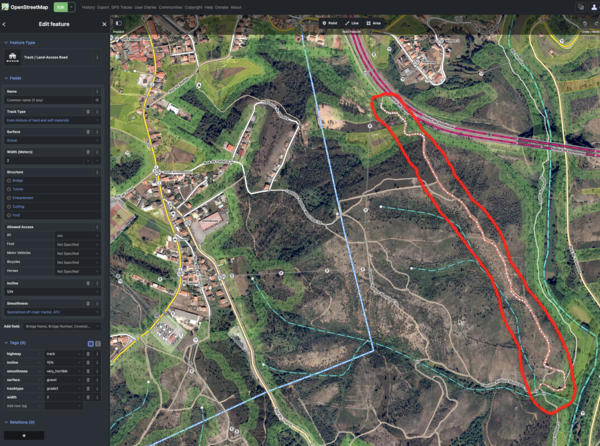


Made in the Cotswolds. Published by Éditions Système D Ltd.
Log in with your cycle.travel account:
| Password |
Or simply use your account on:
