
Become a supporter
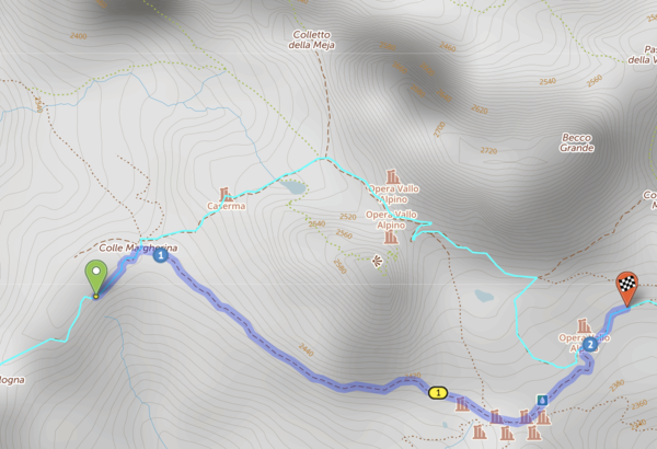
Hi, while plotting the established Torino-Nice gravel route, I found that cycle.travel would not allow routing on this segment. I am not familiar enough with OSM to understand why. Bicycles are permitted and I didn't think the surface condition would preclude routing. Perhaps the "very_bad" smoothness? https://www.openstreetmap.org/way/50894205
https://cycle.travel/map/journey/389779
Below is an image of the desired route (in light blue). Any insight would be appreciated, as it will help me to learn how to best use OSM and c.t routing. Thanks!
Our original route past Chialvetta with the rough stuff section into Little Peru. A notable hike/push on footpaths in beautiful surroundings beyond Chialvetta rewards with some #bunkerresearch at the top and a dramatic unveiling of the altopiano from the Passo della Gardetta. If you rode the Col d’Izoard rather than the hike-a-bike option there and still want to earn your Rough Stuff Alps points on this route, then this is the route to take.
The route continues on a long descent to Demonte, a bike path road to Borgo San Dalmazzo and good resupplies at Limone Piemonte. It follows the same route as 4.2 after the Gardetta area, using a flat route between Demonte and Limone Piemonte.
Both 4.1 and 4.2 routes pass two bike shops around the 75km point, on the way out of Borgo San Dalmazo.
This route includes the high point of the ride, the 2744m Col Agnel / Colle dell'Agnello which also marks the France-Italy border, and the stunning and "memorable" Strada Cannoni along the Varaita-Maria ridge. A section of the Cannoni descent features the biggest gravel (aka rocks) on the route, it’s a challenge on any bike but it’s been done on 35mm tyres in the past (it’s not recommended...). Don’t get caught without spare inner tubes - it's rocky and not typical gravel bike terrain at all. The roughest few km of the descent takes you onto a relaxing, almost flat valley road - a welcome breather in between the big mountains. The ride along the Val Varaita is particularly nice if you go all the way to the Gardetta hike-a-bike (4.1) turn-off.
There is also the linked SCR.2 file within the collection. SCR.2 bypasses the rough section of the Cannoni. There is also the fully safe, very pretty (unrouted/off-route) SP335 road descent off the Col Sampeyre if needed – both re-join this main route file (3) within 10km of its end.
A classic road climb over the Col d'Izoard takes you to the Fort Queyras / Chateau Ville Vieille area. The Izoard is a truly beautiful climb and one that doesn’t feel as hard as its height and fame may suggest - it's a different matter on a hot day though.
Look out for the memorial to Louison Bobet and Fausto Coppi within the incredible scenery of the Casse Deserte at the top.
The original 'Fred Wright tribute' route over the Col des Peas that we explored during the route recce in 2015. We didn’t do any more than look at the map and see a path marked on it, linking the valleys. We found a beautiful, quiet road up an open valley that leads to a small village with food and lodging possibilities, then there’s a push and a carry up to the Col des Peas. It’s followed by a descent that starts as singletrack before becoming a stone and gravel track to Chateau Ville Vieille with a wonderful view of Fort Queyras.
Every good ride includes some hike-a-bike and the less easy the route, the quieter and more remote it is. It isn’t an easy section but on the true scale of hike-a-bike it’s nothing major. Don’t try it in road cleats though, or with a 50lb bike that you can’t carry. If you’ve packed light and are wearing MTB shoes you have no excuses really. After all, “What would Fred do?”


Made in the Cotswolds. Published by Éditions Système D Ltd.
Log in with your cycle.travel account:
| Password |
Or simply use your account on:
