
Become a supporter
www.komoot.com/collection/1354647/to-the-abbeys-of-belgium-la-cyclotrappiste
6 days; 4-6 h/day; 449 km; 5,170 m
The Cyclotrappiste is a multi-day cycling route that takes you to three of the five monasteries in Belgium where the special Trappist beers are brewed: Orval, Chimay and Rochefort – three names that already make beer lovers' mouths water!
Over the 450 kilometres (280 mi), you can enjoy exceptional landscapes from lonely paths and wheat fields to forests, lakes and rivers. In this environment, you can concentrate on relaxation. On the way, you’ll also pass plenty of relics: abbeys, castles and archaeological sites are on the program for six days.
The peculiarity of this route is that it’ll take you specifically to the Trappist abbeys of Wallonia: these imposing buildings are monuments full of history, traditions and legends. Moreover, very special beers are brewed there. The beers of Orval, Chimay and Rochefort are among the ten beers in the world that can call themselves Trappist beers, as they are still brewed in the monasteries by the monks. There are a total of five such beers in Belgium.
You'll need strong legs to climb the hills of the Ardennes, but the route also takes in flatter stretches along the banks of the Semois and Lesse rivers. It also runs along numerous so-called RAVeL routes (réseau autonome de voies lentes (autonomous network of slow ways)), which only non-motorised traffic can use.
This route deliberately avoids the most direct routes. It winds through Belgian, French and Luxembourgian landscapes and takes you along the most beautiful roads and paths. The stages vary between 60 and 90 kilometres (37–56 mi) per day with altitude gains between 700 and 1,100 metres (2,297–3,609 ft). So the daily distances are quite strenuous, even more so if you are travelling with luggage.
For this route, it’s best to take a touring bike. If you already own a bike that rides well and you want to ride a long-distance route for the first time, you can always adapt it for your trip with a rack and mudguards.
The best seasons for cycling in Belgium are from spring to fall. However, the weather can be unpredictable even in summer, so be prepared with the appropriate clothing.
The route starts and ends at the Arlon train station, which you can easily reach by train or car. The stage destinations are in small towns or villages, where you can find campsites, hotels or hostels to stay overnight.
iOS app 1.9
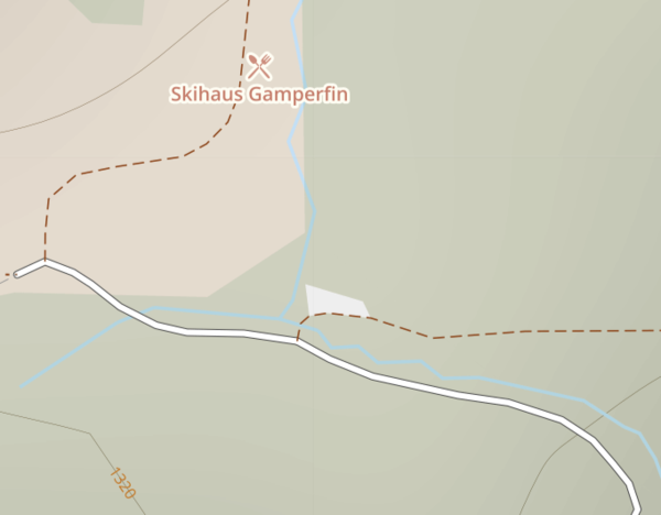
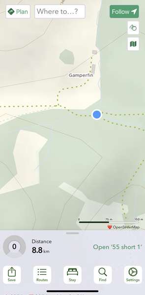
In Switzerland, I noticed that many (most?) of the track/land access roads were showing as green dashed lines in the app ("footpath - no cycling" per the website key). The roads were in fact legal double tracks.
Example: The roads converging at this intersection are double-track and either compacted or paved - They seem to be represented correctly on the website. They are shown as foot paths in the app.
(I am assuming that the key for the app map is the same as the key for the website map.)
iOS 18.6.2, app version 1.9, iPhone 16 Pro


Made in the Cotswolds. Published by Éditions Système D Ltd.
Log in with your cycle.travel account:
| Password |
Or simply use your account on:
